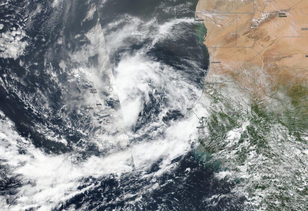
Sep. 08, 2020 – NASA-NOAA Satellite Sees New Tropical Storm Rene Drenching Cabo Verde Islands
NASA-NOAA’s Suomi NPP satellite provided forecasters with a visible image of the latest tropical cyclone in the North Atlantic hurricane season. Tropical Storm Rene was bringing tropical-storm force winds and rain to the Cabo Verde Islands.

Cabo Verde, also known as Cape Verde, is a country consisting of a chain of islands, located about 385 miles (620 km) off the west coast of Africa.
Tropical Depression 18 developed on Monday, Sept. 7 in the far eastern North Atlantic Ocean, about 250 miles (405 km) east-southeast of the Cabo Verde Islands. By 5 p.m. EDT (2100 UTC) on Sept. 7, the depression strengthened into a tropical storm and was renamed Rene.
On Sept. 8, a Tropical Storm Warning was in effect for the Cabo Verde Islands. The Visible Infrared Imaging Radiometer Suite (VIIRS) instrument aboard Suomi NPP provided a visible image of Rene when it passed overhead. The imagery showed that the tropical storm has a well-defined circulation. However, the banding of thunderstorms around the center has shown no increased organization since Sept. 7.
At 11 a.m. EDT (1500 UTC) on Sept. 8, Tropical Storm Rene was bringing tropical-storm force winds and heavy rain to the western Cabo Verde Islands. The center of Tropical Storm Rene was located near latitude 16.5 degrees north and longitude 26.5 degrees west. Rene was moving toward the west near 16 mph (26 kph), and a motion toward the west to west-northwest is expected over the next two or three days. Maximum sustained winds are near 40 mph (65 kph) with higher gusts. The estimated minimum central pressure is 1001 millibars.
On the forecast track, the center of Rene will move away from the Cabo Verde Islands later today. Little change in strength is expected today, followed by gradual strengthening on Thursday and Friday. Rene is forecast to become a hurricane in a couple of days.
NASA Researches Tropical Cyclones
Hurricanes/tropical cyclones are the most powerful weather events on Earth. NASA’s expertise in space and scientific exploration contributes to essential services provided to the American people by other federal agencies, such as hurricane weather forecasting.
For more than five decades, NASA has used the vantage point of space to understand and explore our home planet, improve lives and safeguard our future. NASA brings together technology, science, and unique global Earth observations to provide societal benefits and strengthen our nation. Advancing knowledge of our home planet contributes directly to America’s leadership in space and scientific exploration.
For updated forecasts. Visit: www.nhc.noaa.gov
