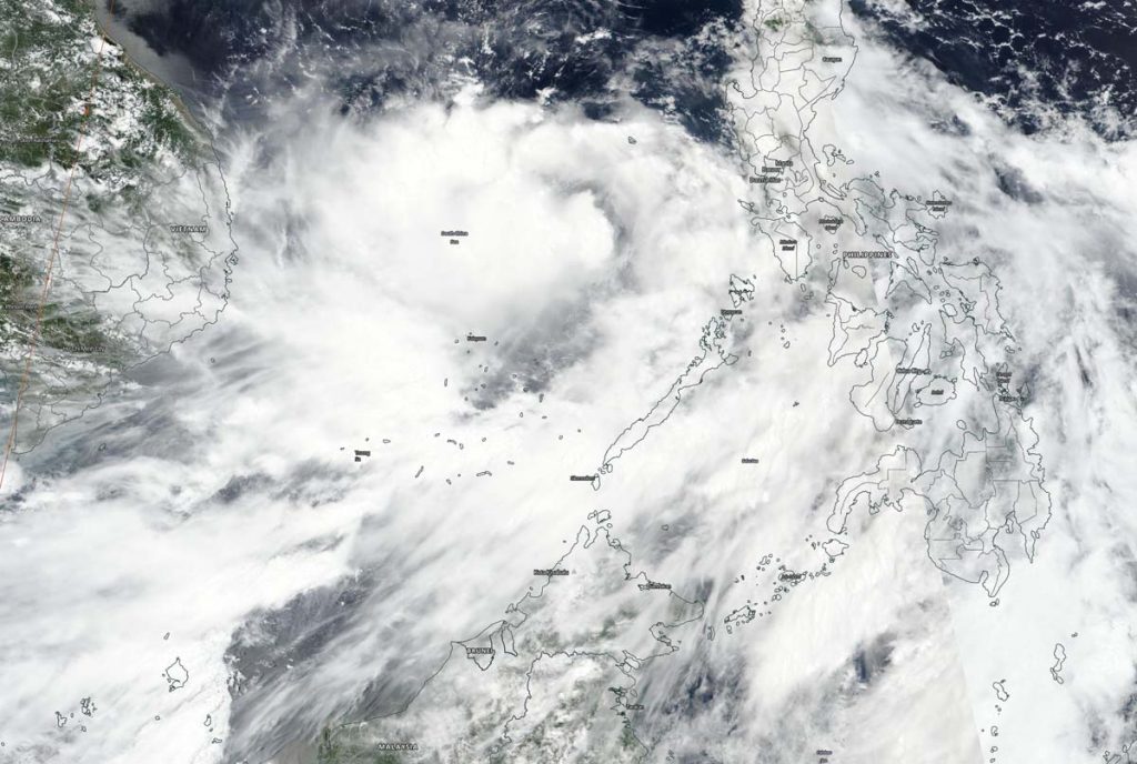
Sep. 16, 2020 – NASA-NOAA Satellite Finds a Strengthening Tropical Storm Noul
NASA-NOAA’s Suomi NPP satellite passed over the South China Sea and captured a visible image of Tropical Storm Noul as it continued to organize and intensify.

Noul formed from a low-pressure area that began on the eastern side of the Philippines. The low crossed the Philippines and developed into Tropical Depression 13W in the Sulu Sea. The depression intensified, consolidated and became a tropical storm renamed Noul.
The Visible Infrared Imaging Radiometer Suite (VIIRS) instrument aboard Suomi NPP provided a visible image of Noul on Sept. 16. The VIIRS imagery and animated enhanced infrared satellite imagery shows building convection and clouds obscuring a partially exposed low-level circulation center. The image also showed some banding of thunderstorms.
At 11 a.m. EDT (1500 UTC) on Sept. 16, the Joint Typhoon Warning Center noted that Tropical storm Noul was located near latitude 13.7 degrees north and longitude 115.6 degrees east. That is about 445 nautical miles east-southeast of Da Nang, Vietnam. Noul is moving to the west-northwest and had maximum sustained winds near 45 knots (52 mph/83 kph). The storm was strengthening in the warm waters of the South China Sea.
Noul is forecast to move west-northwest across the South China Sea. The storm will strengthen to 65 knots (75 mph), just attaining typhoon strength prior to landfall in central Vietnam in one and a half days.
For more than five decades, NASA has used the vantage point of space to understand and explore our home planet, improve lives and safeguard our future. NASA brings together technology, science, and unique global Earth observations to provide societal benefits and strengthen our nation. Advancing knowledge of our home planet contributes directly to America’s leadership in space and scientific exploration.
For updated forecasts, visit: www.nhc.noaa.gov
