Sep. 17, 2018 – NASA Catches Tropical Cyclone 01S’s Last Breath in So. Indian Ocean
The first tropical cyclone of the Southern Indian Ocean season, 01S, formed on Sept. 15 and was already fizzling two days later. Visible satellite imagery from NASA’s Aqua satellite revealed recently developed tropical cyclone 01S was already fading.
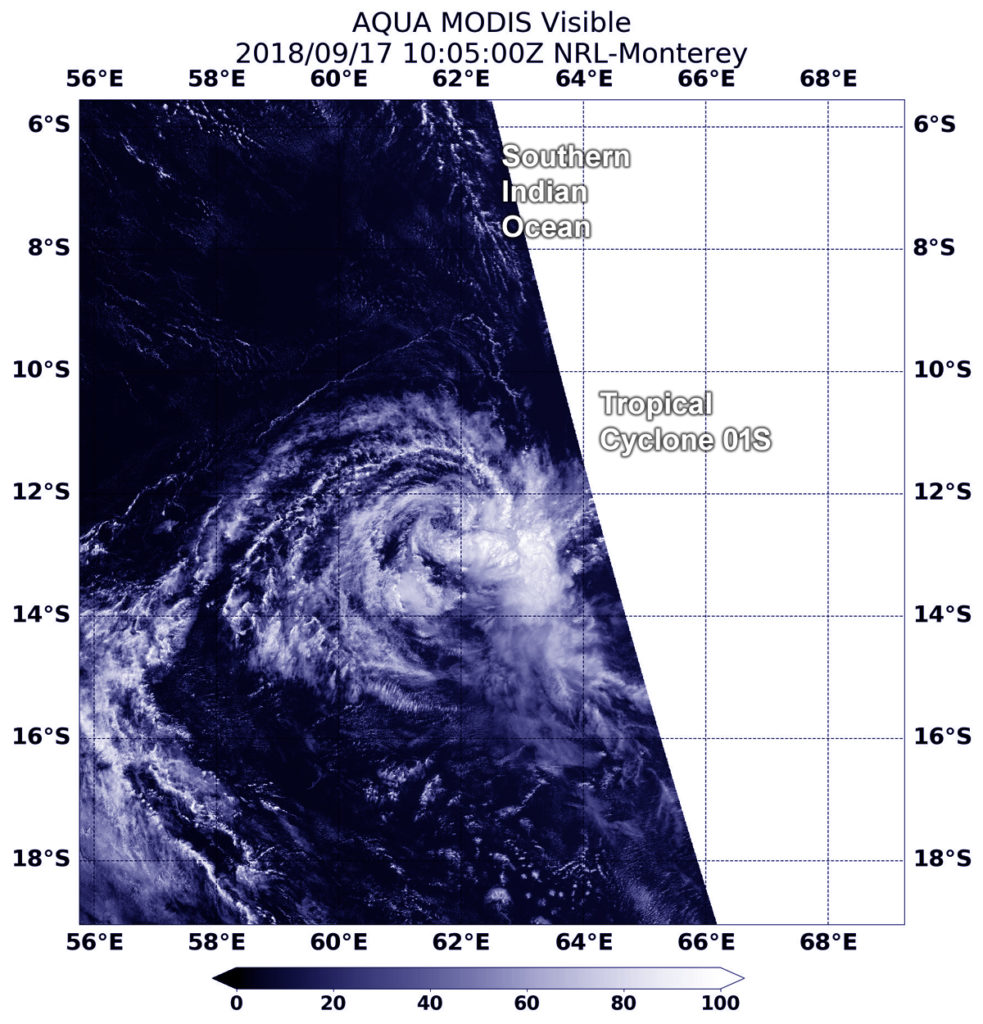
At 6:05 a.m. EDT (1005 UTC) on Sept. 17, the Moderate Resolution Imaging Spectroradiometer or MODIS instrument aboard Aqua captured a visible image of Tropical Depression 01S. The MODIS image shows a few cloud swirls pivoting around a mean center with only a small amount of strongest thunderstorms displaced east of center.
The Joint Typhoon Warning Center or JTWC issued their final advisory on 01S on Sept. 17 at 0300 UTC (Sept. 16 at 11 p.m. EDT). At that time Tropical Cyclone 01S was located near 12.3 degrees south latitude and 63.6 degrees east longitude or 592 miles northeast of Port Louis, Mauritius. 01S was moving to the west and had maximum sustained winds 30 knots (34.5 mph/55.5 kph). However, the winds were weakening and 01S is forecast to dissipate soon.
By Rob Gutro
NASA’s Goddard Space Flight Center