Jan. 05 – 22, 2019 – A Short-lived Tropical Depression 01W
Satellite imagery showed that Tropical depression 01 fizzled on January 6 after triggering a tropical storm watch on Jan. 5 for Mili, Ailinglaplap, Majuro, Kwajalein and Jaluit.

Tropical Depression 01W formed on Jan. 4 near 4.8 degrees north latitude and 174.0 east longitude, about 217 miles southeast of Majuro, Marshall Islands.
On Jan. 6 at 10 a.m. EST (1500 UTC) the Joint Typhoon Warning Center issued their final bulletin on 01W. At that time it was near 5.6 north latitude and 173.6 east longitude, about 169 miles east-southeast of Majuro. Maximum sustained winds dropped to 20 knots as it neared the Marshall Islands.
01W had weakened and no longer qualified as a tropical cyclone.
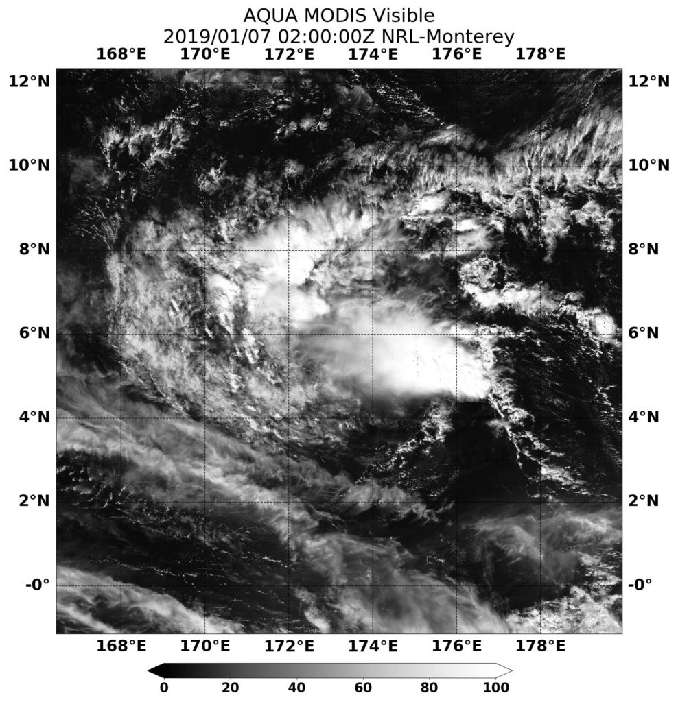
On Jan. 7 at 0200 UTC (Jan. 6 at 9 p.m. EST), the MODIS instrument aboard NASA’s Aqua satellite captured a visible image of the dissipating storm.
On January 8, the storm was reduced to a remnant low pressure area located 190 miles south of Majuro. 01W continued to linger in the Northwestern Pacific as a low pressure area, struggling to regenerate. A week later, on January 15, the low pressure area was still hanging around! The Joint Typhoon Warning Center still gave 01W a medium chance to regenerate. On that date, it was located about 160 miles south of Chuuk.
Five days later, 01W was still hanging around and was 305 nautical miles east-northeast of Manila, Philippines. It was close enough to the country that it was given the name Amang, and triggered warnings. At 4 a.m. EST (0900 UTC) warnings were posted for the remnants of tropical cyclone 01W.
Tropical cyclone warning signal #1 was in effect for the Visayas provinces of Northern and Eastern Samar, Samar, Biliran, Leyte. Signal #1 was also in effect for the Luzon provinces of Sorsogon and Masbate, including Ticao Island. On Jan. 22, the warnings had been dropped and the remnants from System 01W were near 12.0 degrees north latitude and 125.5 degrees east longitude, about 302 nautical miles east-southeast of Manila.
By Rob Gutro
NASA’s Goddard Space Flight Center
