06E – Eastern Pacific Ocean

July 15, 2020 – NASA Finds Limited Water Vapor as Depression 06E Becomes a Trough

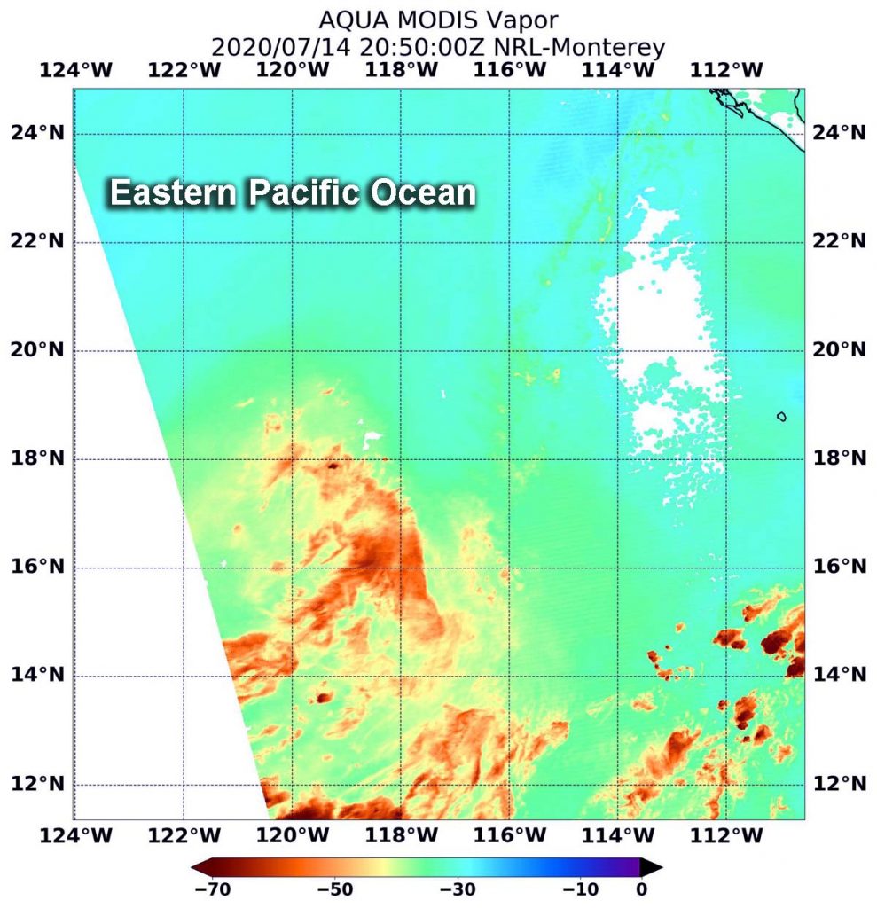
When NASA’s Aqua satellite passed over the Eastern Pacific Ocean, it gathered water vapor data on Tropical Depression 06E that showed it had opened up into a trough. A trough is an elongated area of low pressure.
Aqua image of 06E
On July 14 at 4:50 p.m. EDT (2050 UTC), NASA’s Aqua satellite passed over the remnants of Tropical Depression 06E. The concentrations of water vapor (light brown) were minimal and the circulation had opened up into an elongated area of low pressure. Credits: NASA/NRL

On July 14 at 4:50 p.m. EDT (2050 UTC), NASA’s Aqua satellite passed over the remnants of Tropical Depression 06E. The Moderate Resolution Imaging Spectroradiometer or MODIS instrument aboard Aqua gathered the water vapor content and temperature information. MODIS found minimal concentrations of water vapor and the circulation had opened up into a trough.

Water vapor analysis of tropical cyclones tells forecasters how much potential a storm has to develop. Water vapor releases latent heat as it condenses into liquid. That liquid becomes clouds and thunderstorms that make up a tropical cyclone. Temperature is important when trying to understand how strong storms can be. The higher the cloud tops, the colder and stronger the storms. TD6E showed very limited water vapor.

At 5 p.m. EDT on July 14, the National Hurricane Center (NHC) said a satellite overpass “indicated that the circulation of the tropical depression was no longer closed with light and variable winds evident on its south side. Therefore, the system no longer meets the criteria of a tropical cyclone.”

At 5 p.m. EDT (2100 UTC) on July 14, NHC issued their final advisory on Tropical Depression 06E. At that time, the remnants of 06E were located near latitude 18.2 degrees north and longitude 118.0 degrees west, about 615 miles (990 km) west-southwest of the southern tip of Baja California, Mexico. The remnants were moving toward the west near 17 mph (28 kph). Maximum sustained winds were near 30 mph (45 kph) and waning. The estimated minimum central pressure is 1008 millibars.

The remnants were producing a very limited amount of shower activity. The NHC said that associated convection could pulse up and down for another day until the trough moves over cooler waters.

NASA’s Aqua satellite is one in a fleet of NASA satellites that provide data for hurricane research.

Tropical cyclones/hurricanes are the most powerful weather events on Earth. NASA’s expertise in space and scientific exploration contributes to essential services provided to the American people by other federal agencies, such as hurricane weather forecasting.

By Rob Gutro
NASA’s Goddard Space Flight Center

06E – Eastern Pacific Ocean

July 14, 2020 – NASA Infrared View Finds Small Areas of Strength in New Depression 6E

NASA’s Aqua satellite used infrared light to identify the strongest storms and coldest cloud top temperatures in Tropical Depression 6E. Aqua found a few small areas of strength but cooler sea surface temperatures are expected to weaken them.

Aqua image of 06E
On July 14 at 5:50 a.m. EDT (0950 UTC), the MODIS instrument aboard NASA’s Aqua satellite gathered temperature information about Tropical Depression 6E’s cloud tops. MODIS found a few small areas of powerful thunderstorms (red) where temperatures were as cold as or colder than minus 70 degrees Fahrenheit (minus 56.6 Celsius). Credit: NASA/NRL

Tropical Depression 6E formed in the Eastern Pacific Ocean by 5 p.m. EDT on July 13 and was located well to the southwest of Baja California Sur, Mexico.

On July 14 at 5:50 a.m. EDT (0950 UTC), the Moderate Resolution Imaging Spectroradiometer or MODIS instrument aboard NASA’s Aqua satellite analyzed Tropical Depression 6E’s cloud tops in infrared light. Infrared data provides temperature information, and the strongest thunderstorms that reach high into the atmosphere have the coldest cloud top temperatures.

Aqua found the most powerful thunderstorms in several small, fragmented areas northeast, southeast and southwest of the center of circulation, where temperatures were as cold as or colder than minus 70 degrees Fahrenheit (minus 56.6 Celsius). Cloud top temperatures that cold indicate strong storms with the potential to generate heavy rainfall. Cloud top temperatures around the rest of the depression were warmer, indicating less-powerful storms.

At 11 a.m. EDT (1500 UTC) on July 14, the NHC said the center of Tropical Depression Six-E was located near latitude 18.1 degrees north and longitude 116.6 degrees west. 6E is far from land areas and is about 545 miles (880 km) southwest of the southern tip of Baja California, Mexico. The depression is moving toward the west-northwest near 16 mph (26 kph). A faster motion toward the west-northwest or west is expected during the next day or two. The estimated minimum central pressure is 1008 millibars. Maximum sustained winds are near 30 mph (45 kph) with higher gusts. Little change in strength is forecast during the next day or two.

NHC forecaster Robbie Berg noted that, “The depression is forecast to reach waters colder than 26 degrees Celsius (78 degrees Fahrenheit) in 12 to 24 hours, which should extinguish the remaining deep convection.” Tropical cyclones require sea surface temperatures of at least 26.6 degrees Celsius (80 degrees Fahrenheit) to maintain intensity. Therefore, the depression is expected to become a remnant low or dissipate by early Wednesday.

Tropical cyclones/hurricanes are the most powerful weather events on Earth. NASA’s expertise in space and scientific exploration contributes to essential services provided to the American people by other federal agencies, such as hurricane weather forecasting.

For updated forecasts, visit: www.nhc.noaa.gov

By Rob Gutro
NASA’s Goddard Space Flight Center