Boris – Eastern Pacific Ocean

June 29, 2020 – NASA-NOAA Satellite Animation Shows the End of Tropical Cyclone Boris

NASA-NOAA’s Suomi NPP satellite imagery provided a look at the end of the second named tropical cyclone of the Eastern Pacific Ocean’s 2020 Hurricane Season.

Suomi NPP image of Boris
NASA-NOAA’s Suomi NPP satellite provided this image of former Tropical Cyclone Boris as it weakened to a remnant low-pressure area on June 29, 2020 in the Central Pacific Ocean. The circulation center can be seen surrounded by wispy clouds with the exception of a small area of thunderstorms on the western side of the circulation. Credit: NASA Worldview, Earth Observing System Data and Information System (EOSDIS)

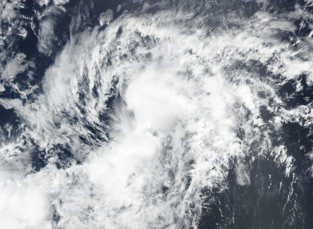
Tropical Cyclone Boris formed in the Eastern Pacific Ocean on Wednesday, June 24 and by early on Sunday, June 29, the storm had become a remnant low-pressure area.

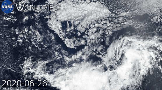
At NASA’s Goddard Space Flight Center in Greenbelt, Md., an animation of satellite imagery was created from NASA Worldview, Earth Observing System Data and Information System (EOSDIS). The animation used imagery from the Visible Infrared Imaging Radiometer Suite (VIIRS) instrument aboard NASA-NOAA’s Suomi NPP satellite and ran from June 26 to June 29, 2020.  The animation showed the progression and weakening of Tropical Cyclone Boris as it crossed from the Eastern Pacific Ocean into the Central Pacific Ocean.

Suomi NPP animation of Boris
This animation shows the progression and dissipation of Tropical Cyclone Boris in the Eastern and Central Pacific Ocean. The animation using imagery from the VIIRS instrument aboard NASA-NOAA’s Suomi NPP satellite runs from June 26 to June 29, 2020. Credit: NASA Worldview, Earth Observing System Data and Information System (EOSDIS)

The final advisory issued by NOAA’s National Hurricane Center came on Saturday, June 27 at 11 p.m. EDT. At that time, center of Post-Tropical Cyclone Boris was located near latitude 12.1 degrees north and longitude 142.0 degrees west. That was about 1,015 miles (1,635 km) east-southeast of Hilo, Hawaii. The post-tropical cyclone was moving toward the west-southwest near 8 mph (13 kph).  Maximum sustained winds were near 30 mph (45 kph) and weakening.

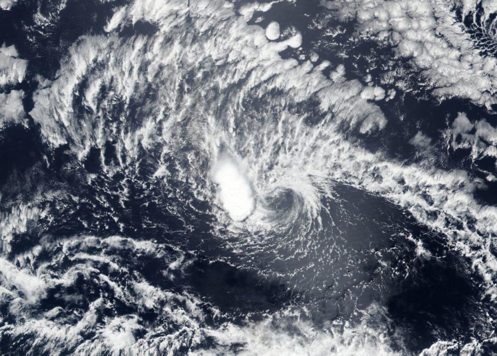
NASA-NOAA’s Suomi NPP satellite provided an image of former Tropical Cyclone Boris as it weakened to a remnant low-pressure area on June 29. In the image, the circulation center can be seen surrounded by wispy clouds with the exception of a small area of thunderstorms on the western side of the circulation.

The remnant low is expected to dissipate by June 30.

Tropical cyclones/hurricanes are the most powerful weather events on Earth. NASA’s expertise in space and scientific exploration contributes to essential services provided to the American people by other federal agencies, such as hurricane weather forecasting.

By Rob Gutro
NASA’s Goddard Space Flight Center

Boris – Eastern Pacific Ocean

June 26, 2020 – NASA-NOAA’s Suomi NPP Satellite Sees Tropical Storm Boris Form

NASA-NOAA’s Suomi NPP satellite provided forecasters with visible image of the Eastern Pacific Ocean’s second tropical storm of the season, Boris. Boris formed just east of the Central Pacific Ocean’s boundary as it was moving into that region.

Suomi NPP image of Boris
On June 25, 2020, NASA-NOAA’s Suomi NPP satellite provided forecasters with a visible image of Tropical Storm Boris in the Eastern Pacific Ocean, during its short time as a tropical storm. Credit: NASA Worldview, Earth Observing System Data and Information System (EOSDIS)

The Central Pacific Ocean Basin is the central area of the North Pacific Ocean. Its boundaries are the Marshall Islands to the west and the Line Islands to the east. Hawaii lies in the Central Pacific Ocean.

Satellites have been monitoring the progress and development of Tropical Depression 3 in the Eastern Pacific for two days. On June 25, the depression organized and strengthened into a tropical storm and was renamed Boris at 5 p.m. EDT. Boris reached maximum strength with maximum sustained winds near 40 mph and weakened back to a depression in 12 hours by 5 a.m. EDT (0900 UTC) on June 26.

Visible imagery from NASA satellites help forecasters understand if a storm is organizing or weakening. The Visible Infrared Imaging Radiometer Suite (VIIRS) instrument aboard Suomi NPP provided a visible image of Boris during its short time as a tropical storm on June 26, 2020.

At 11 a.m. EDT (1500 UTC) on June 26, NOAA’s Central Pacific Hurricane Center noted the center of Tropical Depression Boris was located near latitude 12.0 degrees north and longitude 139.0 degrees west. That is about 1,195 miles (1,920 km) east-southeast of Hilo, Hawaii. The depression was moving toward the west-northwest near 7 mph (11 kph), and this motion should continue through tonight. Maximum sustained winds were near 35 mph (55 kph) with higher gusts.

A turn toward the west is expected late on Friday June 26, or on Saturday June 27. Gradual weakening is forecast during the next couple of days, and Boris is forecast to degenerate to a remnant low pressure area Saturday night or Sunday.

Tropical cyclones/hurricanes are the most powerful weather events on Earth. NASA’s expertise in space and scientific exploration contributes to essential services provided to the American people by other federal agencies, such as hurricane weather forecasting.

By Rob Gutro 
NASA’s Goddard Space Flight Center