Calvinia – Southern Indian Ocean

Dec. 31, 2019 – NASA Finds Tropical Storm Calvinia Moving Away from Mauritius

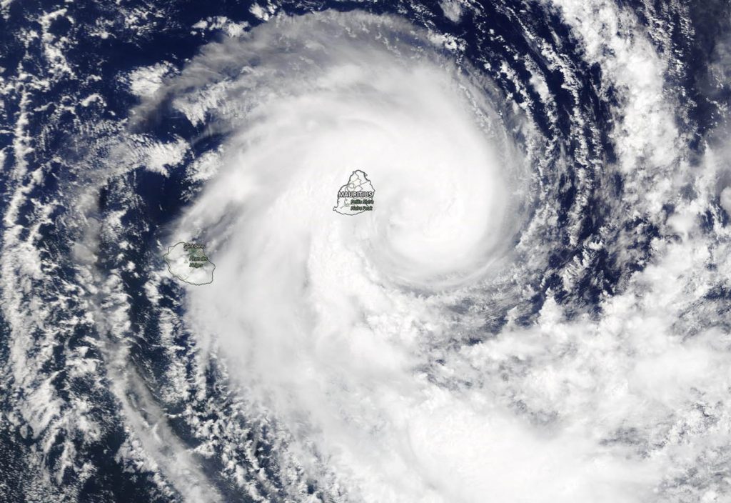
Visible imagery from NASA’s Aqua satellite on Dec. 31 revealed that Tropical Cyclone Calvinia had moved south of the island of Mauritius in the Southern Indian Ocean.

Aqua image of Calvinia
On Dec. 31, 2019, the MODIS instrument that flies aboard NASA’s Aqua satellite provided a visible image of Tropical Storm Calvinia in the Southern Indian Ocean. Credit: NASA Worldview

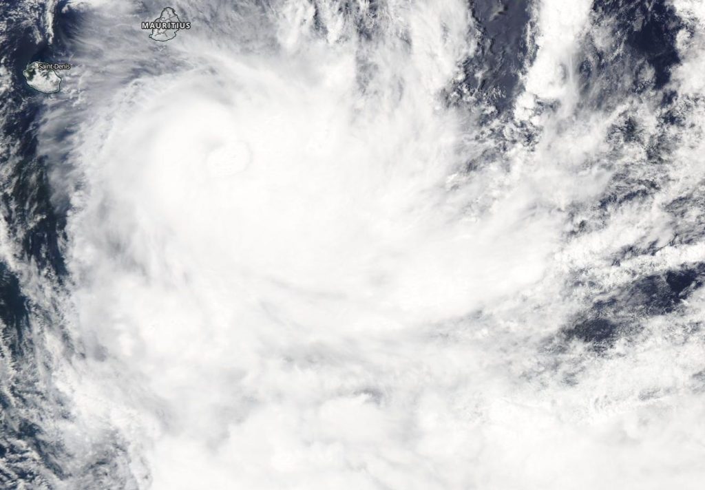
A tropical cyclone warning class III was still in effect in Mauritius.

On Dec. 31 at 0300 UTC (Dec. 30 at 10 p.m. EST) the Joint Typhoon Warning Center noted that Tropical Cyclone Calvinia was located near latitude 21.1 degrees south and longitude 58.0 degrees east, about 72 nautical miles south-southeast of Port Louis, Mauritius. Maximum sustained winds had increased to 60 knots (69 mph/112 kph).

Later on Dec. 31 the Moderate Resolution Imaging Spectroradiometer or MODIS instrument that flies aboard NASA’s Aqua satellite provided a visible image of Calvinia that showed the storm had a well-rounded shape. The MODIS image revealed bands of thunderstorms spiraling into the tight low-level center of circulation.

Calvinia is forecast to turn to the southeast and strengthen to 65 knots.  After Jan. 1, the storm will start to become extra-tropical.

NASA’s Aqua satellite is one in a fleet of NASA satellites that provide data for hurricane research.

Tropical cyclones and hurricanes are the most powerful weather events on Earth. NASA’s expertise in space and scientific exploration contributes to essential services provided to the American people by other federal agencies, such as hurricane weather forecasting.

By Rob Gutro
NASA’s Goddard Space Flight Center

Calvinia – Southern Indian Ocean

Dec. 30, 2019- NASA Sees Mauritius Covered by Tropical Storm Calvinia

Tropical Cyclone Calvinia formed on Dec. 29 and by the next day, its clouds from a band of thunderstorms on its western side had blanketed the island of Mauritius in the Southern Indian Ocean.

Terra image of Calvinia
On Dec. 30, 2019, the MODIS instrument that flies aboard NASA’s Terra satellite provided a visible image of Tropical Storm Calvinia covering the island of Mauritius in the Southern Indian Ocean. Credit: NASA Worldview

Calvinia’s center was just east of the island on Dec. 30. The storm has triggered a tropical cyclone warning class III in Mauritius.

On Dec. 30, 2019, the Moderate Resolution Imaging Spectroradiometer or MODIS instrument that flies aboard NASA’s Terra satellite provided a visible image of Calvinia that showed the storm had a rounded shape. A rounded shape in a tropical cyclone indicates an organized storm. The MODIS image revealed bands of thunderstorms from the western side spiraled into the low-level center of circulation. That thick band of thunderstorms blanketed Mauritius bringing gusty winds and heavy rains.

On Dec. 30 at 0300 UTC (Dec. 29 at 10 p.m. EST) the Joint Typhoon Warning Center noted that Tropical Cyclone Calvinia was located near latitude 20.6 degrees south and longitude 58.8 degrees east, about 90 nautical miles east-southeast of Mauritius. Maximum sustained winds were 35 knots (40 mph). This storm is moving to the southwest.

Calvinia is forecast to strengthen to 55 knots and curve to the southeast and away from Mauritius and St. Denis.

NASA’s Terra satellite is one in a fleet of NASA satellites that provide data for hurricane research.

Tropical cyclones and hurricanes are the most powerful weather events on Earth. NASA’s expertise in space and scientific exploration contributes to essential services provided to the American people by other federal agencies, such as hurricane weather forecasting.

By Rob Gutro
NASA’s Goddard Space Flight Center