Claudia – Southern Indian Ocean

Jan. 16, 2020  – NASA Catches the Dissipation of Tropical Cyclone Claudia

Tropical Cyclone Claudia was dissipating in the Southern Indian Ocean when NASA’s Terra satellite captured a visible image of storm as it flew overhead in its orbit around the Earth.

Terra image of Claudia
On Jan. 16, 2020, the MODIS instrument that flies aboard NASA’s Terra satellite provided a visible image of Tropical Cyclone Claudia as it was dissipating in the Southern Indian Ocean. Credit: NASA Worldview

On Jan. 15 at 4 p.m. EST (2100 UTC) the Joint Typhoon Warning Center (JTWC) noted in their final warning that Tropical Cyclone Claudia’s maximum sustained winds were down to 35 knots (40 mph/65 kph). Claudia was far from land, near latitude 21.4 degrees south and longitude 104.8 degrees east, about 521 nautical miles west of Learmonth, Australia.

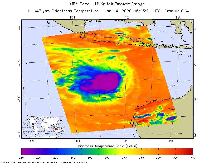
On Jan. 16, 2020, the Moderate Resolution Imaging Spectroradiometer or MODIS instrument that flies aboard NASA’s Terra satellite provided a visible image of Claudia that showed the storm was dissipating. Strong northeasterly wind shear had pushed the bulk of clouds to the southwest of the center of circulation. The center appeared exposed and surrounded by a wispy circle of clouds in the Terra satellite image.

The JTWC forecast said Claudia remnants are expected to continue moving in a southwest direction and dissipate later today, Jan. 16.

NASA’s Terra satellite is one in a fleet of NASA satellites that provide data for hurricane research.

Tropical cyclones/hurricanes are the most powerful weather events on Earth. NASA’s expertise in space and scientific exploration contributes to essential services provided to the American people by other federal agencies, such as hurricane weather forecasting.

By Rob Gutro
NASA’s Goddard Space Flight Center

Claudia – Southern Indian Ocean

Jan. 15, 2020 – NASA Infrared Data Analyzes Cloud top Temperatures in Tropical Cyclone Claudia

Satellite data of Tropical Cyclone Claudia’s cloud top temperatures revealed that the storm was weakening.

AIRS image of Claudia
On Jan. 14 at 1:23 EST (0623 UTC) NASA’s Aqua satellite analyzed Tropical Storm Claudia using the Atmospheric Infrared Sounder or AIRS instrument. AIRS found coldest cloud top temperatures as cold as or colder than (purple) minus 63 degrees Fahrenheit (minus 53 degrees Celsius) north and east of Imelda’s center. Credit: NASA JPL/Heidar Thrastarson

One of the ways NASA researches tropical cyclones is using infrared data that provides temperature information. The AIRS instrument aboard NASA’s Aqua satellite captured a look at those temperatures in Claudia’s cloud tops and got insight into the storm’s strength.

Cloud top temperatures provide information to forecasters about where the strongest storms are located within a tropical cyclone. Tropical cyclones do not always have uniform strength, and some sides have stronger sides than others. The stronger the storms, the higher they extend into the troposphere,  and the colder the cloud temperatures.

On Jan. 14 at 1:23 EST (0623 UTC) NASA’s Aqua satellite analyzed the storm using the Atmospheric Infrared Sounder or AIRS instrument. AIRS found the coldest cloud top temperatures were getting warmer. That is an indication that the uplift of air in the storm is not as strong as it was before. AIRS found temperatures as cold as or colder than minus 63 degrees Fahrenheit (minus 53 degrees Celsius) around Claudia’s center.  NASA research has shown that cloud top temperatures that cold indicate strong storms that have the capability to create heavy rain.

On Jan. 15, satellite imagery showed strongest storms within Claudia were separated well to the west of the low level center, indicating wind shear from the east was tearing the storm apart. The Joint Typhoon Warning Center noted, “Central convection has begun to unravel and elongate as convective tops warmed.” Claudia is expected to weaken further as it moves over cooler waters.

At 7:55 a.m. EST (8:55 p.m. AWST) on Jan. 15, the Australia Bureau of Meteorology noted that Claudia has maximum sustained winds near 40 mph (65 kph) and weakening. It was located near latitude 20.7 degrees south and longitude 105.8 degrees east.

Tropical Cyclone Claudia continues to move towards the southwest, well away from the Western Australia coast. It is expected to become a depression by Jan. 16 and weaken to a remnant low-pressure area.

Typhoons and hurricanes are the most powerful weather event on Earth. NASA’s expertise in space and scientific exploration contributes to essential services provided to the American people by other federal agencies, such as hurricane weather forecasting.

The AIRS instrument is one of six instruments flying on board NASA’s Aqua satellite, launched on May 4, 2002.

By Rob Gutro
NASA’s Goddard Space Flight Center  

Claudia – Southern Indian Ocean

Jan. 14, 2020 – NASA-NOAA Satellite Imagery Reveals a Weaker Tropical Cyclone Claudia

Tropical Storm Claudia now has two factors against it: wind shear and dry air.  NASA-NOAA’s Suomi NPP satellite provided forecasters with an image of the storm on January 14 as it continued to weaken and move further away from Western Australia.

Suomi NPP image of Claudia
NASA-NOAA’s Suomi NPP satellite provided forecasters with a visible image of a weaker Tropical Storm Claudia on Jan. 14 as it continued moving in a southwesterly direction in the Southern Indian Ocean. Credit: NASA Worldview, Earth Observing System Data and Information System (EOSDIS)

Visible imagery from NASA satellites help forecasters understand if a storm is organizing or weakening. The Visible Infrared Imaging Radiometer Suite (VIIRS) instrument aboard NASA-NOAA’s Suomi NPP satellite provided a visible image of Claudia that showed the storm continued to appear elongated. The shape of a tropical cyclone provides forecasters with an idea of its organization and strength. Usually, the more circular a storm appears, the stronger the rotation. When storms become less symmetrical, they tend to weaken. Suomi NPP’s imagery showed Claudia continued to appear elongated from west to east.

In addition to the visible imagery, microwave and other satellite imagery shows diminishing thunderstorms northwest of the center of circulation and the strongest thunderstorms, located in the southern quadrant of Claudia, have weakened. The southern quadrant storms have weakened because of dry air moving into the system and sapping thunderstorm development. In addition, easterly wind shear continues to batter the storm.

At 7:46 a.m. EST (8:46 pm WST) on Monday, January 14, 2020 the Australian Government Bureau of Meteorology (ABM) noted that Tropical Cyclone Claudia continued to move far from Western Australia. At that time it was located near latitude 18.3 degrees south and longitude 109.32 east, about 404 miles (650 km) northwest of Exmouth. It was moving to the west-southwest at 11 miles (18 kilometers) per hour. Maximum sustained winds had dropped to 47 mph (75 kph).

Tropical Cyclone Claudia is expected to continue to track towards the west southwest and slowly weaken.

Tropical cyclones/hurricanes are the most powerful weather events on Earth. NASA’s expertise in space and scientific exploration contributes to essential services provided to the American people by other federal agencies, such as hurricane weather forecasting.

By Rob Gutro 
NASA’s Goddard Space Flight Center

Claudia – Southern Indian Ocean

Jan. 13, 2020 – NASA Tracking Tropical Storm Claudia Battling Wind Shear

Tropical Storm Claudia is battling wind shear as it continues moving away from Western Australia and through the Southern Indian Ocean. NASA-NOAA’s Suomi NPP satellite provided forecasters with an image of the storm on January 13.

Suomi NPP image of Claudia
NASA-NOAA’s Suomi NPP satellite provided forecasters with a visible image of Tropical Storm Claudia on Jan. 13 as it continued moving in a westerly direction in the Southern Indian Ocean. Credit: NASA Worldview, Earth Observing System Data and Information System (EOSDIS)

Visible imagery from NASA satellites help forecasters understand if a storm is organizing or weakening. The Visible Infrared Imaging Radiometer Suite (VIIRS) instrument aboard Suomi NPP provided a visible image of Claudia that showed the storm appeared elongated.

The shape of a tropical cyclone provides forecasters with an idea of its organization and strength, and NASA-NOAA’s Suomi NPP satellite provided a visible image of the landfall of the storm to forecasters. The storm appeared elongated from west to east. The imagery shows that Claudia is under strong vertical wind shear from the northwest to southeast. The low-level center now appears to the east of the main convection (rising air that creates the thunderstorms that make up the tropical cyclone).

In general, wind shear is a measure of how the speed and direction of winds change with altitude. Tropical cyclones are like rotating cylinders of winds. Each level needs to be stacked on top each other vertically in order for the storm to maintain strength or intensify. Wind shear occurs when winds at different levels of the atmosphere push against the rotating cylinder of winds, weakening the rotation by pushing it apart at different levels.

At 7:43 a.m. EST (8:43 pm WST) on Monday, January 13, 2020 the Australian Government Bureau of Meteorology (ABM) noted that “Severe Tropical Cyclone Claudia (Category 3) was located latitude 17.3 degrees south and longitude 114.1 east, about 298 miles (480 km) northwest of Karratha and 320 miles (515 km) north of Exmouth. Claudia is moving west-southwest at 18 miles (29 kilometers) per hour. Maximum sustained winds were near 80 knots (92 mph/148 kph).”

Claudia is expected to continue to track towards the west-southwest and remain over open waters, well north of the Pilbara.

Tropical cyclones/hurricanes are the most powerful weather events on Earth. NASA’s expertise in space and scientific exploration contributes to essential services provided to the American people by other federal agencies, such as hurricane weather forecasting.

By Rob Gutro 
NASA’s Goddard Space Flight Center