Fung-Wong – Northwestern Pacific Ocean

Nov. 22, 2019 – NASA Examines Tropical Storm Fung-Wong’s Rainfall

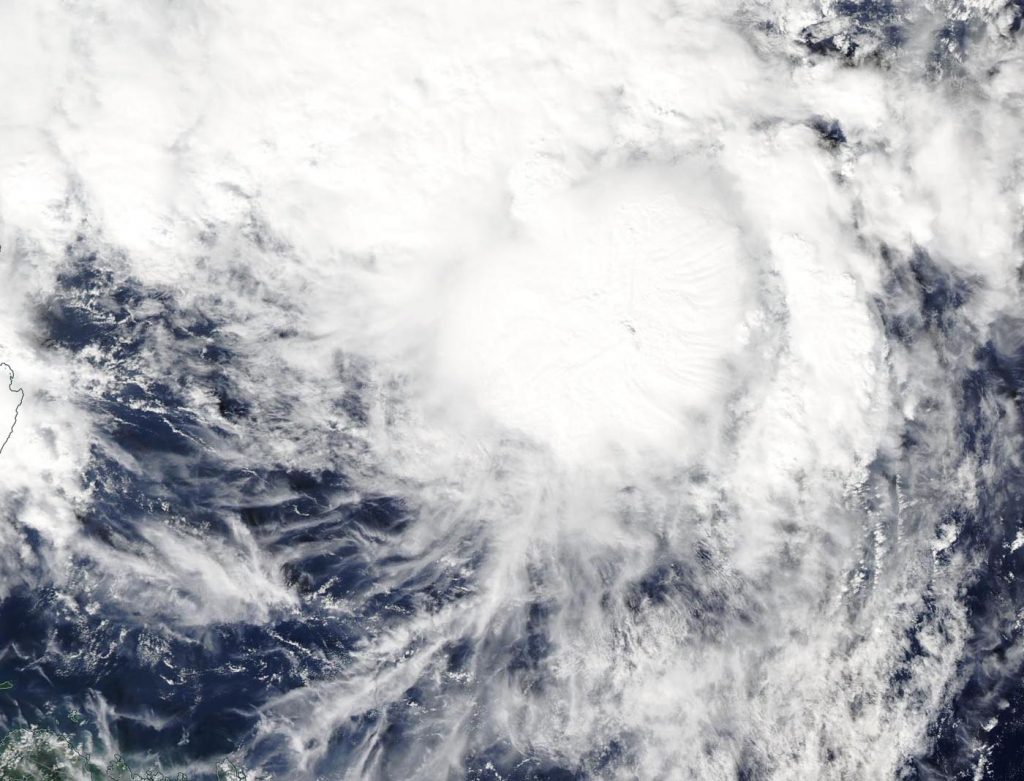
NASA analyzed Tropical Storm Fung-Wong’s rainfall and found two small areas of moderate to heavy rainfall, despite being battered by strong wind shear.

GPM image of Fung-Wong
The GPM core satellite passed over Tropical Storm Fung-Wong on Nov. 22 at 3:08 a.m. EST (0808 UTC). Heaviest rainfall (pink) was north of the center falling at a rate of 1.6 inches (40 mm) per hour. Another area far north of the center showed rainfall (red) occurring at a rate of 1 inch (25 mm) per hour. Light rain (blue) was found throughout the rest of the storm. Credit: NASA/JAXA/NRL

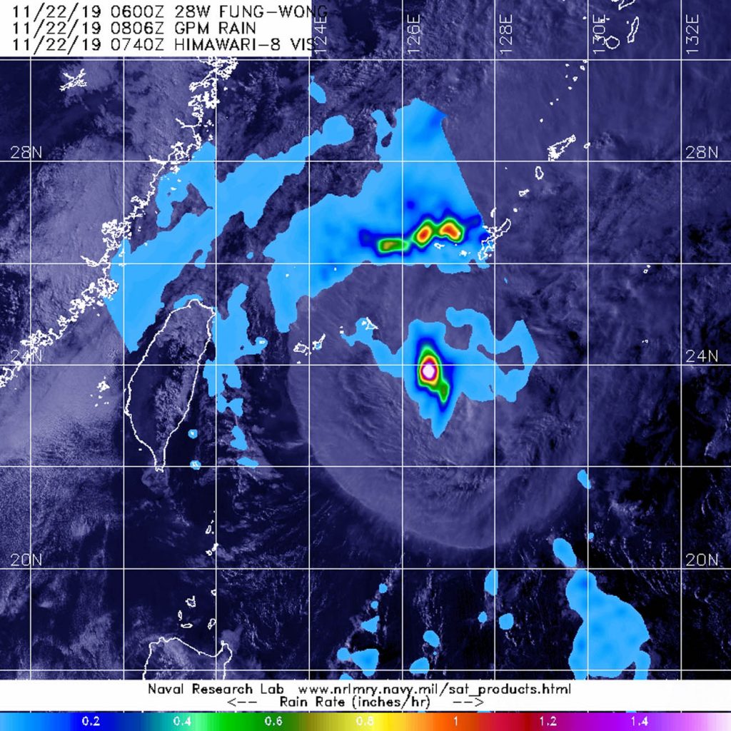
NASA has the unique capability of peering under the clouds in storms and measuring the rate at which the rain is falling. Global Precipitation Measurement mission or GPM core passed over Fung-Wong from its orbit in space and measured rainfall rates throughout the storm on Nov. 22 at 3:08 a.m. EST (0808 UTC).

Heaviest rainfall was being pushed north of the center where it was falling at a rate of 1.6 inches (40 mm) per hour. Another area far north of the center showed heavy rainfall occurring at a rate of 1 inch (25 mm) per hour. Light rain was found throughout the rest of the storm.

In general, wind shear is a measure of how the speed and direction of winds change with altitude. Tropical cyclones are like rotating cylinders of winds. Each level needs to be stacked on top each other vertically in order for the storm to maintain strength or intensify. Wind shear occurs when winds at different levels of the atmosphere push against the rotating cylinder of winds, weakening the rotation by pushing it apart at different levels. Winds from the south were pushing against the storm and displacing the heaviest rainfall north of the center.

Seven hours later by 10 a.m. EST, the Joint Typhoon Warning Center noted that Fung-Wong had become devoid of the heavy rainfall that GPM found earlier. That’s an indication that the storm is continuing to weaken under the wind shear.

On Nov. 22 at 10 a.m. EST (1500 UTC), despite the wind shear, Tropical Storm Fung-Wong was holding onto tropical storm status with maximum sustained winds near 35 knots (40 mph/65 kph). Fung-Wong was located near latitude 24.8 degrees north and longitude 125.3 degrees east about 169 miles southwest of Kadena Air Base, Okinawa Island, Japan.

Fung-Wong is moving north-northeast and is expected to dissipate within 24 hours.

Typhoons and hurricanes are the most powerful weather event on Earth. NASA’s expertise in space and scientific exploration contributes to essential services provided to the American people by other federal agencies, such as hurricane weather forecasting.

Both the Japan Aerospace Exploration Agency, JAXA and NASA manage GPM.

By Rob Gutro
NASA’s Goddard Space Flight Center

Fung-Wong – Northwestern Pacific Ocean

Nov. 21, 2019 – NASA Tracks a Weaker Tropical Storm Fung-Wong  

NASA’s Terra satellite captured an image of Tropical Storm Fung-Wong as it continued weakening in the Northwestern Pacific Ocean.

Terra image of Fung-Wong
On Nov. 20, 2019, the MODIS instrument that flies aboard NASA’s Terra satellite provided a visible image of Tropical Storm Fung-Wong near Taiwan. Credit: NASA Worldview

In the Philippines, tropical cyclone warning Signal #1 was in effect for the Luzon province of Batanes on Nov. 21 as the storm tracks northward and away from the Philippines. The storm is expected to stay to the east of Taiwan and affect the northeastern part of the country.

On Nov. 21, the Moderate Resolution Imaging Spectroradiometer or MODIS instrument that flies aboard NASA’s Terra satellite provided a visible image of Fung-Wong. The MODIS image showed strong thunderstorms around the low-level center of circulation. The Joint Typhoon Warning Center noted, “A microwave image that depicts tight shallow banding wrapping into a defined low level circulation center with deep convection (strong rising air that forms the clouds and storms that make up a tropical cyclone) sheared to the northeast due to strong southwesterly flow aloft.”

At 10 a.m. EST (1500 UTC) on Nov. 21, Tropical Storm Fung-Wong was located near latitude 21.1 degrees north and longitude 124.2 degrees east which is 379 nautical miles south-southwest of Kadena Air Base, Okinawa Island, Japan. Fung-Wong is moving to the north and had maximum sustained winds of 55 knots (63 mph/102 kph).

The Central Weather Bureau of Taiwan issued an “Extremely Heavy Rain Advisory” for the extreme northeastern part of the country. That includes Keelung North Coast, New Taipei City Mountain Area, and the Taipei City Mountain Area and Yilan County.

A Strong Wind Advisory was also issued for Keelung North Coast, New Taipei City, Taoyuan City, Hsinchu City, Hsinchu County, Miaoli County, Taichung City, Changhua County, Yunlin County, Chiayi County, Tainan City, Hengchun Peninsula, Yilan County, Hualien County, Taitung County, Lanyu and Ludao Islands, Penghu County, Kinmen Area, and the Matsu Area.

Fung-Wong is moving north and weakening rapidly.

NASA’s Terra satellite is one in a fleet of NASA satellites that provide data for hurricane research.

Typhoons and hurricanes are the most powerful weather event on Earth. NASA’s expertise in space and scientific exploration contributes to essential services provided to the American people by other federal agencies, such as hurricane weather forecasting.

For forecast updates from Taiwan’s Central Weather Bureau, visit: https://www.cwb.gov.tw/eng/

By Rob Gutro
NASA’s Goddard Space Flight Center

Fung-Wong – Northwestern Pacific Ocean

Nov. 20, 2019 – NASA Observes Tropical Storm Fung-Wong Organize

As Tropical Depression 28W continued organizing and developing into Tropical Storm Fung-Wong in the Philippine Sea, NASA’s Aqua satellite provided data on the storm to forecasters. In the Philippines, Fung-Wong is known as Sarah.

Aqua image of Fung-Wong
On Sept. 19, the MODIS instrument that flies aboard NASA’s Aqua satellite took this image of Tropical Storm Fung-Wong while it continued organizing in the Philippine Sea. Credit: NASA Worldview

On Nov. 20, the Moderate Resolution Imaging Spectroradiometer or MODIS instrument that flies aboard NASA’s Aqua satellite provided a visible image on Fung-Wong. The image indicated that the circulation center was more well-defined. A band of thunderstorms was also seen on the eastern side of the storm.

The shape of the storm is a clue to forecasters that a storm is either strengthening or weakening. If a storm takes on a more rounded shape it is getting more organized and strengthening. Conversely, if it becomes less rounded or elongated, it is a sign the storm is weakening. Fung-Wong has appeared to become more symmetrical in the MODIS imagery, indicating it is getting better organized.

In addition, the Joint Typhoon Warning Center noted that animated enhanced infrared satellite imagery suggests the low-level circulation center is obscured under central dense overcast. The deep convection (bands of thunderstorms) appears to have begun wrapping completely around the low-level center of circulation.

At 10 a.m. EST (1500 UTC) on Nov. 20, the center of Tropical Storm Fung-Wong was located near latitude 19.5 degrees north and longitude 126.4 degrees east. That puts the center about 432 nautical miles southeast of Taipei, Taiwan. Maximum sustained winds were near 45 knots (52 mph/83 kph). Fung-Wong is moving to the north-northwest.

The Joint Typhoon Warning Center or JTWC noted that Fung-Wong would move northwest toward Taiwan. The system is forecast to strengthen to 55 knots (63 mph/102 kph) within 24 hours before weakening rapidly on approach to Taiwan.

The Central Weather Bureau of Taiwan is keeping track of the storm and will provide watches and warnings.

Typhoons and hurricanes are the most powerful weather event on Earth. NASA’s expertise in space and scientific exploration contributes to essential services provided to the American people by other federal agencies, such as hurricane weather forecasting.

For Taiwan Central Weather Bureau updates, visit https://www.cwb.gov.tw/V7e/prevent/typhoon/ty.htm

By Rob Gutro
NASA’s Goddard Space Flight Center