Sep. 25, 2018 – NASA Gets a Final Look at Leslie as a Subtropical Storm
NASA’s Aqua satellite passed over the Central North Atlantic Ocean and analyzed Subtropical Storm Leslie in infrared light to determine what was happening within.
At the time of Aqua’s overpass from space, Leslie was transitioning from a subtropical to a post-tropical storm.
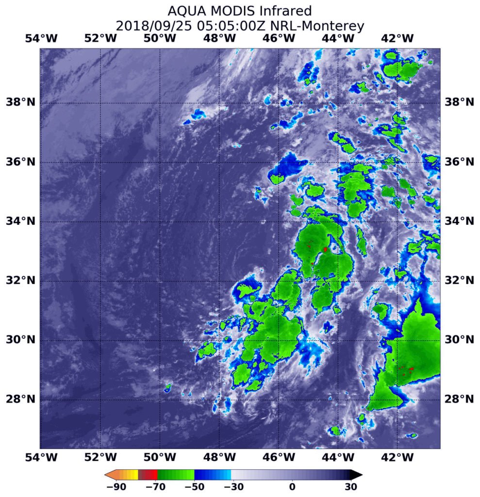
Infrared Imagery Shows Dry Air Sapping Leslie
Infrared satellite data captured at 1:05 a.m. EDT (0505 UTC) on Sept. 25, the Moderate Resolution Imaging Spectroradiometer or MODIS instrument aboard NASA’s Aqua satellite revealed strongest storms with the coldest cloud top temperatures east and southeast of Leslie’s center. MODIS found coldest cloud tops had temperatures near minus 63 degrees Fahrenheit (minus 53 degrees Celsius). NASA research has found that cloud top temperatures that cold have the capability to generate heavy rainfall.
The western quadrant appeared devoid of clouds because dry air had moved into the western side of the storm, suppressing thunderstorm development.
What is a Sub-tropical Storm?
A sub-tropical storm is a low-pressure system that is not associated with a frontal system and has characteristics of both tropical and extratropical cyclones. Like tropical cyclones, they are non-frontal that originate over tropical or subtropical waters, and have a closed surface wind circulation about a well-defined center. Unlike tropical cyclones, subtropical cyclones derive a significant proportion of their energy from baroclinic sources (atmospheric pressure), and are generally cold-core in the upper troposphere, often being associated with an upper-level low pressure area or an elongated area or trough of low pressure. In comparison to tropical cyclones, these systems generally have a radius of maximum winds occurring relatively far from the center (usually greater than 60 nautical miles), and are generally less symmetric.
What is a Post-tropical Storm?
The National Hurricane Center or NHC defines a post-tropical storm as a former tropical cyclone. This generic term describes a cyclone that no longer possesses sufficient tropical characteristics to be considered a tropical cyclone. Post-tropical cyclones can continue carrying heavy rains and high winds. Note that former tropical cyclones that have become fully extratropical…as well as remnant lows…are two classes of post-tropical cyclones.
Last Advisory Issued by NHC
At 11 a.m. EDT (1500 UTC) on Sept. 25, the National Hurricane Center or NHC issued their final advisory on Leslie after the storm transitioned to a post-tropical storm. At that time the center of was located near latitude 31.6 degrees north and longitude 44.4 degrees west. Leslie is far from land areas. It is 1,080 miles (1,735 km) west-southwest of the Azores Islands. Maximum sustained winds remain near 35 mph (55 kph) with higher gusts.
The NHC said “Strengthening as a post-tropical cyclone is expected, and Leslie is forecast to become a large and powerful post-tropical cyclone by Wednesday with winds increasing to hurricane force on Thursday, Sept. 27.
Additional information can be found in High Seas Forecasts issued by the National Weather Service at: https://ocean.weather.gov/shtml/NFDHSFAT1.shtml