November 27, 2018 – NASA-NOAA Satellite Finds Man-yi Becoming Extra-tropical
Tropical Cyclone Man-yi appeared elongated on satellite imagery as it continued moving in a northeasterly direction in the Northwestern Pacific Ocean. Man-yi was being affected by wind shear and was becoming an extra-tropical cyclone.
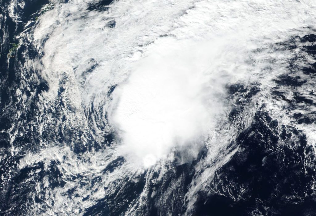
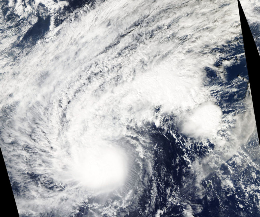
On Nov. 27, the Visible Infrared Imaging Radiometer Suite (VIIRS) instrument aboard NASA-NOAA’s Suomi NPP satellite analyzed Tropical Cyclone Man-yi. A visible image showed that wind shear was affecting the storm and it was elongated from southwest to northeast.
In general, wind shear is a measure of how the speed and direction of winds change with altitude. Winds at different levels of the atmosphere push against the cylindrical circulation center and weaken the storm’s rotation.
On Nov. 27, the Joint Typhoon Warning Center issued the final warning on Man-yi.
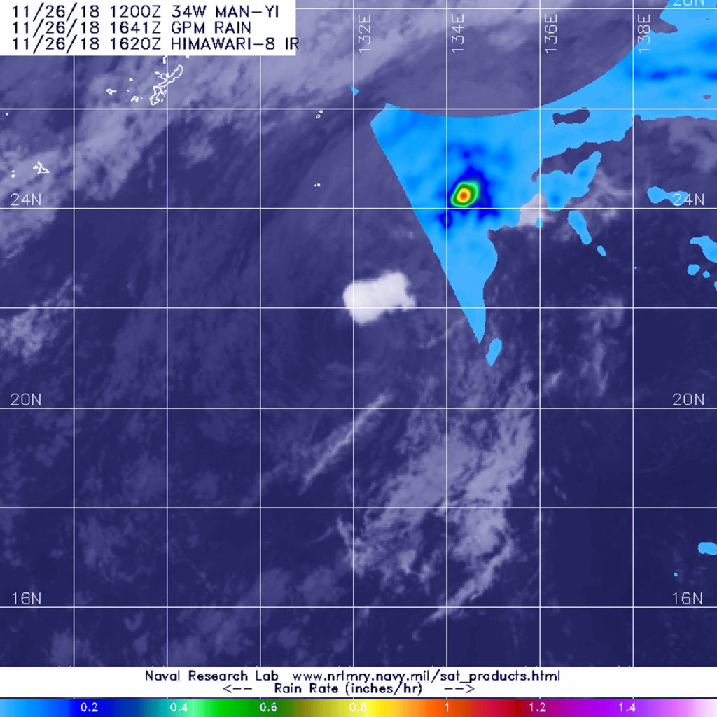
At 10 a.m. EDT (1500 UTC) Man-yi’s maximum sustained winds were near 30 knots (34.5 mph/55.5 kph). It was located near 24.1 degrees north latitude and 133.8 degrees east longitude. That’s approximately 351 nautical miles east-southeast of Kadena Air Base, Okinawa, Japan. Man-yi was moving northeastward.
Man-yi already started the process into an extra-tropical transition. That happens when a tropical cyclone has lost its “tropical” characteristics. The National Hurricane Center defines “extra-tropical” as a transition that implies both poleward displacement (meaning it moves toward the north or south pole) of the cyclone and the conversion of the cyclone’s primary energy source from the release of latent heat of condensation to baroclinic (the temperature contrast between warm and cold air masses) processes. It is important to note that cyclones can become extratropical and still retain winds of hurricane or tropical storm force.
On Nov.27, Man-yi is expected to complete extra-tropical transitioning in the next day.

