December 17, 2018 – NASA Catches India Landfall of Tropical Depression Phethai
NASA’s Aqua satellite passed over the Northwestern Indian Ocean and captured a visible image of Tropical Depression Phethai after it made landfall in southeastern India.
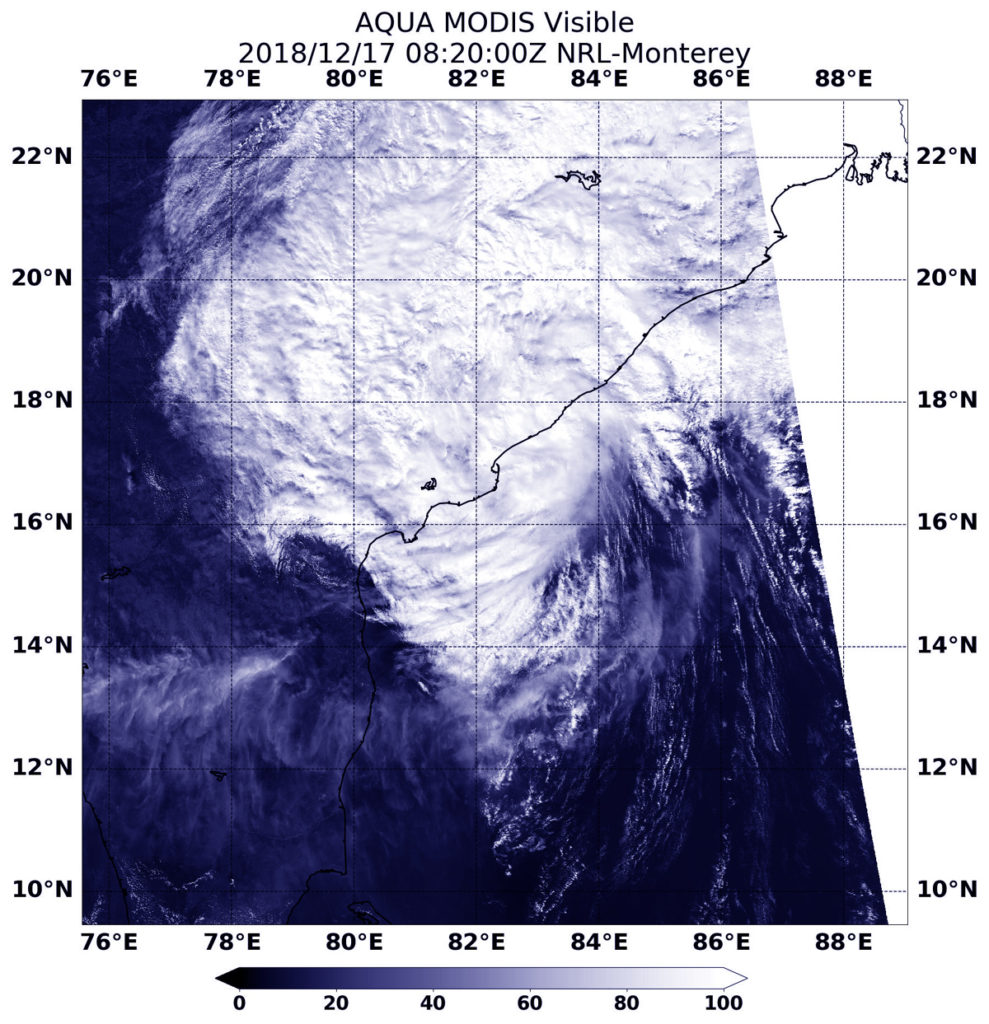
Phethai developed on Dec. 15 as tropical cyclone 08B, about 450 miles south-southeast of Visakhapatnam, India. Phethai made landfall early on Dec. 17 south of the city of Visakhapatnam, in the Indian state of Andhra Pradesh, on the Bay of Bengal.
On Dec. 17 at 3:20 a.m. EST (0820 UTC) the MODIS instrument aboard NASA’s Aqua satellite looked at Tropical Depression Phethai after it made landfall south of Visakhapatnam. Satellite imagery showed that the bulk of clouds and showers were north and east of the center of circulation indicating that wind shear was affecting the storm.
In general, wind shear is a measure of how the speed and direction of winds change with altitude. Wind shear can tear a tropical cyclone apart or weaken it.
On Dec. 17 at 10 a.m. EST (1500 UTC) the Joint Typhoon Warning Center noted that Phethai had maximum sustained winds near 30 knots (34.5 mph/55.5 kph). It was centered near 17.7 degrees north latitude and 82.4 east longitude, about 65 nautical miles west-southwest of Visakhapatnam, India. Phethai has tracked northward.
Phethai is forecast to move on a north-northeasterly track over land and rapidly weaken.