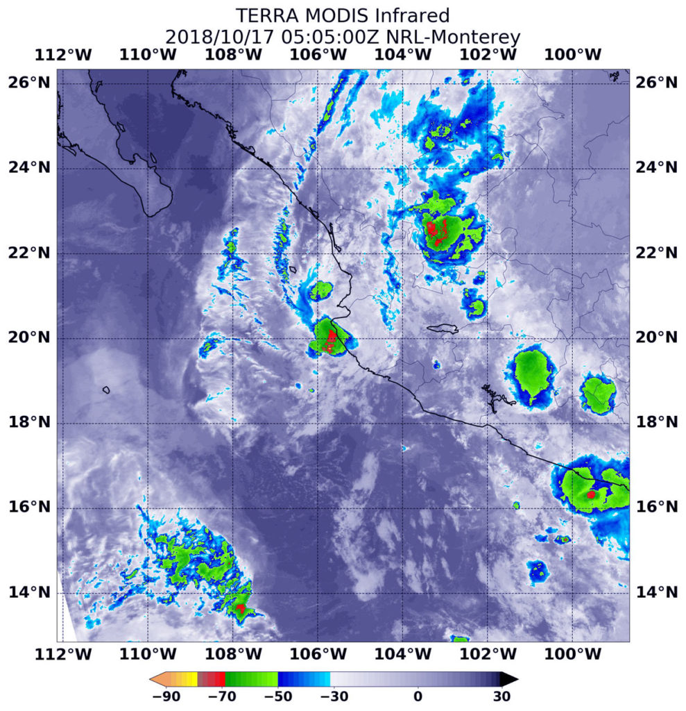
Oct. 17, 2018 – NASA Catches the Scattered Remains of Former Tropical Storm Tara
NASA’s Aqua satellite captured an infrared image of the remnants of former Tropical Storm Tara after it dissipated near the coast of western Mexico’s Jalisco state. Jalisco is a western Mexican state along the Eastern Pacific Ocean.

On Oct. 16 the high terrain of Mexico caused Tara’s surface circulation to open into a trough or elongated area of low pressure and dissipate.
At 11 p.m. EDT on Oct. 16 (0300 UTC on Oct 17) the National Hurricane Center or NHC noted the remnants of Tara were located near latitude 20.0 degrees north and longitude 105.5 degrees west. That’s 105 miles (170 km) northwest of Manzanillo, Mexico. Maximum sustained winds were near 35 mph (55 kph) and waning.
At that time, NHC’s discussion stated “The remnants of Tara are expected to produce additional rainfall of 1 to 3 inches over the Mexican states of Colima and western Jalisco, through tonight, with isolated maximum storm total amounts of 15 inches possible. These rains may produce life-threatening flash floods and mudslides, especially in mountainous terrain.”
At 1:05 a.m. EDT (0505 UTC) on Oct. 17, the MODIS instrument that flies aboard NASA’s Aqua satellite gathered infrared data on the remnants of Tara. Infrared data provides temperature information. Strongest thunderstorms were found along western Mexico’s coast just south of Puerto Vallarta and scattered throughout Jalisco state. Those fragmented storms had cloud top temperatures as cold as minus 63 degrees Fahrenheit (minus 53 Celsius). NASA research has shown that cloud tops with temperatures that cold were high in the troposphere and have the ability to generate heavy rain.


