July 24, 2019 – NASA’s Terra Sees the End of Atlantic Tropical Depression 3
The third tropical depression of the Atlantic Ocean hurricane season didn’t last long. NASA’s Terra satellite provided an image of the system’s remnant clouds on July 23, 2019.
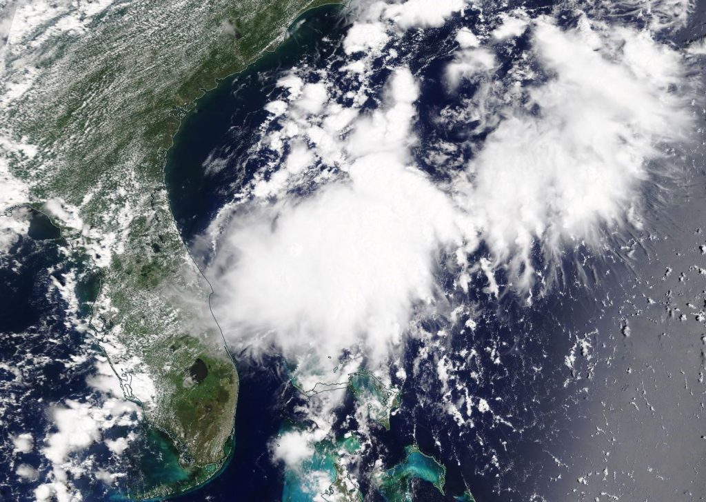
NASA’s Terra satellite captured a visible image of the remnants of Tropical Depression 3 on July 24, 2019 at 1:30 p.m. EDT off the east coast of Florida. Credit: NASA Worldview
Tropical Depression 3 formed on Monday, July 22 and dissipated by 11 a.m. EDT (1500 UTC) on July 24, 2019. At that time, the National Hurricane Center or NHC issued the final advisory on the remnants of the depression as it dissipated near latitude 29.0 degrees north and longitude 80.0 degrees west. It was centered about 60 miles (100 km) east-southeast of Daytona Beach, Florida and about 100 miles (160 km) southeast of St. Augustine, Florida. The remnants were moving toward the north near 17 mph (28 kph). Maximum sustained winds were near 35 mph (55 kph) with higher gusts.
Two hours after the final update from the NHC, the MODIS instrument aboard NASA’s Terra satellite captured a visible image of the remnants of Tropical Depression 3. The MODIS image showed the elongated remnant clouds of Tropical Depression 3 on July 24, 2019 at 1:30 p.m. EDT off the east coast of Florida.
July 23, 2019 – NASA Analyzes New Atlantic Depression’s Tropical Rainfall
Tropical Depression 3 has formed about off the eastern coast of central Florida. NASA analyzed the rainfall that the new depression was generating using the Global Precipitation Measurement mission or GPM core satellite.
The Global Precipitation Measurement mission or GPM core satellite passed over Tropical Depression 3 at 5:21 a.m. EDT (0921 UTC) on July 23. GPM found the heaviest rainfall (orange) was northeast of the center of circulation. There, rain was falling at a rate of 25 mm (about 1 inch) per hour. Credit: NASA/JAXA/NRL
The third depression of the Atlantic Ocean hurricane season developed around 5 p.m. EDT on July 22 about 120 miles (195 km) southeast of West Palm Beach, Florida.
The Global Precipitation Measurement mission or GPM core satellite passed over Tropical Depression 3 at 5:21 a.m. EDT (0921 UTC) on July 23. GPM found the heaviest rainfall was northeast of the center of circulation. There, rain was falling at a rate of 25 mm (about 1 inch) per hour. The National Hurricane Center noted in their discussion, “Although deep convection has redeveloped near and to the northeast of the low-level center, the overall convective appearance is somewhat ragged.”
On July 23, the National Hurricane Center or NHC noted at 5 a.m. EDT (0900 UTC), the center of Tropical Depression Three was located near latitude 27.0 degrees North and longitude 79.5 degrees west. That puts the center of Tropical Depression 3 (TD3) about 40 miles (70 km) east-northeast of West Palm Beach, Florida, and about 55 miles (90 km) northwest Freeport, Grand Bahama Island.
Maximum sustained winds had increased to near 35 mph (55 kph) with higher gusts. No significant increase in strength is anticipated and the depression is forecast to dissipate on Wednesday, July 24.
The depression is moving toward the north near 12 mph (19 kph). A motion toward north-northeast with an increase in forward speed is expected tonight, followed by a turn toward the northeast on Wednesday.
On the NHC forecast track, the center of the depression should remain offshore the coast of the southeastern United States through Wednesday.
GPM is a joint mission between NASA and the Japan Aerospace Exploration Agency, JAXA.