Student Airborne Science Alumni Fly High

by Emily Schaller / PALMDALE, CALIFORNIA /

The Student Airborne Research Program (SARP) is now in its eighth summer. Many SARP alumni have gone on to get advanced degrees, others now work at NASA centers, national labs and universities, and some even participate on NASA Airborne Science Program research campaigns.

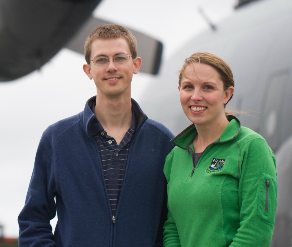
Two SARP alumni, Benjamin Nault (2010) and Tamara Sparks (2012), were instrument scientists on board the DC-8 during the Korea U.S.-Air Quality mission in May. Ben is a postdoc at the University of Colorado, Boulder. He operated an instrument that measured the chemical composition of small particles in the atmosphere. Tamara is a graduate student at the University of California, Berkeley, who operated an instrument that measures nitrogen dioxide, a molecule that is important for understanding pollution production rates and lifetimes. Here they describe how the SARP internship influenced their careers and their work on the KORUS-AQ mission.

When you were a little kid, what did you want to be when you grew up?

Ben: At first, I did not even think about being a scientist and my inclinations were more in the arts—chef, jazz musician, art teacher. Though I still cook as a source of relaxation every night, it was towards the end of 8th grade, after experiencing middle school science classes, that I started wanting to be a scientist. In particular, I was drawn to environmental science, especially due to all the activities I did outside, such as camping, hiking and fishing.
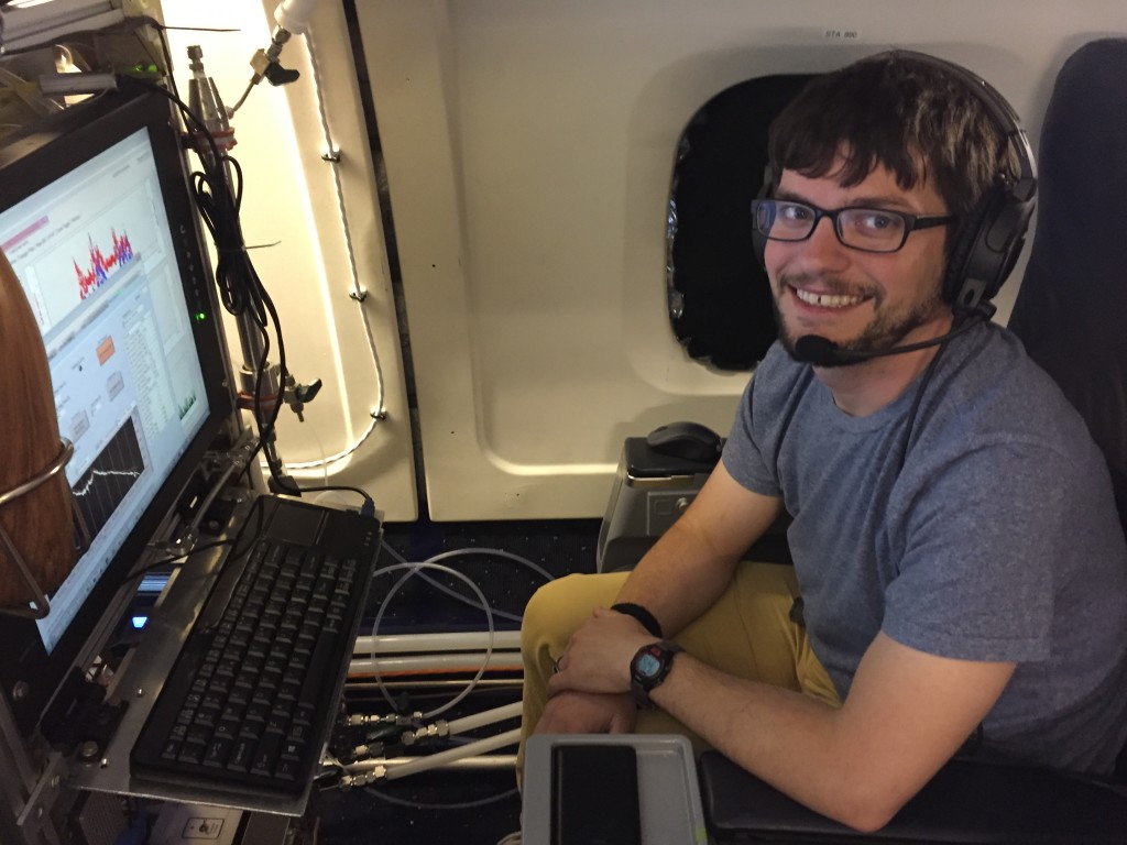
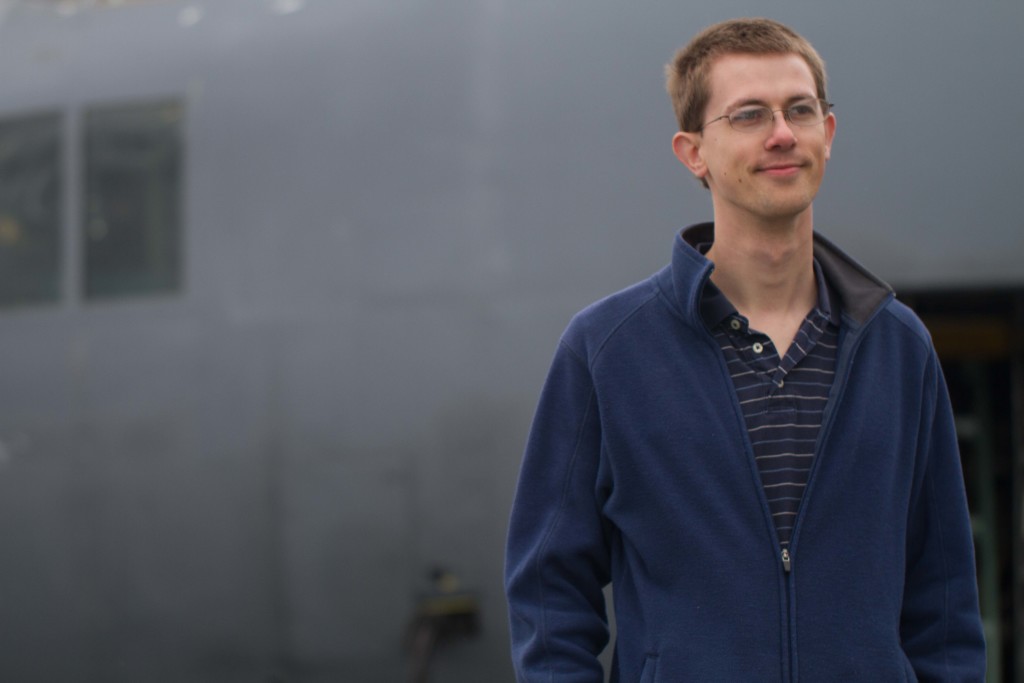
Ben_Nault_DC8_KORUSBen Nault onboard the NASA DC-8 during the Korea U.S.-Air Quality mission.

Tamara: There were a variety of things I wanted to be when I grew up, but the ones that come to mind are an astronaut or a marine biologist.

Describe your educational background before SARP.

Ben: I was completing my bachelor of science in chemistry at Purdue University. I decided to go to Purdue in order to earn a degree in the one of the core sciences prior to going to graduate school for my Ph.D. Originally, I wanted to do research in oceanography; however, Purdue provided undergraduate research opportunities with two groups looking at atmospheric chemistry problems. These opportunities allowed me to participate in research in Chile and a large science mission in northern Michigan. These opportunities made me extremely excited about atmospheric chemistry prior to applying to SARP.

Tamara: Before SARP, I was attending Westmont College, where I got a B.S. in chemistry. I was looking for a way to apply my background in chemistry to studying the environment. I didn’t know that atmospheric chemistry was a field until I heard about SARP, and it immediately struck me as a perfect fit for my interests.
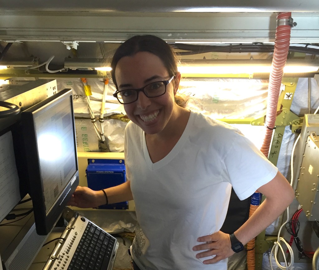
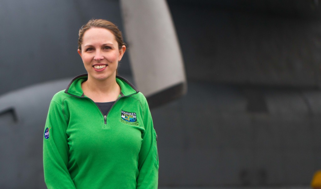
Tamara_Sparks v2Tamara Sparks at work over Korea on NASA’s DC-8 flying laboratory.

What was an exciting part of the KORUS-AQ mission for you?

Ben: One aspect I love about my research is the opportunity to travel, and this mission took me to South Korea (awesome sauce!). Also, South Korea provides an excellent opportunity to investigate the impacts of local emissions on regional chemistry (and vice versa) as well as the impacts of these emissions on biogenic chemistry due to its geography.

Tamara: I was excited to experience an international airborne science mission. It’s exciting that while doing science, I get to travel and experience new places.

What are your goals for the future?

Ben: I plan on becoming a research professor at a university and continuing my investigation of atmospheric chemistry, including aspects that would need airborne research.

Tamara: Graduate with a Ph.D.! I’m not certain yet what I will do after, although I plan to continue doing work related to the atmosphere. 

What would you tell an undergraduate who was thinking about applying for SARP?

Ben: It is an awesome opportunity. The program gives you an opportunity to see how airborne research is done and to see how the sciences are used to investigate tangible, real-world problems. Also, flying on a research airplane 1000 feet above ground level is something you will never forget. Try to do as many research and/or internship opportunities as possible prior to graduating to help you decide what you want to do after you graduate. Finally, enjoy this opportunity. It’s awesome!!!!!

Tamara: Definitely apply! SARP was a great and unique experience. I learned so much and got to see firsthand how airborne science is done. The connections I made and knowledge I gained have been incredibly valuable.

Students Experience Airborne Science over California

by Mariah Heck, Julia Lafond and Ariana Tribby / PALMDALE, CALIF. /

Thirty-two undergraduates from across the country had the experience of a lifetime last week flying on the NASA DC-8 laboratory as part of the NASA Student Airborne Research Program (SARP). This hands-on internship gives students the opportunity to not only help scientists collect data but also creatively design their own research projects based on that data to address environmental issues that have global impact.  

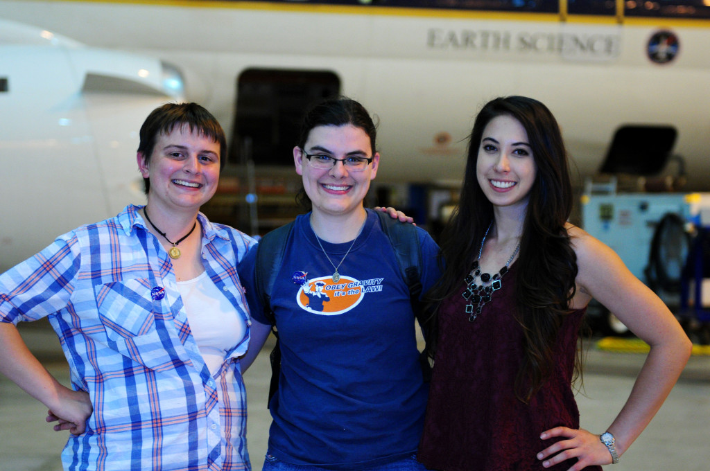
On June 17 and 18, the students flew on the DC-8, which had recently returned from research flights in the Republic of Korea as part of NASA’s Korea U.S.-Air Quality mission. SARP participants observed and participated in flight planning and scientific data collection. Here, three of those students—Mariah Heck, Julia Lafond and Ariana Tribby—share their flight experiences. Julia is a geology major and biology minor from North Carolina State University. Mariah studies geophysics and geology at the University of Tulsa in Oklahoma. Ariana is a chemistry major at Pomona College in Claremont, California.

Students
Mariah Heck, Julia Lafond and Ariana Tribby. Credit: NASA/Jane Peterson

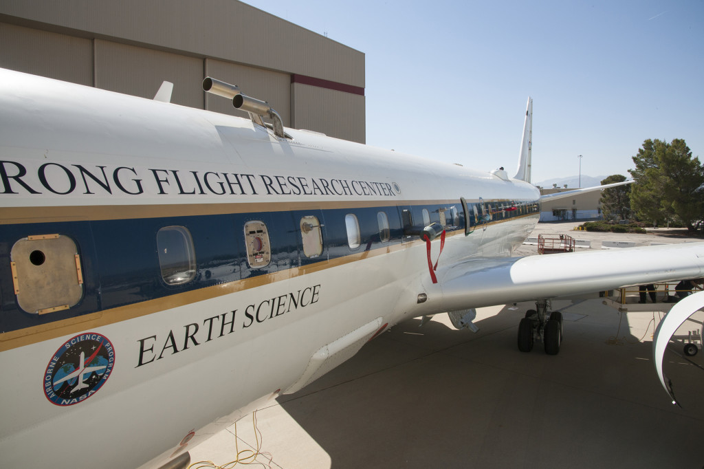
The NASA DC-8 is not your typical commercial aircraft. The windows are filled with many sensors and air sampling devices that feed into instruments inside the plane. Usually, SARP flights have just a few instruments on board, but this time there were more than 20 because of the recent Korea U.S.-Air Quality mission (KORUS-AQ).

Aircraft exterior
The DC-8 is highly modified to accommodate various air intake probes for the Student Airborne Research Program (SARP) mission. Credit: NASA/Carla Thomas

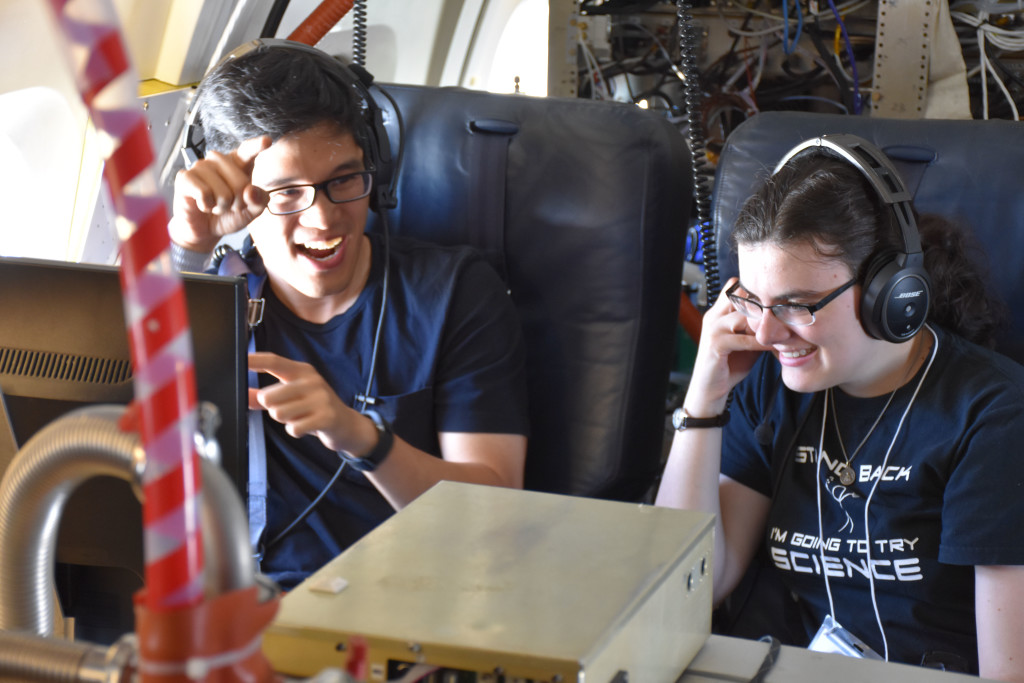
We wandered around the plane during flight to learn about not only the equipment on board but also how scientists work together on missions. Seeing the data-gathering process in action was incredible. While we were flying, the scientists announced their findings over headsets. They would often ask each other about the levels of specific compounds they were measuring, because results from each instrument comprised a piece of the entire puzzle of chemical reactions taking place in the atmosphere. It demonstrated that no scientific research is truly isolated—collaboration is key.

Student Airborne Research Program (SARP) students enjoyed interacting with recently returned researchers from the Korea U.S.-Air Quality mission. Julia learns about one of the spectrometers used to analyze air pollution. Credit: NASA/Jane Peterson
SARP students enjoyed interacting with recently returned researchers from the Korea U.S.-Air Quality mission. Julia learns about one of the spectrometers used to analyze air pollution. Credit: NASA/Jane Peterson

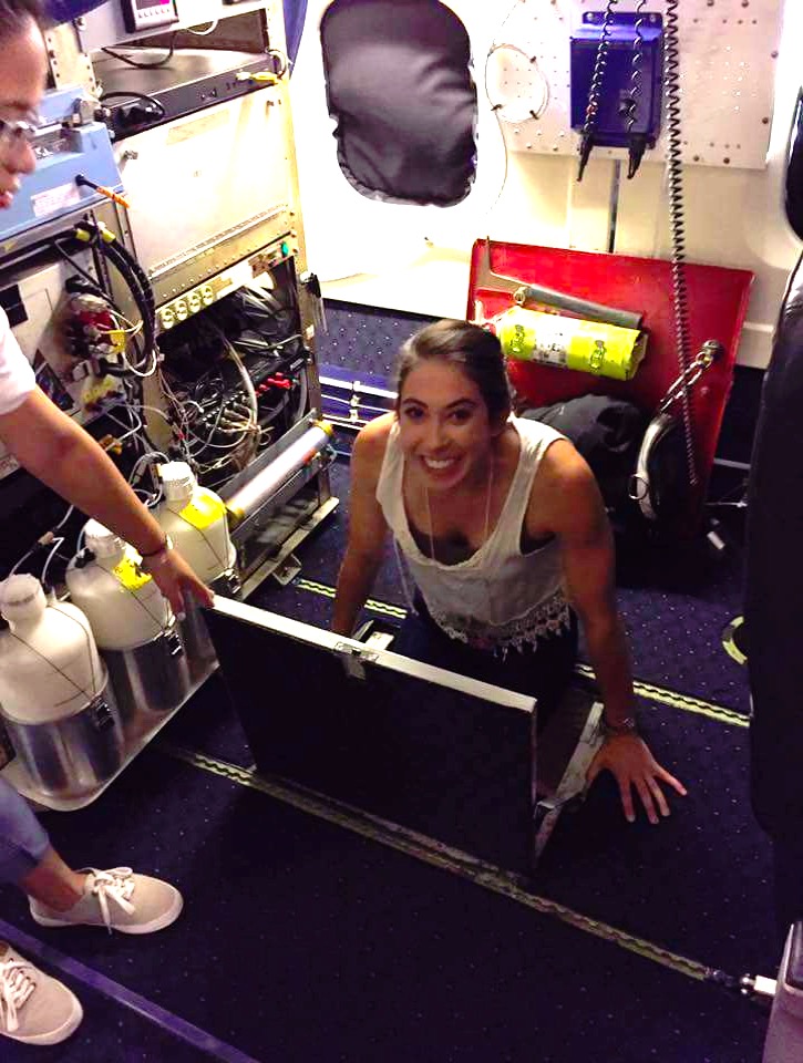
One of the instruments, the Airborne Tropospheric Hydrogen Oxides Sensor (ATHOS), required adjustments below deck to allow the flow of several gases into the sensor above. The scientist operating this instrument, Alexandra Brosius, gladly took students into the cargo area to demonstrate how to adjust gas flow inlets. It was extremely exciting to get into the pit, all while fighting to keep our balance because of all of the bumps and movement caused by the DC-8 flying through turbulent winds.

Aircraft interior
Ariana emerges from the aircraft cargo pit area. Credit: Claire Buysse

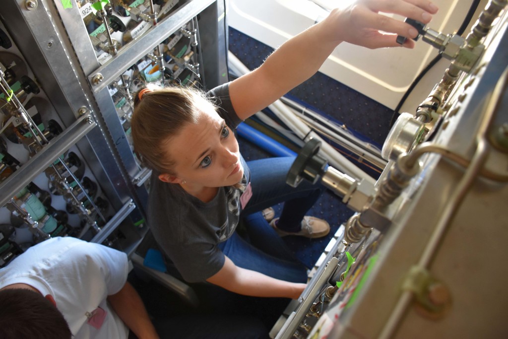
The whole air sampling team was the busiest student group. They took samples of the outside air by filling vacuum cylinders every five minutes throughout the duration of the flight. They took samples more frequently at specific locations, such as when the aircraft flew over oil drilling fields or during missed approaches. Careful sampling during these events is essential for examining harmful emissions at their source.

Aircraft interior
SARP participant Dakota Crane operates the Whole Air Sampler in flight aboard the DC-8. Credit: NASA/Jane Peterson

Going into the flights, we were both nervous and excited, as we were thoroughly warned that flying would consist of many spirals and missed approaches at area airports in order to collect data closer to the ground. A missed approach means approaching the runway like you are going to land, but then pulling back up. These maneuvers would also involve a lot of turbulence, and the high temperatures meant the plane would be uncomfortably warm—all factors that contribute to airsickness.

Flight tracks
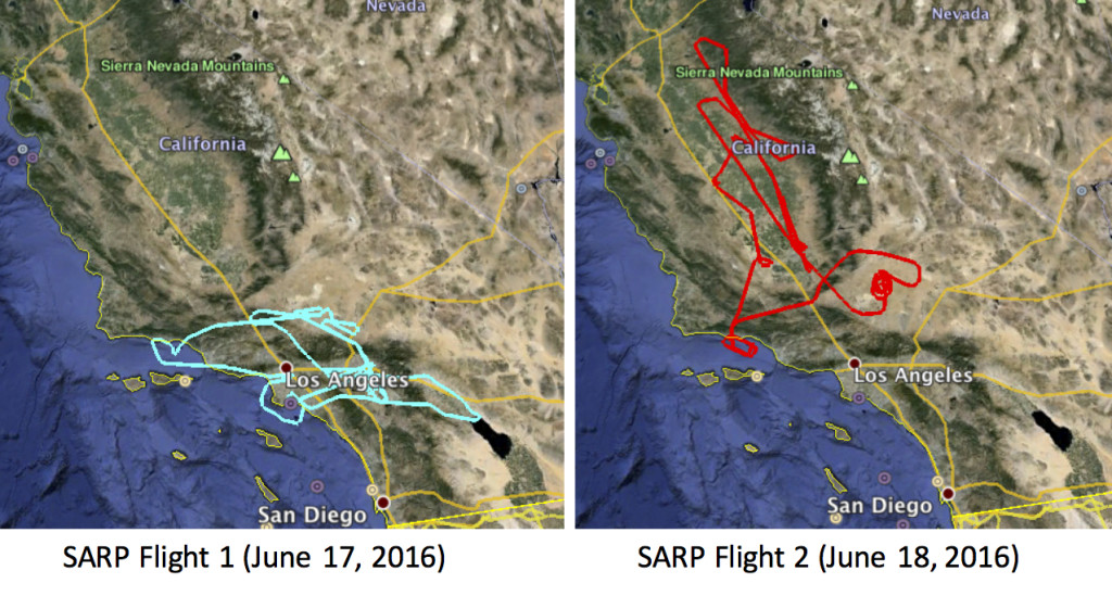
The flight tracks over southern and central California for two SARP research flights. Credit: NASA

As planned, we made several missed approaches, and because most of the flight took place in the boundary layer (approximately 1000 feet above ground), it was a bumpy flight overall. The maneuvers and low flying made seven people queasy.

During parts of the flight, we could see smoke through the window. The Sherpa brush fire outside Santa Barbara was in full swing that weekend, and we could see how it directly influenced the chemistry of the atmosphere.

A time-lapse video of the NASA DC-8 sampling haze from a wildfire near Santa Barbara, CA on June 18, 2016 during a SARP flight.

Despite the motion sickness, heat and tight space, this was an experience of a lifetime and we were very honored and fortunate to work with such incredible, accomplished scientists, engineers and pilots!

CORAL Completes First Airborne Look at Coral Reefs

Scientists stand near research aircraft
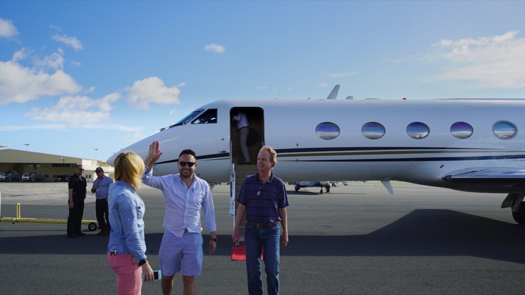
A high five for a successful science flight. Michelle Gierach (left) greets Coral Reef Airborne Laboratory (CORAL) Project System Engineer Ernesto Diaz and Portable Remote Imaging Spectrometer (PRISM) Lead Technician Scott Nolte, all of NASA’s Jet Propulsion Laboratory, after its arrival June 19 at Honolulu International Airport.

by Carol Rasmussen / OAHU, HAWAII /

The Coral Reef Airborne Laboratory’s research aircraft collected its first coral reef data on Sunday, June 19. As the Gulfstream-IV aircraft approached Oahu from Southern California, it took a sharp right turn off the normal approach route. The plane flew a long, straight line above the island’s windward coast, then turned around and flew a second line right next to the first one, like lawnmower tracks. As it flew, NASA’s Portable Remote Imaging SpectroMeter (PRISM) collected spectral measurements, light reflected from the Oahu coastal waters below the aircraft.

As CORAL project scientist Michelle Gierach waited for the plane in Honolulu, she watched the flight lines on her computer, using flight-tracker software. “We’ve been on location waiting for this exact moment,” she said. “Everything has come together — the weather, the plane, and the in-water team. Right now we’re having optimal weather conditions. The field team is in the water as the plane is flying over. You can see [the plane] is aligned perfectly over Kaneohe Bay.”

The group is planning one or more additional science flights, but Gierach is already happy with what CORAL has accomplished. “This has been a long day coming,” she said. “I can’t believe everything has aligned perfectly. It’s been a super-successful operational readiness test.”

   Gierach gives an overview of the CORAL campaign’s research aircraft and the PRISM instrument.

Research aircraft
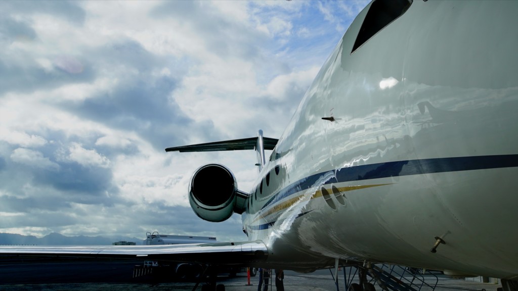
PRISM flies on a Gulfstream-IV from Tempus Applied Solutions. The plane’s Hawaii base for the CORAL flights is Air Service Hawaii at Honolulu International Airport.
Scientists examine an aircraft instrument.
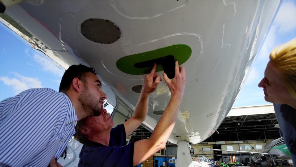
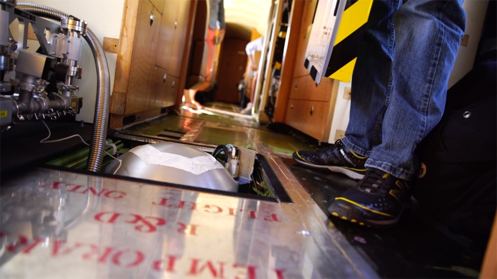
Diaz, Nolte and Gierach examine PRISM’s peephole beneath the plane. The instrument records the spectra of light reflected from surfaces below the plane.
Looking like a very large teakettle, PRISM is recessed into the floor the plane. Specifically designed to observe coastal systems, after a successful test run in Hawaii, the instrument will be used in the CORAL campaign to collect information about coral reef ecosystems across the Pacific.
Looking like a very large teakettle, PRISM is recessed into the floor of the plane. After a successful test run in Hawaii the instrument will be used in the CORAL campaign to collect information about coral reef ecosystems across the Pacific.

The Puzzling Case of Kaneohe Bay

Bay in Hawaii
Kaneohe Bay, with Moku O Loe island at right center. Dredge and fill operations in the bay expanded the island from 12 acres to 28 acres. Credit: NASA/James Round

by Carol Rasmussen / OAHU, HAWAII /

The Coral Reef Airborne Laboratory (CORAL) will be the first campaign to study coral reefs at an ecosystem scale. During its operational readiness test in Hawaii last week, we had a chance to talk with two people who have made a lifelong study of their own coral reef in Kaneohe Bay, Oahu, where the CORAL test is taking place. There’s a striking similarity between their observations and those of the CORAL scientists.

“Did you know this used to be called Coral Gardens?” said Leialoha (Rocky) Kaluhiwa, gesturing at Kaneohe Bay. At low tide the bay still looks like a garden, with varied shades of green and patches of coral like ornamental shrubs. In Kaluhiwa’s long lifetime, Kaneohe Bay has undergone a litany of impacts, from dredge-and-fill operations to a level of ocean acidification that some scientists predicted would kill all of the reefs. Yet the bay’s coral reefs appear to be surviving these insults, perhaps even growing in extent.

Coral reef
One of the Kaneohe Bay reefs. Credit: NASA/James Round

If one spot on Earth could prove that scientists need a better understanding of reef ecosystems, Kaneohe Bay is it. Humans started changing the bay about 700 years ago by fishing and other interactions, but in the last century, the rate of change has exploded. After World War II, Hawaii’s fast-growing population brought urbanization, pollution and silt runoff. The bay was dredged to create a ship channel and seaplane runways and filled to build out Moku O Loe island, then privately owned but now the location of the Hawaii Institute of Marine Biology. Invasive algae spread so thickly in the 1970s and 1980s that two barge vacuum cleaners called Super Suckers are still used to remove them.

Two Hawaii residents
Jerry and Rocky Kaluhiwa are lifelong residents of Kaneohe Bay. Credit: NASA/James Round

Native Hawaiians Rocky Kaluhiwa and her husband Jerry have watched these changes firsthand. “My grandparents taught me about the ocean,” Jerry said. “They taught me what kind of crustaceans we have here, how to catch them and how to prepare them. I’ve passed that knowledge over to my kids.” When Rocky was a child, the bay water was so clean it was thought to have healing properties. “If you had a big sore, they would tell you to go to a certain place in the bay and wash it out,” she said. “Today if you go to that place with that sore, it’ll get infected, because [the water is] totally polluted.” Despite that and other impacts, Jerry said, “We have more coral now [than in the past], and some new corals have come into the bay.”

“Reefs that are doing well can recover from stress or disturbance by increasing the amount of coral,” said CORAL principal investigator Eric Hochberg. He has seen this pattern not only in Kaneohe Bay but in other reefs around the world. It’s only one of many puzzles of how reef ecosystems interact with their changing environment.

In planning the CORAL campaign, Hochberg correlated data on 10 widely recognized threats to coral reefs, natural and human-made, with data on the condition of reefs worldwide. The results were surprising: There were no clear patterns. In some cases, threatened reefs even appeared to be doing better than unthreatened ones. “The question is, are reef scientists incorrect, or are we missing something in our data?” Hochberg asked. “I don’t think we’re incorrect; it makes complete sense that pollution would be bad for an ecosystem, for example. I think the problem is largely the data. That’s the impetus for CORAL.”

Scientists studying coral reefs
Daniel Schar, Hawaii Institute of Marine Biology, and Eric Hochberg, Bermuda Institute of Ocean Sciences, collecting corals in Kaneohe Bay to study their spectra. Credit: NASA/James Round

Like Hochberg, the Kaluhiwas are more concerned about the reef ecosystem than about any single species. “Coral is not only the coral alone,” Jerry said. “If you lift the coral up and look underneath, you can see oyster shells, clams, octopus, all the small fish, hiding between the branches.” The Kaluhiwas know the value of a thriving ecosystem in producing food and revenue and even have some experience with medical use of reefs, a hot area of biotechnology research today. Rocky remembers her great-aunt using powdered coral in compounding traditional medicines, but those recipes are now lost.

Rocky and Jerry have worked for decades to protect the reefs from coral harvesting and other threats, but the resilience of Kaneohe Bay has also taught them that not every impact is a disaster. That came out clearly when they talked about coral bleaching, which has featured largely in Hawaii news media this year. “You’re going to find it here and there [in the bay],” Jerry said. “That doesn’t mean that type of coral is going to die. It’s not. You watch very closely, and you can see green coming up from under the white. Those guys are growing again.”

“Absolutely we should be worried about threats to reefs, but it’s not as simple as some people think it is,” Hochberg said. “We don’t know the answers yet.” The reef areas that CORAL will survey this year encompass every reef type plus a range of environmental conditions that scientists have identified as influencing reefs. With those data in hand, scientists may finally be able to say more about the relationship between reefs and threats that is so puzzling in this beautiful corner of Oahu.

How We Became CORAL Scientists

Scientists on a boat
Coral Reef Airborne Laboratory (CORAL) scientists Michelle Gierach and Eric Hochberg identify reef locations for study at Kaneohe Bay on Oahu, Hawaii. Credit: NASA/James Round

Where most coral reef studies take the close-up view of a diver, Coral Reef Airborne Laboratory (CORAL) will get the wide-angle view that comes with remote sensing instruments. CORAL scientists Eric Hochberg, Bermuda Institute of Ocean Sciences, and Michelle Gierach, NASA Jet Propulsion Laboratory, talked about how their backgrounds and training prepared them for this ground-breaking mission.

Eric Hochberg (center) and CORAL scientists preparing for boat operations at Kaneohe Bay on Oahu, Hawaii.

Eric Hochberg, CORAL principal investigator

Did you grow up near the ocean?

I was born and raised in Tampa, Florida. Every year my father took us down to the Florida Keys to catch lobsters — “to try to catch lobsters” would be a better phrase. The whole family would spend a week on a boat, and I just loved it. Because of these experiences I started diving off the Florida Keys when I was 13 years old.

When I got to college [Brown University], I thought maybe I’d be an engineer because I liked high school physics. Then I took college physics and said “No thank you.” In my junior year, I took a class in invertebrate biology and, from that moment, I wanted to be marine biologist.

After college I lived in Taipei, Taiwan, for three years. I kept applying to grad schools, and on my third try I applied to the Department of Oceanography at the University of Hawaii. In the oceanography program my focus shifted away from “look at the pretty things” on a reef to trying to understanding reefs as an ecosystem.

When did you get involved with remote sensing?

I knew I wanted to do something with coral reefs in grad school, but I didn’t know exactly what it would be. My advisor, Marlin Atkinson, told me about a new technology program where they put a hyperspectral imager on an airplane and flew it over a reef. He thought it would fit me. It turned out to be a career-defining decision.

I’m very fortunate that I got in at the beginning of the program. No one else [in the department] was doing spectroscopy of coral reefs. My committee included renowned planetary scientists and biogeochemists, and I was able to learn from these diverse people, but I was there on my own. That was a challenge because collaborations help you get new ideas. At the same time, it was a benefit because I had to learn everything myself. That made me a lot more self-reliant than I would have been if I’d been in a big lab with 10 other grad students.

With remote sensing I see reefs as systems, not organisms. That’s a perspective that reef scientists often lack because of how they do their science. The science is very good, but it’s up close and personal. Remote sensing gives us a bird’s-eye view.

What do you hope to learn from the CORAL mission?

We’re worried about the future of coral reefs, and we have good reason to be. At the same time, I have seen reefs bounce back from major disturbances, and I have seen reefs that were not disturbed at all when we expected them to be. I have seen places where corals are growing and people say they shouldn’t even be there.

Reefs are vast and spread out over wide areas of ocean. There are a lot of fundamental questions that we can’t answer yet because we haven’t looked at enough reefs over a long enough time. CORAL will give us a better chance to answer some of those questions.

Scientist on a boat
Michelle Gierach scoping Kaneohe Bay on Oahu, Hawaii. Credit: NASA/James Round

Michelle Gierach, CORAL project scientist

Did you always want to be an oceanographer?

As a Floridian, I’ve always loved the water, but I actually started out as an aspiring TV meteorologist. Not just any meteorologist, but a Jim Cantore [from the Weather Channel] reporting live in the field during severe weather. Well, first I wanted to be Shamu’s trainer like most kids in Orlando, but by middle school I was determined to be a meteorologist.

I went to Florida State University for their renowned meteorology program. My freshman year I had an internship at [a TV station] in Orlando. It was a fantastic experience, but I realized TV was not for me. Rather, I wanted to be behind the scenes answering questions about atmospheric processes that would improve weather forecasts — a weather caped crusader of sorts.

My advisor at the time was a meteorologist and oceanographer, and he encouraged all his atmospheric science students to take oceanography classes and vice versa. The coupling between air and sea is so important that you really have to have an understanding of both. One particular class I took that got me thinking about oceanography as a career was satellite oceanography. It was intriguing to me that there was a suite of satellites informing us about different components of the Earth system. You could say this is where it all started. My master’s thesis used satellite observations to develop a technique to detect and monitor the early stages of tropical cyclone formation, and my Ph.D. dissertation [at the University of South Carolina’s Marine Science Program] used satellite observations and models to assess the ocean response to tropical cyclones.  I may not have known it at the time, but I was already destined for NASA and the Jet Propulsion Laboratory.

What is it you like so much about satellite observations?

I love the synergies, taking multiple observations to say something about a particular topic. If you look at an eddy, for example, from the Jason series [of satellites] you see it as elevated or depressed sea surface height. From a different satellite you get a chlorophyll-a response in its core or around its periphery, and from a third one you get a sea surface temperature response. Combining these observations tells a story about the transport of heat and carbon by eddies.

One of the great things about NASA is that all data are publicly available. This increases data visibility and usability to a larger community, increasing the opportunity for new measurements and science to be discovered, ultimately improving our understanding of the Earth system.

You’ve done quite a few field campaigns. How do you like field work?

When I got out of grad school I had only done remote sensing. I love it, but you always need some kind of validation to make sure that what you’re seeing is correct. For my postdoc [at the University of Miami’s Rosenstiel School of Marine and Atmospheric Science] I wanted to witness firsthand what it takes to get those observations, as well as earn the right to call myself a seagoing oceanographer.

[Gierach’s first field experience was the 2010 Impact of Typhoons on the Ocean in the Pacific campaign off Taiwan. She helped place two buoys in the path of typhoons.]

They did withstand the typhoons and took observations. If you were to look at a global map with just those two [data points], they look like nothing, but seeing the work it took to get those two … it definitely took a village. I liked going to sea and was glad I had done it, but I realized that’s not the life for me. Remote sensing is my wheelhouse. I’m going to stick with it.

What are you most looking forward to in CORAL?

Seeing all the moving parts come together. There’s beauty to that. Also, seeing if the results confirm the held assumptions that coral reef cover decreases with increasing ocean temperature and increasing marine pollution, or if they tell us something entirely different.

The next steps beyond CORAL are also exciting. Is there additional information that can be extracted from the remote sensing data to further understand reef ecosystems and their environment? Can we take the next leap toward a dedicated, spaceborne mission to provide monitoring of coral reef ecosystems with greater spatial and temporal coverage? The CORAL mission, and the steps to follow, will take us to new heights in understanding.

Looking for a Few Cloudless Hours

Leafy valley
Kaaawa Valley, near Kaneohe Bay on the island of Oahu, on an overcast day. Credit: NASA/James Round

by Carol Rasmussen / OAHU, HAWAII /

Most offices in Honolulu were closed Friday, June 10, for King Kamehameha Day, but the National Weather Service (NWS) office was open. CORAL project scientist Michelle Gierach and project manager Bill Mateer from NASA’s Jet Propulsion Laboratory dropped in to learn about Hawaii weather from the pros.

That’s not to say that Gierach and Mateer are amateurs. Gierach has bachelor’s and master’s degrees in meteorology, and as JPL’s airborne science program manager, Mateer has an advanced degree and a good working knowledge of weather maps and forecasts. But Hawaii’s tropical climate and mountain terrain offer special weather challenges. “We’re just coming into the region, and they have the expert knowledge,” Gierach said.

Scientists talking
After giving a weather map briefing, NWS Senior Meteorologist Jon Jelsema discussed Hawaii weather with Michelle Gierach. Credit: NASA/James Round

Weatherwise, the biggest concern for CORAL’s airborne instrument is clouds. On a sunny day, the Portable Remote Imaging SpectroMeter (PRISM) can see the light reflecting off the bottom of the ocean to discriminate benthic cover — the ratio of coral, sand and algae. But the light from the seafloor is only about 1 percent of the total reflected light that reaches the instrument from the atmosphere and ocean below. If cloudy skies obscure or even dim that signal, PRISM can’t produce good measurements of coral reefs.

At the Honolulu NWS office, Science and Operations Officer Robert Ballard briefed the JPL scientists on what cloud cover they’re likely to see both this week and when the campaign returns in February 2017 to survey reefs in the entire island chain.

“Climatologically, you’re fighting a battle here,” Ballard said. “But you only need clear skies for an hour or two, and there are weather patterns where you get that.” The most common such pattern is light winds with a ridge of atmospheric high pressure over or near the islands. Offshore winds at night blow clouds away from the island so that mornings are generally cloudless. This pattern is more common during winter because the trade winds don’t blow as persistently as they do the rest of the year, so even though winter is rainier, it also has more clear skies.

National Weather Service Science and Operations Officer Robert Ballard.
National Weather Service Science and Operations Officer Robert Ballard. Credit: NASA/James Round

This weather pattern, Ballard noted, can usually be spotted a few days before it reaches the islands. “Forecasting in the tropics can be tricky, but this is a large-scale pattern, which lowers the level of difficulty for us.” Small-scale events like showers are still hard to predict because even the state-of-the-art weather forecasting models that NWS uses “don’t see the island super well. Knowing the climatology is huge.”

So prospects for February are good, but the prospects for the coming weeks are not as promising, Ballard said. “The trade winds are going on for at least the next 10 days. If you get [a long period of] clear skies in the trades, I want a picture of it.”

Fortunately, science flights during the Hawaii operational readiness test will not be as demanding in terms of results as the flights during the actual field campaign, Mateer said. From his perspective as project manager, “Success for the operations readiness test is to make sure we can execute all the steps of a mission day — the airplane’s ready to go, we can communicate with the optics team in the boat, we can get the data off the plane and onto the server, and we can confirm that the quality of the data meets the requirements. It’s important to get the whole data collection machine, both remote and in situ instruments, working as one unit. Then we’ll have confidence we’re ready for full science operations when we get to Australia.”

In an Airborne Campaign, Why Boats?


Science instrument
As boat operations begin on Tuesday, June 7, Brandon Russell (University of Connecticut) drops the inherent optical properties “cage” into the water. Instruments in the cage measure how light is absorbed and scattered in the water. The measurements will help scientists “see through” the water and isolate the light reflected from the bottom. Credit: HIMB/Daniel Schar

by Carol Rasmussen / OAHU, HAWAII /

What makes the Coral Reef Airborne Laboratory (CORAL) a game-changer is its airborne instrument. NASA’s Portable Remote Imaging Spectrometer (PRISM) will fly at 28,000 feet, viewing entire coral reef ecosystems on a scale that no boat-based campaign can match. Yet CORAL is using three research boats and scuba divers in the same areas that PRISM will be flying above. With a state-of-the-art remote sensing instrument in action, what’s the point of getting wet?

“We have to go in the water to make sure the airborne data are accurate,” said CORAL principal investigator Eric Hochberg, of the Bermuda Institute of Ocean Sciences. The boat measurements are like independent witnesses in a trial. If they agree with the PRISM data, it confirms that the PRISM measurements are valid—which is why this step is called validation.

Scientist on a boat
Eric Hochberg talks about the next location for collecting data with Russell and Garcia.

As CORAL’s operational readiness test—its final dress rehearsal—continues on Oahu, the first boat team has been testing optical instruments in the waters of Kaneohe Bay. Researchers Brandon Russell, from the University of Connecticut, and Rodrigo Garcia, from the University of Massachusetts, Boston, are measuring light at the ocean surface and optical properties of the water around the 17-square-mile bay. A second boat team arrived Thursday to start assembling and testing equipment to measure reef metabolism, specifically  photosynthesis and calcification. A third boat team arriving Saturday will measure the composition (coral, algae, and sand) of the seafloor, scientifically known as benthic cover. The third team will also measure optical properties (reflectance) of the seafloor.

Hochberg noted that validation is especially important in CORAL because its science is ultimately based on the large-scale airborne measurements, and it will be collecting data in many locations where there are no supporting data available. “The airplane will be flying over remote regions where we can’t go diving and we don’t know what’s there,” he said. “Every pixel in the PRISM data will have to be identified. Some will have more coral or less coral, some will be deeper, some will be shallower. We need validation data to give us confidence in all these different conditions.”


CORAL Mission Starts Work in Hawaii

Boat
Eric Hochberg, principal investigator of the CORAL mission, steers the research boat in Kaneohe Bay. Credit: NASA/James Round

by  Carol Rasmussen / OAHU, HAWAII /

Even in dark glasses, Eric Hochberg is squinting a little in brilliant sunlight glinting from a green ocean. He is driving a research boat across Kaneohe Bay, Oahu, Hawaii, on June 7, the first day of the operations readiness test for NASA’s Coral Reef Airborne Laboratory (CORAL) mission. Hochberg, a scientist at the Bermuda Institute of Ocean Sciences and CORAL’s principal investigator, is overseeing tests of two instruments that measure water’s optical properties.

Kaneohe Bay is patchy in the sunlight, brighter and darker spots showing where the ocean floor is mostly sand and where there’s a coral reef. Warm, sheltered and spectacularly beautiful, the bay is a magnet for both locals and tourists. About a dozen tourist boats are moored on a large sandbar. Hochberg and his team appear to be the only people who are working anywhere in the vicinity, but in fact, a small island in the bay houses the researchers of the Hawaii Institute of Marine Biology (HIMB), CORAL’s base during this Hawaii test.

Moku O Lo'e, also known as Coconut Island, is CORAL's base of operations in Hawaii. Credit: NASA/James Round
Moku O Loe, also known as Coconut Island, is CORAL’s base of operations in Hawaii. Credit: NASA/James Round

Hochberg has been working for years to bring a program like CORAL into existence. “The coral reef data we have were mostly gathered by scuba divers with measuring tapes, so they’re local, inconsistent and patchy,” he says. “CORAL will give us the first large, uniform dataset on the condition of coral reefs across key regions of the Pacific. We have good reason to be concerned about the future of reefs, but there are a lot of fundamental things we just don’t understand about them. With the CORAL dataset, we can begin to better understand how reefs interact with their environments.”

What makes this possible is a new airborne instrument called PRISM, the Portable Remote Imaging Spectrometer. Michelle Gierach of NASA’s Jet Propulsion Laboratory is the CORAL project scientist. She says, “PRISM is the heart and soul of the CORAL mission. It came into being to address the challenge of coastal observations.”

Scientist
Michelle Gierach, CORAL’s project scientist, at the Hawaii Institute of Marine Biology on Oahu. Credit: NASA/James Round

The abundant light on the water that makes the scientists squint creates similar problems for remote sensors trying to focus on dimly visible objects underwater. PRISM was designed specifically to handle these tough light conditions. From reflected light on the ocean, it can extract the spectral signatures of coral, sand and algae — important indicators of the condition of a reef. The PRISM instrument is able to survey entire reef ecosystems in about the same time it would take boat-based researchers to survey a few square yards or meters.

In Kaneohe Bay, the scientists pull their instrument out of the water one final time, and Hochberg points the boat back toward HIMB’s boat docks. Their agenda for today was to check the performance of the optical instruments, and they’ve collected enough data for a first test. Two other boat teams will also be checking out their instruments in the next few days. When the aircraft and PRISM arrive from the mainland, the boat teams and aircraft will make more or less simultaneous measurements on and over the bay. While that’s going on, the workers on Kaneohe Bay might actually outnumber the tourists.

Canadian Fire Plume Detected During NAAMES Transit Flight

Island from the air
NASA’s C-130 descends down in a spiral over Sable Island during a May 13 transit flight. Credit: Denise Lineberry / NASA

by Denise Lineberry / ST. JOHN’S, CANADA /

Sometimes, researchers don’t find data as much as the data finds them. Such was the case for the transit flight on May 13 from NASA’s Langley Research Center to St. John’s International Airport to support NAAMES, or the North Atlantic Aerosols and Marine Ecosystems Study.

The mission focuses on collecting biogenic or marine aerosols — far away from land and away from human influence. After all, about 71 percent of Earth’s surface is water, and the oceans hold about 96 percent of it. It can be easy for the everyday person on land to overlook the massive influence that the ocean has on the atmosphere and climate. But by air and sea, NAAMES researchers work tirelessly in the field to study this connection.

Flying over narrow, crescent-shaped Sable Island in Nova Scotia, some 185 miles southeast of Halifax and home to only a handful of residents, is a great place to collect biogenic data and validate aerosol instruments from a ground site on the island.

NAAMES researchers flying over during the transit flight on NASA’s C-130 at 3,200 feet didn’t expect to fly through an extensive smoke plume. But that’s exactly what happened. 

Along the aircraft’s track, the plume appeared as a haze, but the scientific instruments on board the aircraft would get a much better view. The instruments, along with measurements from a ground station on Sable Island, measured the vertical extent and composition of the plume. To do this, they ascended and descended in spirals over the island to fully capture the plume’s variations.

Onboard, the LARGE, or Langley Aerosols Research Group Experiment, in situ suite captured aerosol features in the marine boundary layer and upper troposphere. Langley’s HSRL, or High Spectral Resolution Lidar, also captured data on smoke features in the marine boundary layer of the atmosphere, widely influenced by the ocean.

The High Spectral Resolution Lidar (HSRL) lidar captures smoke features in the atmosphere and ecosystem features in the ocean. Credit: NASA

The curiosity that makes a scientist, well, a scientist, kicked into full gear. They wanted to know where the plume came from.

They knew of wildfires, which began on May 3 just southwest of Fort McMurray and proceeded to sweep through the community, resulting in Alberta’s largest wildfire evacuation. But to see from where else the plume could have originated, they looked at a map from the Canadian Wildland Fire Information System.

From there, they were able to create a forward trajectory of fires using the National Oceanic and Atmospheric Administration’s Hybrid Single Particle Lagrangian Integrated Trajectory (HYSPLIT) Model, and determined that the plume over Sable Island came from fires near Winnipeg. Earlier this month, two massive forest fires broke out on the Manitoba-Ontario border covering about 75,000 hectares at its peak, resulting in the evacuation of two provinces. Since then, it’s been 60 percent contained. The plume from the fires traveled about 1,700 miles to Sable Island in Nova Scotia, where it was detected by NASA’s C-130.

“It is well known that biomass plumes from large forest fires are transported a great distance across the globe,” said NAAMES research scientist John Hair. “It will be interesting on this flight to connect the aircraft measurements made in the atmosphere and the ocean, and relate them to what the satellite saw on the same day.”

The NAAMES team will further study the plume data gathered from the transit flight with help from student researchers making corroborative data from the Sable Island Ground Station, the only permanently staffed facility on the island.

Students.
Student researchers make corroborative measurements at a ground station on Sable Island for NAAMES. Credit: Mark Gibson

The team was pleased that the plume’s trajectory does not reach as far out as their NAAMES mission study area, approximately 500 nautical miles off the coast of the North Atlantic, where marine aerosols and the research vessel Atlantis roam free. That’s where they were headed for their first official science flight on May 18.

From plumes rising from massive fires to aerosols rising from microscopic marine life – everything on the land, in the ocean and in the atmosphere plays a part in Earth’s interconnected system. And some very curious NAAMES researchers are on the case to understand a massive part of that system better than they ever have before.

Sunny with a Chance of Icebergs

While in the field, plans can change as quickly as the weather. Meteorologists for the North Atlantic Aerosols and Marine Ecosystems Study (NAAMES) constantly provide forecasts for the aircraft and ship teams who, weather permitting, will rendezvous several times over the next few weeks in the North Atlantic — home to the world’s largest phytoplankton bloom. Plankton ecosystems profoundly affect climate and life on Earth.

NAAMES meteorologists Amy Jo Scarino and Michael Shook tend to work behind the scenes, but they are an integral part of making the mission successful. Amy Jo, a Penn State graduate with a B.S. in meteorology, works at NASA’s Langley Research Center. Michael graduated from the University of Kansas with a B.S. in atmospheric science and began working at NASA Langley as a programmer/analyst with the atmospheric composition branch.

Amy Jo Scarino. Credit: Michael Starobin/NASA

Amy, what is your involvement with the NAAMES mission?

AJS: I am one of the project meteorologists and helping out with flight planning.  I am also a member of the High Spectral Resolution Lidar [HSRL] team – one of the instruments on the C-130 – and will assist with processing the data.

How did you end up in meteorology?

AJS: Growing up in Michigan, I always enjoyed the weather, especially watching thunderstorms from the front porch and also lake effect snowstorms.  In high school, I made contact with the local meteorologist in Grand Rapids, Michigan–George Lessens.  He became my mentor, and I learned the ropes of forecasting during an internship at WZZM-13.  George went to Penn State for meteorology, so that is where I decided I wanted to also go for college.  At Penn State I participated in the Campus Weather Service, providing forecasts for The Daily Collegian and select Pennsylvania radio stations.

What is a typical day like to forecast for NAAMES?

AJS: Every day Michael Shook or I prepare the forecast by looking at current observations and then start looking at the latest model runs.  For NAAMES, one of the main drivers is forecasting clouds and the synoptic pattern, but also forecasting sea state [ocean wind and waves] for the R/V Atlantis. We then have a daily forecast briefing with recommendations on the outlook for potential science flight days. On the day of a planned science flight, I am up a couple hours before the C-130 would take off for the go/no-go meeting.  At that time, we are checking current observations and confirming whether the previous day’s forecast still stands or not.  Take a breath and repeat; during a field campaign, the meteorologists don’t take a day off.

How does your work on NAAMES compare to other projects you’ve worked on?

AJS: Other projects I have worked on have been related to applications of the HSRL data from other field campaigns, such as deriving mixed layer heights from aerosol backscatter profiles and relating that to air quality studies. For the first NAAMES mission, I provided the weather forecasts from home base at NASA Langley.  This time I am out in the field and working right with the project scientists, flight planners and the instrument scientists.

Being out in the field, are you going to do anything exciting in St. John’s?

AJS: Gearing up for the second NAAMES mission, I was watching the iceberg field that is in the North Atlantic Ocean off the coast of Newfoundland and Labrador.  I am hoping that while I am in the field I can view an iceberg from Signal Hill or other areas along the coast.

Michael Shook. Credit: Michael Starobin/NASA

Michael, how did you end up in meteorology?

MS: I’ve always loved the weather for as long as I can remember.  Growing up, I wanted to be an operational forecaster for the National Weather Service.  To work toward that goal, I got my bachelor’s degree in atmospheric science from the University of Kansas.  Through my courses and after graduation, I learned that atmospheric science includes much more than operational forecasting, which is how I ended up as a contractor for NASA working with the Langley Aerosol Research Group and the airborne science data management team.  With my meteorology background, NAAMES asked if I could help them with flight forecasting as well.

What does a typical day in NAAMES look like for the forecasters?

MS: On a day that we don’t have a flight scheduled, we come in around 7:30am to work with the flight planners and project scientist to adjust our plans to account for changes in the weather forecast.  That way, changes in the flight plans can be communicated with air traffic control as soon as possible.  Then we begin reviewing observations and atmospheric and ocean model forecasts to prepare for a 2 pm briefing to the science team, looking for the right conditions to fly over the coming week.  On flight days, we come in as early as 4am to help make the final go/no-go call before a flight, and then help support the scientists in the air by feeding them updated weather information from the ground.

What other work do you do on NAAMES?

MS: In addition to forecasting, I also process data from some of the Langley Aerosol Research Group instruments and create standardized data files that get uploaded to the NAAMES data archive.  In addition, I create combined files—we call them “the merge”—from all the individual instrument groups’ files and the aircraft’s position information.  In a lot of cases, looking at data from a single instrument isn’t as helpful as getting a comprehensive look from all the instruments, so these files are invaluable as the scientists start analyzing the data we’ve collected.

What are you going to do in St. John’s when you’re not working on NAAMES?

MS: If we get some down time, I want to visit Cape Spear, which is the easternmost point in North America.  I’d also love to see an iceberg and try curling for the first time.

How does your work on NAAMES compare to the other projects you’ve worked on?

MS: I’ve traveled to a few field campaigns before to do data processing and merging, but this is the first time I’ve traveled to do forecasting.  On the first deployment of NAAMES, the forecasting team stayed in Virginia, which made it difficult to coordinate schedules and ask and answer the quick little questions that invariably come up.  This is also my first time supporting a field campaign in a different country!