November 26, 2018 – NASA Sees Tropical Cyclone 33W Dissipating
When NASA-NOAA’s Suomi NPP satellite passed over the Ca Mau Peninsula it captured a visible image of the dissipating former Tropical Cyclone 33W.
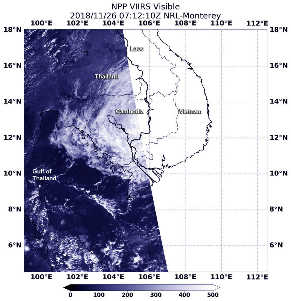
The Ca Mau Peninsula is the southernmost area of Vietnam, located between the South China Sea to the east and the Gulf of Thailand on the west.
The Joint Typhoon Warning Center issued its last advisory on 33W known as Usagi, on Sunday, Nov. 25, 2018. On that day, Tropical Storm 33W weakened to a depression after making landfall near Ho Chi Minh City, Vietnam. Maximum sustained winds had weakened to 30 knots (34.5 mph/55.5 kph) and it continued weakening as it moved further inland.
At 2:12 a.m. EDT (0712 UTC) on Nov. 26, the Visible Infrared Imaging Radiometer Suite (VIIRS) instrument aboard NASA-NOAA’s Suomi NPP satellite analyzed Tropical Cyclone 33W’s disorganized remnants dissipating over the Ca Mau Peninsula.