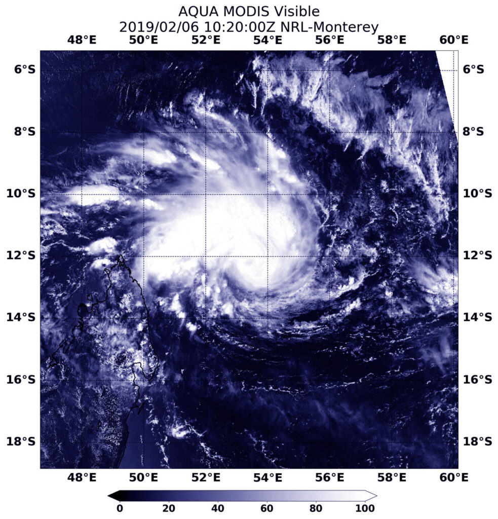
Feb. 6, 2019 – NASA Catches Development of Tropical Cyclone Gelena
Visible-light imagery from NASA’s Aqua satellite revealed the development of Tropical Depression 13S into a tropical storm. Tropical Storm Gelena intensified rapidly and appeared to have a cloud-filled eye.
At 5:20 a.m. EDT (1020 UTC) on Feb. 6 the Moderate Resolution Imaging Spectroradiometer, or MODIS, instrument aboard NASA’s Aqua satellite provided a visible image of Tropical Storm Gelena in the Southern Indian Ocean. The image showed the storm developing an eye, with bands of thunderstorms wrapping into the low-level center.

At 10 a.m. EDT (1500 UTC) on Feb. 6, the Joint Typhoon Warning Center or JTWC noted that Trami had maximum sustained winds near 45 knots (52 mph/83 kph). It was centered near 12.3 degrees south latitude and 53.4 degrees east longitude. That’s 504 nautical miles north-northwest of St. Denis, La Reunion Island.
JTWC has forecast Gelena to strengthen rapidly and will eventually turn to the southeast. It is expected to reach hurricane-strength upon approach to Rodrigues, on Feb. 9.
Rob Gutro
NASA’s Goddard Space Flight Center, Greenbelt, Md.
