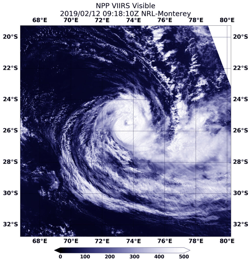
Feb. 12, 2019 – NASA-NOAA Satellite Finds Tropical Cyclone Gelena Sheared
Wind shear can push tropical cyclones apart and satellite imagery from NASA-NOAA’s Suomi NPP satellite revealed that is what is happening to Tropical Cyclone Gelena in the Southern Indian Ocean.

In general, wind shear is a measure of how the speed and direction of winds change with altitude. Winds at different levels of the atmosphere pushed against the cylindrical circulation center and skewed it, weakening the rotation.
On Feb. 12 at 4:18 a.m. EDT (0918 UTC) the Visible Infrared Imaging Radiometer Suite (VIIRS) instrument aboard NASA-NOAA’s Suomi NPP satellite captured a visible image of Tropical Cyclone Gelena moving through the Southern Indian Ocean. The Joint Typhoon Warning Center noted that: “Animated multispectral satellite imagery shows a system with a mostly exposed low level circulation and its associated convection sheared eastward.” The clouds are being pushed eastward by strong westerly winds.
On Feb. 12 at 10 a.m. EDT (1500 UTC) Gelena’s maximum sustained winds were near 50 knots (57 mph/92 kph) and weakening. Gelena was located approximately 961 nautical miles east-southeast of Port Louis, Mauritius. The tropical storm is moving to the east-southeast. Because Gelena is expected to move over cooler sea surface temperatures and the wind shear is expected to persist, the storm is forecast to dissipate in two days.
