Mar. 15, 2019 – Satellite Sees Tropical Cyclone Savannah Moving Away from Indonesia
Tropical Cyclone Savannah continued to move in southerly direction in the Southern Indian Ocean, and move away from Indonesia. NASA-NOAA’s Suomi NPP satellite provided a visible image of the storm. Savannah is no threat to land areas.
Savannah formed on March 14 as Tropical Cyclone 19S and once it strengthened into a tropical storm it was renamed.
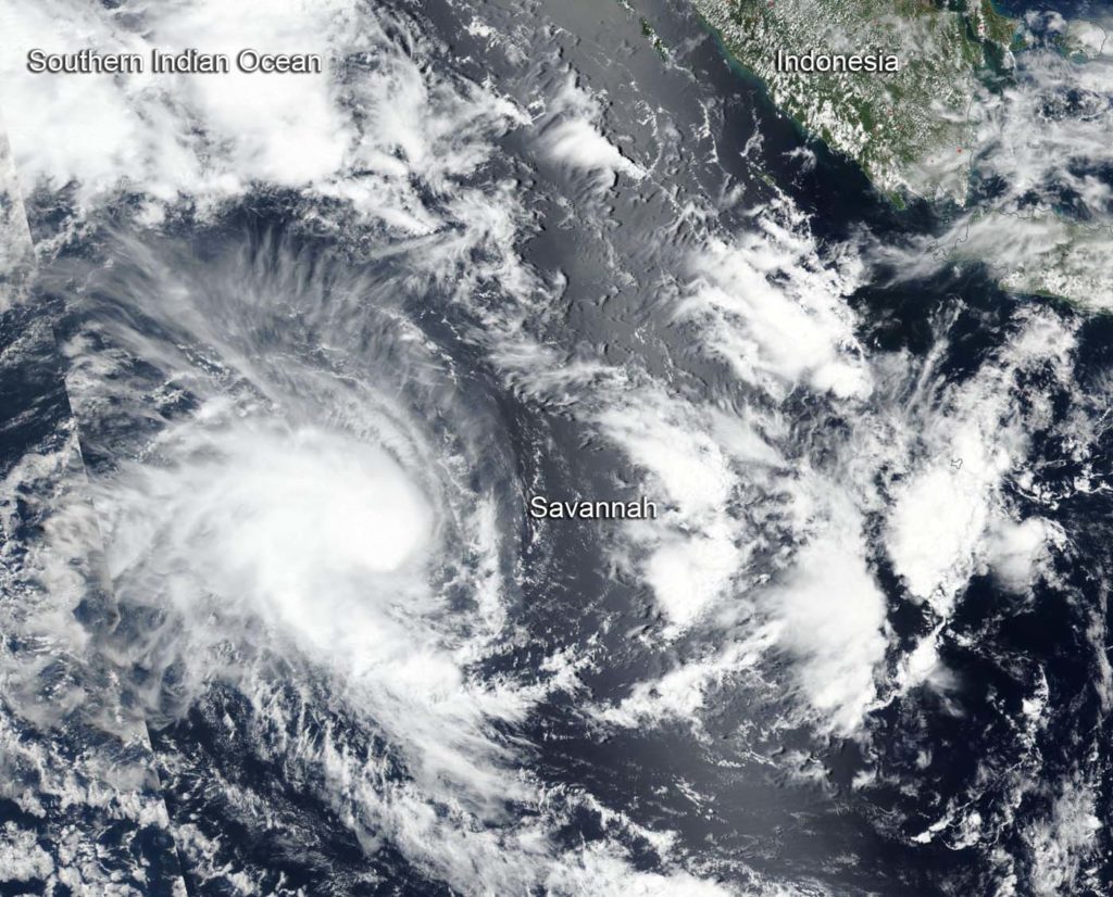
Suomi NPP passed over Savannah on March 15 and the Visible Infrared Imaging Radiometer Suite (VIIRS) instrument provided a visible image of the storm. The VIIRS image showed a rounded area of storms around the low-level center of circulation with a band of thunderstorms feeding into the center, extending to the southeast. The Joint Typhoon Warning Center (JTWC) noted “animated enhanced infrared satellite imagery depicts a consolidating system with a central dense overcast feature persisting over the low-level circulation center.” A microwave image showed tightly-curved bands of thunderstorms wrapping around an eye feature, indicating the storm was strengthening.
Savannah is forecast to move towards the southwest over the coming days, continuing on its path away from Indonesia. At 11 a.m. EDT (1500 UTC), Savannah was near 14.4 degrees south longitude and 98.4 degrees east latitude, about 185 nautical miles southwest of Cocos Island. Maximum sustained winds were near 55 knots (63 mph/102 kph).
Forecasters at the Joint Typhoon Warning Center noted that Savannah will move southwest, later turning west-southwest, while intensifying to 80 knots after three days. The storm will then start to weaken.