Mar. 20, 2019 – NASA’s Terra Satellite Eyes a Weaker Tropical Cyclone Savannah
Tropical Cyclone Savannah visibly showed the effects of wind shear in imagery from NASA’s Terra satellite.
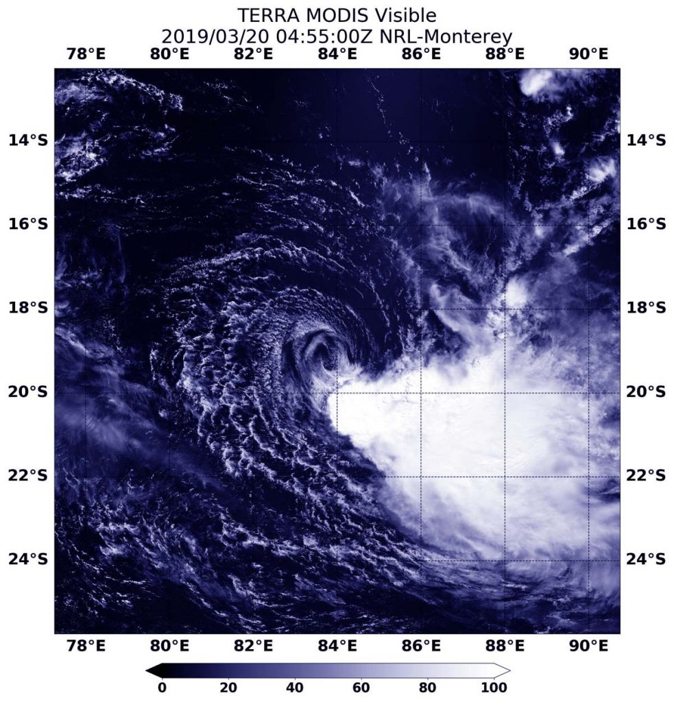
On March 20, 2019 at 12:55 a.m. EDT (0455 UTC) the Moderate Resolution Imaging Spectroradiometer or MODIS instrument aboard NASA’s Terra satellite captured a visible image of the storm that revealed the bulk of clouds and showers were pushed southeast of the center from strong vertical wind shear. That wind shear was at a rate of 25 to 40 knots. Although most of the clouds were pushed away from the center, a ghostly ring of clouds still circled the circulation center.
At 11 a.m. EDT (1500 UTC) on March 20, 2019, maximum sustained winds near Savannah’s center were near 40 knots (46 mph/74 kph). Savannah was centered near 19.1 degrees south latitude and 83.3 degrees east longitude. That’s about 964 nautical miles (1,109 miles/1785 kilometers) southeast of Diego Garcia. Diego García is an atoll just south of the equator in the central Indian Ocean. Savannah was slowly tracking to the west.
The Joint Typhoon Warning Center forecasts Savannah to track west-southwestward over the next 36 hours while gradually dissipating under the persistent influence of strong vertical wind shear.