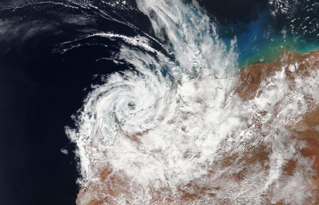
Mar. 26, 2019 – Satellite Finds Tropical Cyclone Veronica’s Stripped Center Along Australia Coast
Early on March 26, Tropical Cyclone Veronica continued to move along the coast of Western Australia and NASA-NOAA’s Suomi NPP satellite provided a visible image of the storm that showed the storm was stripped of strong thunderstorm development around the center.

Suomi NPP passed over Veronica on March 26 and the Visible Infrared Imaging Radiometer Suite (VIIRS) instrument provided a visible image of the storm. The VIIRS image revealed that the storm weakened and the center cleared of clouds from the previous day. The cause of the raid weakening was strong vertical wind shear. Winds blowing at different levels in the atmosphere at strong speeds tore the storm apart.
In the image, the eastern and southern quadrant of Veronica was over land, while the rest of the storm was over the Southern Indian Ocean. However due to the strong winds Veronica is rapidly deteriorating and is expected to dissipate by the end of the day on March 26.
The Australian Bureau of Meteorology or ABM said the marine warning has been canceled for
Pilbara Coast West and Ningaloo Coast. However, there are still warnings in effect on March 26: A Moderate Flood Warning is in effect for the De Grey River Catchment, a Flood Warning is in effect for the Pilbara Coastal Rivers and the Final Flood Watch has been posted for the Pilbara District Rivers.
The Joint Typhoon Warning Center issued their final advisory on Veronica at 11 p.m. EDT on March 25 (0300 UTC on March 26). At that time Veronica had maximum sustained winds near 35 knots (40 mph/65 kph). Veronica was located near 21.1 degrees South latitude and 115.4 degrees East longitude. That’s about 123 nautical miles northeast of Learmonth, Australia.
Veronica will continue to rapidly deteriorate and dissipate later in the day.
For updated local forecasts, visit: http://www.bom.gov.au
