July 31, 2019 – NASA Finds Tropical Storm Wipha Whipped Up
Tropical Storm Wipha formed quickly in the South China Sea. It was affecting Hainan Island, China when NASA’s Aqua satellite passed overhead on July 31.
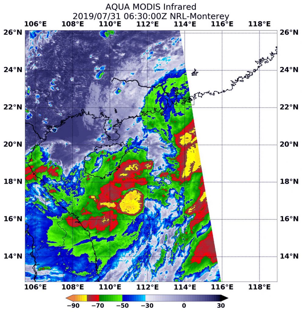
NASA’s Aqua satellite used infrared light to analyze the strength of storms and found the bulk of them in the southern quadrant. Infrared data provides temperature information, and the strongest thunderstorms that reach high into the atmosphere have the coldest cloud top temperatures.
ON July 31 at 2:30 a.m. EDT (0630 UTC), the Moderate Imaging Spectroradiometer or MODIS instrument that flies aboard NASA’s Aqua satellite gathered infrared data on Tropical Storm Wipha. Strong thunderstorms circled the center where cloud top temperatures were as cold as minus 80 degrees Fahrenheit (minus 62.2 Celsius). Those storms were over the South China Sea, just southeast of Hainan Island, China. Another area of storms that strong were in a fragmented band to the northeast of the center.
Cloud top temperatures that cold indicate strong storms with the potential to generate heavy rainfall. Those strongest storms were south and southeast of the center of the elongated circulation.
At 11 a.m. EDT (1500 UTC) on July 31, Tropical Storm Wipha had maximum sustained winds near 35 knots (40 mph/64 kph). It was located near 19.4 degrees north latitude and 112.2 degrees west longitude, about 207 miles south-southwest of Hong Kong, China. Wipha was moving to the northwest.
The Joint Typhoon Warning Center expects that Wipha will move northwest towards southern China. After passing the Leizhou Peninsula, the system will turn west and after crossing the Gulf of Tonkin will make landfall near Hanoi, Vietnam.