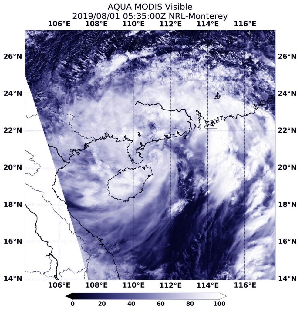
Aug. 01, 2019 – NASA’s Aqua Satellite Sees Tropical Storm Wipha Hugging China Coast
NASA’s Aqua satellite passed over the South China Sea and saw Tropical Storm Wipha hugging the southern coast of China.

On August 1, 2019 at 1:35 a.m. EDT (0535 UTC), the Moderate Resolution Imaging Spectroradiometer or MODIS instrument aboard NASA’s Aqua satellite provided a visible image of Wipha that showed the center of circulation just off the coast of southern China. The center was just east of the southern tip of the Leizhou Peninsula of southern Guangdong province, and northeast of Hainan Island, China. MODIS imagery shows that despite the center in that area, the bands of thunderstorms that circle the center extend over Hainan Island and into the southern Guangdong Province as well as over the South China Sea.
At 11 a.m. EDT (1500 UTC), the center of Wipha was located near latitude 21.3 degrees north and longitude 110.2 degrees west. Wipha was about 241 nautical miles east of Hanoi, Vietnam. Wipha was moving to the northwest and had maximum sustained winds near 35 knots (40 mph/64 kph).
The Joint Typhoon Warning Center expects Wipha to skirt the southern coast of China and move through the Gulf of Tonkin, with landfall along the northeast coast of Vietnam early on August 3. It is expected to dissipate soon after landfall.
