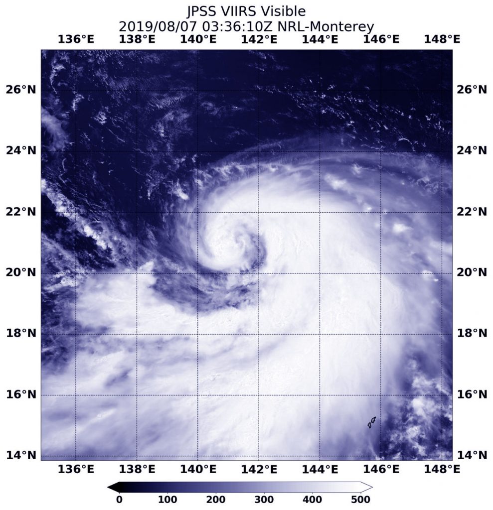
Aug. 07, 2019 – Tropical Storm Krosa Gets a Comma Shape
Tropical Storm Krosa continued on its journey northward in the Northwestern Pacific Ocean when NOAA’s NOAA-20 polar orbiting satellite passed overhead and captured a visible image of the strengthening storm in a classic tropical cyclone shape.

Credit: NASA/NRL/NOAA
The Visible Infrared Imaging Radiometer Suite (VIIRS) instrument aboard NOAA-20 provided a visible image of the storm. There’s also a VIIRS instrument aboard the NASA-NOAA Suomi NPP satellite that preceded NOAA-20.
The VIIRS image revealed Krosa had developed the signature “comma shape” of a strengthening storm. A large wide band of thunderstorms were feeding into the low-level center from the south and east of the center.
At 5 a.m. EDT (0900 UTC) on Aug. 7, Tropical Storm Krosa’s maximum sustained winds were near 60 knots (69 mph/111 kph) and strengthening. It was centered near 21.2 degrees north latitude and 141.3 degrees east longitude. That is about 31 nautical miles south of Iwo To island, Japan. Krosa was moving to the north-northwest.
The Joint Typhoon Warning Center said that Krosa will move northwest, and then later turn north while becoming a typhoon.
