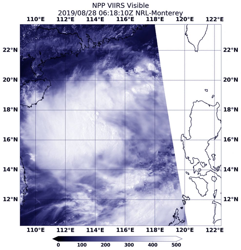
Aug. 28, 2019 – NASA-NOAA Satellite Finds Tropical Storm Podul Marching Through South China Sea
Tropical Storm Podul was moving through the South China Sea when NASA-NOAA’s Suomi NPP satellite passed overhead from space and snapped a visible image of the storm.

The Visible Infrared Imaging Radiometer Suite (VIIRS) instrument aboard Suomi NPP provided a visible image of the storm on Aug. 28 at 2:18 a.m. EDT (0618 UTC). The VIIRS image showed the storm was being affected by wind shear because much of the cloud cover and thunderstorms were being pushed west of the center. That left minimal clouds and storms east of center. The Joint Typhoon Warning Center noted, “The environment is marginal overall with unfavorably strong (25-30 knot) vertical wind shear.”
In general, wind shear is a measure of how the speed and direction of winds change with altitude. Tropical cyclones are like rotating cylinders of winds. Each level needs to be stacked on top each other vertically in order for the storm to maintain strength or intensify. Wind shear occurs when winds at different levels of the atmosphere push against the rotating cylinder of winds, weakening the rotation by pushing it apart at different levels.
At 11 a.m. EDT (1500 UTC) on Aug. 28, the Joint Typhoon Warning Center or JTWC noted that Tropical Storm Podul was centered near 17.2 degrees north latitude and 114.0 degrees east longitude. That’s about 336 nautical miles east-northeast of Da Nang, Vietnam. Podul was moving west toward Vietnam. Maximum sustained winds 35 knots (40 mph/65 kph).
Podul is expected to strengthen as it continues moving through the South China Sea, and will make landfall in northern Vietnam on Aug. 30.
