Sep. 02, 2019- Update #1 – 9:00am EDT – Destructive Dorian Lashing Grand Bahama Island
Hurricane Dorian is breaking records over the Bahamas as the most destructive hurricane to ever hit the Bahama Islands. Catastrophic winds with gusts over 200 mph are smashing through the islands leaving devastation in their wake. Storm surge of 18 to 23 feet above normal tide levels with higher destructive waves are expected throughout the storm’s passing.
On Dorian’s current track and speed of movement, the core of extremely dangerous Hurricane Dorian will continue to pound Grand Bahama Island through much of today and tonight. The hurricane will move dangerously close to the Florida east coast tonight through Wednesday evening.
NASA’s Global Precipitation Measurement mission (GPM) was on hand to measure the amount of rainfall that the Bahama Islands are experiencing now.
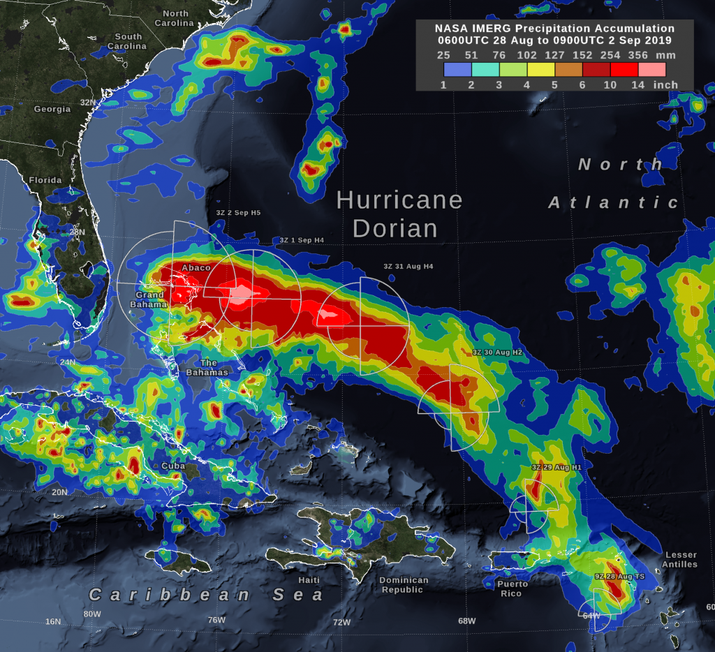
On Monday morning, September 2, Hurricane Dorian was over the island of Grand Bahama as a category 5 storm. As has been the case for the past several days, Dorian’s inner core continues to produce 6 to 14 inches of rain accumulation. Hurricane Dorian’s forward motion has slowed to walking pace, so future updates to this rain-accumulation map may show greater accumulation over Grand Bahama than elsewhere along the storm’s path.
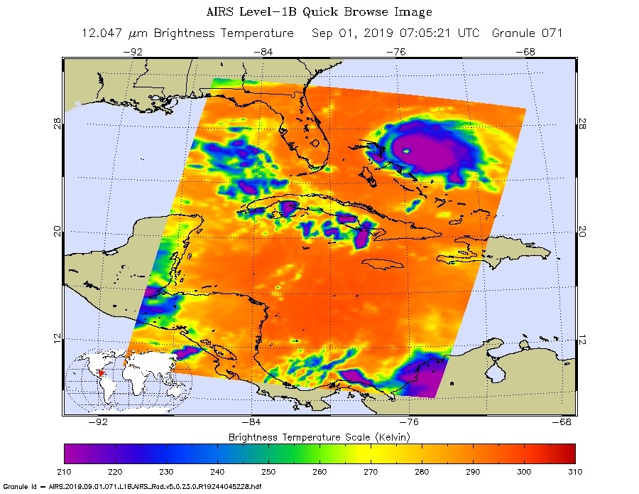
NASA’s Aqua satellite captured this image of Dorian at 2:05 am EDT (0705 UTC) using its AIRS (Atmospheric Infrared Sounder) instrument analyzed temperatures within Hurricane Dorian. Cloud top temperatures within Dorian were as cold as or colder than minus 50 degrees Fahrenheit (minus 45.5 degrees Celsius). Infrared data provides temperature information, and the strongest thunderstorms that reach high into the atmosphere have the coldest cloud top temperatures. In this image, the amount of purple (coldest temperatures) surrounding the eye shows the huge and massive number of thunderstorms that continue to circle around the still very well-defined eye.
At present Dorian is located at latitude 26.7N and longitude 78.3W which is about 30 miles (50 km) east-northeast of Freeport, Grand Bahama Island and about 115 miles (185 km) east of West Palm Beach, FL. Maximum sustained winds are now 165 mph (270 km/h) down from a high of 185 mph (298 km/h). The present movement of storm is west at 1 mph (2 km/h) leaving the storm basically parked in location for hours. The minimum central pressure inside the storm is 916 mb.
For more updates on this storm, visit: https://www.nhc.noaa.gov
By Lynn Jenner
NASA Goddard Space Flight Center