Sep. 02, 2019 – Update #2 4:00 pm EDT – NASA Overhead as Dangerous Hurricane Dorian Takes Aim at Grand Bahamas
Dangerous Hurricane Dorian has weakened slightly and is now a Category 4 storm as it continues to spin over the Bahamas. Dorian has slowed to a crawl in terms of speed of movement only moving at west-northwest at about 1 mph (2 km/h). This means that the Bahamas will continue to get lashed by this monstrous storm and the amount of rainfall totals for the area continue to grow. The National Hurricane Center (NHC) has reported that the eye of the hurricane has begun to wobble a bit over Grand Bahama Island. It is expected to stay over the island for much of the day causing extreme destruction.
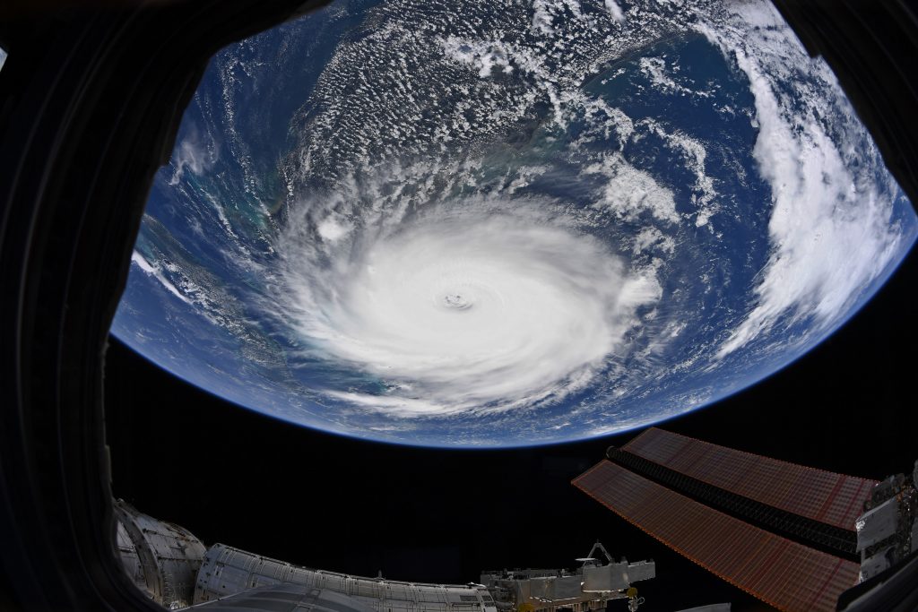
Astronaut Christina Koch captured this image from the International Space Station earlier this morning.
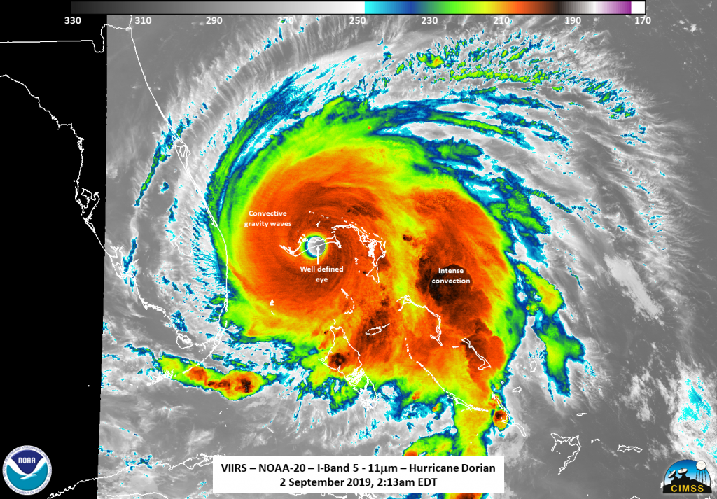
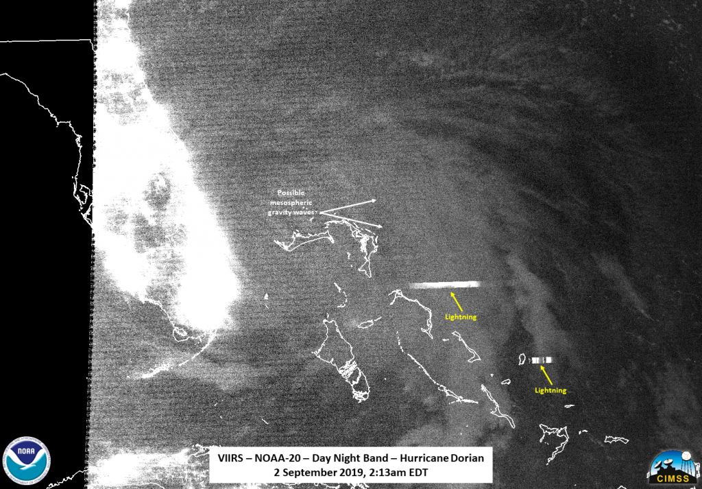
NOAA-20 observed Hurricane Dorian at 2:13 am EDT (0613 UTC) on the extreme western edge of the scan (image below). It provided an image of the classic presentation of a strong hurricane, with a nearly symmetrical circulation. Tropospheric gravity waves coming off the convection surrounding the central circulation could be seen in the infrared imagery. The Day Night Band imagery (second image below) showed the general structure of the storm with some lightning streaks. In addition, some possible mesospheric gravity waves seemed to be near the circulation center.
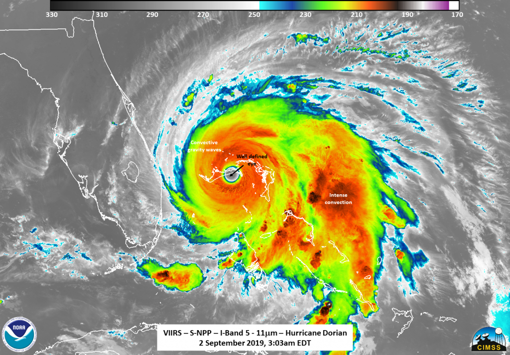
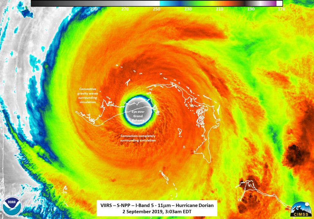
NOAA/NASA’s Suomi NPP satellite flew over Dorian about 50 minutes later at 3:03 am EDT (0703 UTC) and it had the most ideal position for observing the eye of Dorian (image below) . Suomi NPP’s infrared imagery showed the classic presentation of a strong hurricane, though slightly rotated. The lights from the capital city of Nassau could also be seen through the clouds.
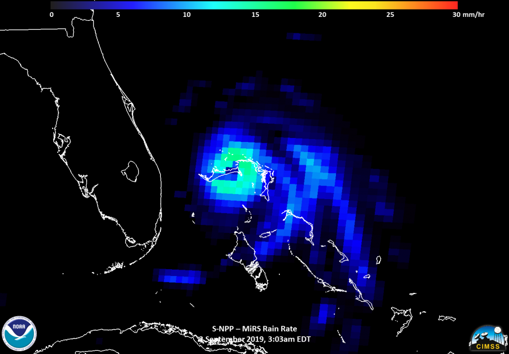
The MiRS rain rate product (image below) on NASA NOAA’s Suomi NPP satellite also showed the rain wrapping into the circulation center.
As of the NHC’s update at Dorian is producing maximum sustained winds of 145 mph (230 km/h) with wind gusts of 190 mph (305 km/h). The storm is located latitude 26.8N and longitude 78.4W which is about 25 miles (40 km) northeast of Freeport, Grand Bahama Island and about 105 miles (170 km) east of West Palm Beach, FL. The minimum central pressure is 940 Mb.
For the latest information on Dorian, visit: https://www.nhc.noaa.gov
By Lynn Jenner
NASA Goddard Space Flight Center