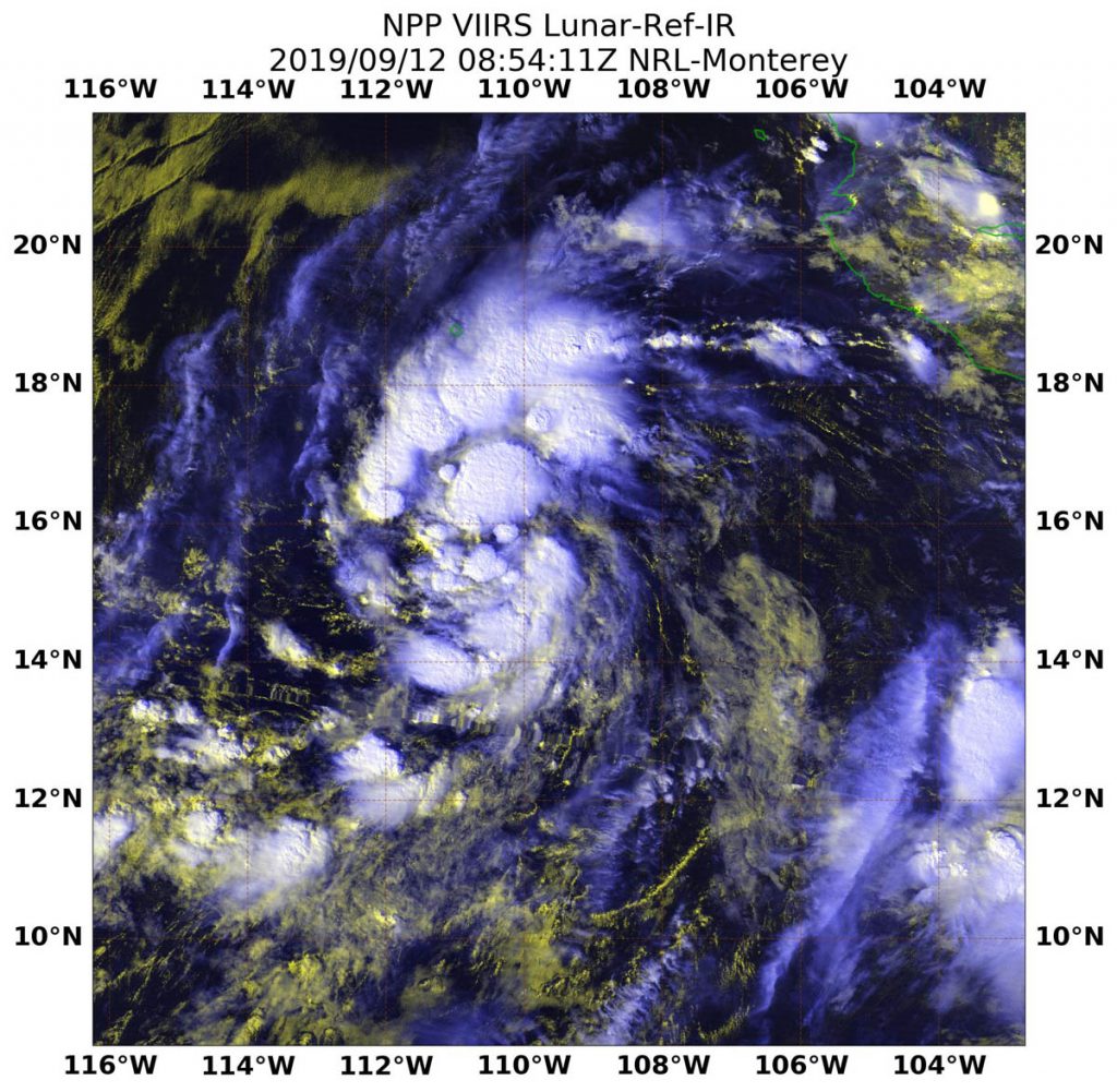
Sep. 13, 2019 – NASA-NOAA Satellite‘s Night-time Look at Tropical Storm Kiko
NASA-NOAA’s Suomi NPP satellite passed over the Eastern Pacific Ocean in the early hours of Sept. 12 and grabbed a nighttime look at Tropical Storm Kiko.

Kiko developed on Sept. 11 as Tropical Depression 13E and strengthened into a tropical storm by 5 p.m. EDT. Once it attained tropical storm status, it was named Kiko.
On Sept. 12 at 4:54 a.m. EDT (0854 UTC), the Visible Infrared Imaging Radiometer Suite (VIIRS) instrument aboard NASA-NOAA’s Suomi NPP provided an infrared image of the strengthening storm. At the time of the overpass the National Hurricane Center (NHC) noted, “There’s a small patch of convection (rising air that formed thunderstorms) near the estimated center, with another larger cluster much farther south. For the most part, however, the circulation consists of a broken low- and mid-level cloud deck with a few embedded showers.” The Suomi NPP image also showed a larger band of thunderstorms had developed north of center.
At 11 a.m. EDT (1500 UTC), the center of Tropical Storm Kiko was located near latitude 16.9 degrees north and longitude 114.4 degrees west. Kiko is far from land and about 505 miles (815 km) southwest of the southern tip of Baja California, Mexico. Kiko was moving toward the west-northwest near 10 mph (17 kph) and this motion is expected to continue through Monday. Maximum sustained winds are near 40 mph (65 km/h) with higher gusts. Estimated minimum central pressure is 1004 millibars.
Some strengthening is forecast during the next 48 hours, and Kiko is expected to approach hurricane strength later this weekend.
For updated forecasts, visit: www.nhc.noaa.gov
