Sep. 18, 2019 – NASA Sees Heavy Rainfall Occurring in Strengthening Tropical Storm Mario
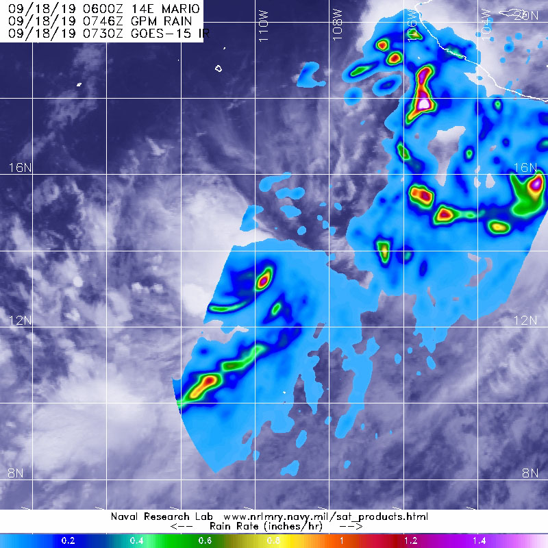
When the Global Precipitation Measurement mission or GPM core satellite passed over the Eastern Pacific Ocean, it flew over the eastern side of Tropical Storm Mario and measured rainfall.

The GPM’s core satellite passed over Mario on Sept. 18 at 3:46 a.m. EDT (0746 UTC). GPM found the heaviest rainfall in the southeastern side of the storm falling at a rate of over 36 mm (about 1.4 inch) per hour. Lighter rainfall was measured throughout the rest of the east and southern quadrants and band of thunderstorms south of center. Forecasters at NOAA’s National Hurricane Center or NHC incorporate the rainfall data into their forecasts.
Mario formed on Sept. 17 as Tropical Depression 14E and six hours later at 6 p.m. EDT, it became a tropical storm.
At 11 a.m. EDT (1500 UTC), NHC forecasters said the center of Tropical Storm Mario was located near latitude 14.5 degrees north and longitude 111.0 degrees west. Mario is far from land, so there are no coastal warnings or watches in effect. Mario is centered about 585 miles (940 km) south of the southern tip of Baja California, Mexico.
Mario is moving toward the northwest near 12 mph (19 kph). This motion is expected to continue through tonight, with a decrease in forward speed beginning on Thursday. Mario is expected to become nearly stationary from early Friday through early Saturday.
Maximum sustained winds have increased to near 65 mph (100 kph) with higher gusts. The estimated minimum central pressure is 996 millibars.
Mario is forecast to become a hurricane by Thursday, Sept. 19.
Hurricanes are the most powerful weather event on Earth. NASA’s expertise in space and scientific exploration contributes to essential services provided to the American people by other federal agencies, such as hurricane weather forecasting.
GPM is a joint mission between NASA and the Japan Aerospace Exploration Agency, JAXA.
For updated forecasts, visit: www.nhc.noaa.gov
