Oct. 15, 2019 – NASA’s Terra Satellite Catches a Glimpse of a Fleeting Ema
Tropical Storm Ema had a very short life, but NASA’s Terra satellite caught a glimpse of the storm before it dissipated in the Central Pacific Ocean.
The newest tropical storm of the Central Pacific Ocean hurricane season formed to the northwest of the Hawaiian Islands late on Oct. 12. Although there was no threat to Hawaii, there was a Tropical Storm Watch is in effect on Oct. 12 for portions of the Papahanaumokuakea Marine National Monument from Nihoa to French Frigate Shoals to Maro Reef.
At 2 a.m. HST/8 a.m. EDT (1200 UTC) on Oct. 13 the center of Tropical Storm Ema was located near latitude 22.1 North, longitude 165.9 West. Ema was moving toward the west-northwest near 10 mph (17 kph), and maximum sustained winds were near 40 mph (65 kph).
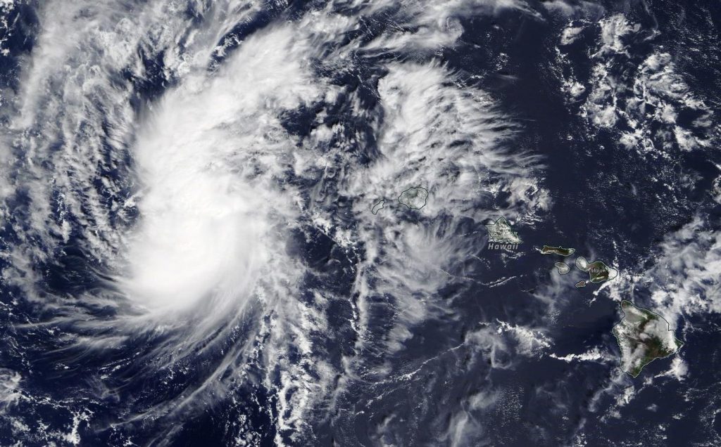
NASA’s Terra satellite passed over Ema on Oct. 13 when it was still a tropical storm. After Terra passed over Ema, the storm weakened to a depression. The MODIS or Moderate Resolution Imaging Spectroradiometer instrument visible image showed strong convection (rising air that forms the thunderstorms that make up a tropical cyclone) was limited to the area north of the center of circulation. That’s because of strong southwesterly wind shear affecting the storm that’s pushing the bulk of clouds and showers to the north. The National Hurricane Center also said that the storm appears shallow other than that area of strong thunderstorms.
By 11 a.m. HST/5 p.m. EDT on Oct. 13, the Tropical Storm Watch for portions of the Papahanaumokuakea Marine National Monument from French Frigate Shoals to Maro Reef has been canceled as Ema weakened to a depression.
On Monday, Oct. 14 at 5 a.m. EDT (0900 UTC), Ema, a post-tropical cyclone by that time, had dissipated near 25.4 degrees north latitude and 168.3 degrees west longitude.
By Rob Gutro
NASA’s Goddard Space Flight Center