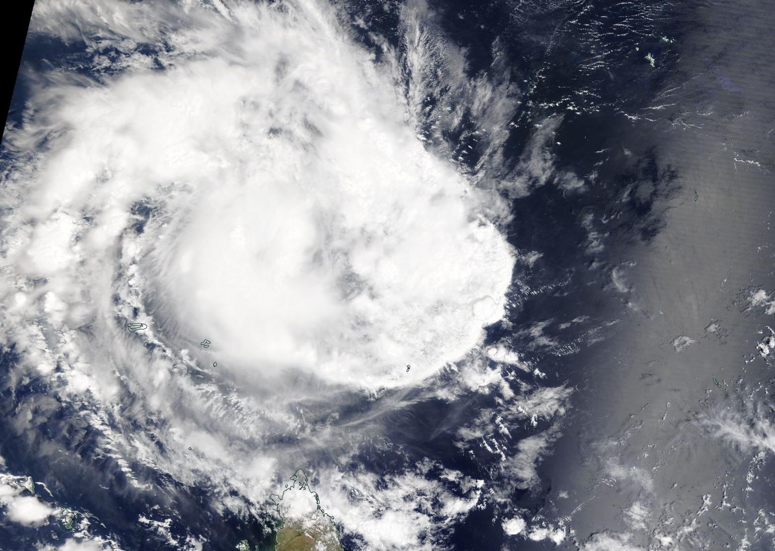
Dec. 06, 2019 – NASA Finds Strengthening Tropical Cyclone Belna North of Madagascar
NASA’s Aqua satellite captured a visible image of Tropical Cyclone Belna, located north of Madagascar in the Southern Indian Ocean. Imagery shows that the storm to be strengthening.

On Dec. 6, 2019, the Moderate Imaging Spectroradiometer or MODIS instrument that flies aboard NASA’s Aqua satellite provided a visible image of Belna, formerly known as 02S. The image showed bands of thunderstorms wrapping into the low-level center from the west. Animated multispectral satellite imagery shows deep, rapidly cycling convection wrapping into a well-defined low-level circulation center.
At 10 a.m. EST (1500 UTC) on Dec. 6, the Joint Typhoon Warning Center or JTWC noted that Tropical Cyclone Belna was located near 7.9 degrees south latitude and 48.7 degrees east longitude. That is about 863 nautical miles west-southwest of St. Denis, La Reunion Island. Belna is moving to the southwest. Maximum sustained winds 55 knots (63 mph/102 kph).
Forecasters at the JTWC said that Belna is expected to turn to the south-southwest. The storm is forecast to intensify to 90 knots (104 mph/167 kph) before making landfall in northwestern Madagascar after four days.
NASA’s Aqua satellite is one in a fleet of NASA satellites that provide data for hurricane research.
Tropical cyclones are the most powerful weather event on Earth. NASA’s expertise in space and scientific exploration contributes to essential services provided to the American people by other federal agencies, such as hurricane weather forecasting.
