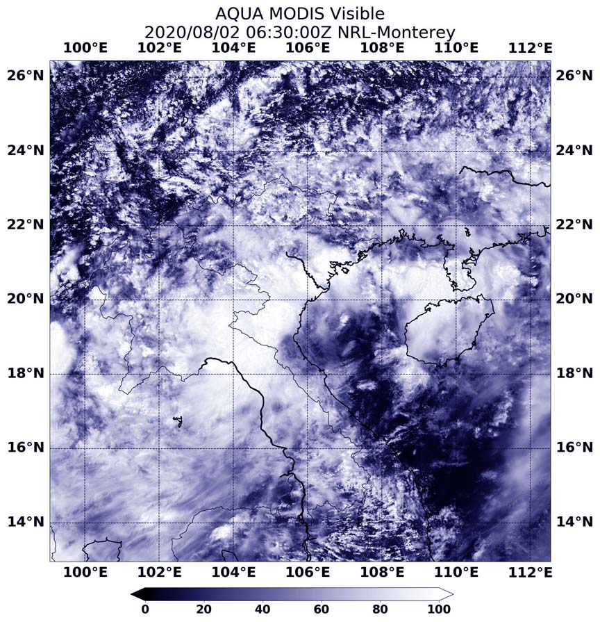
Aug. 02, 2020 –NASA Catches Tropical Storm Sinlaku’s Vietnam Landfall
NASA’s Aqua satellite passed over Tropical Storm Sinlaku shortly after it made landfall around 2 a.m. EDT (0600 UTC) on Aug. 2 in northern Vietnam.

By 5 a.m. EDT (0900 UTC), Sinlaku had moved inland and was located near 19.7 north degrees latitude and 105.8 east degrees longitude, about 78 miles south of Hanoi, Vietnam. Sinlaku had maximum sustained winds near 35 knots (40 mph) and was weakening.
The Moderate Resolution Imaging Spectroradiometer aboard NASA’s Aqua satellite provided a visible image of the storm on Aug 2 at 2:30 p.m. EDT (0630 UTC) shortly after its landfall in northern Vietnam.
Sinlaku is moving northwest and is forecast to dissipate.
By Rob Gutro
NASA’s Goddard Space Flight Center
