Aug. 11, 2020 – NASA Finds Mekkhala Coming Apart After Landfall in Southeastern China
NASA-NOAA’s Suomi NPP satellite provided forecasters with a visible image of former Typhoon Mekkhala shortly after it made landfall in southeastern China. Wind shear had torn the storm apart.
Mekkhala made landfall in Fujian, southeastern China, bringing strong winds and torrential rain. According to the China Meteorological Agency, the typhoon came ashore in coastal areas of Zhangpu County at around 7:30 a.m. local time on Aug. 11 (7:30 p.m. EDT on Aug. 10). The storm generated at least 170 mm (6.7 inches) of rainfall in Zhangpu County by the middle of the day on Aug. 11.
At 11 p.m. EDT on Aug. 10 (0300 UTC, Aug. 11) the Joint Typhoon Warning Center (JTWC) issued their final bulletin on Mekkhala. At that time, the storm was centered near latitude 24.1 degrees north and longitude 117.7 degrees east, about 216 nautical miles west-southwest of Taipei, Taiwan. Mekkhala’s maximum sustained winds were near 70 knots (81 mph/129 kph) at landfall. It continued to move to the north-northwest.
Wind Shear Tearing at Mekkhala
The shape of a tropical cyclone provides forecasters with an idea of its organization and strength. When outside winds batter a storm, it can change the storm’s shape and push much of the associated clouds and rain to one side of it which is what wind shear does.
In general, wind shear is a measure of how the speed and direction of winds change with altitude. Tropical cyclones are like rotating cylinders of winds. Each level needs to be stacked on top each other vertically in order for the storm to maintain strength or intensify. Wind shear occurs when winds at different levels of the atmosphere push against the rotating cylinder of winds, weakening the rotation by pushing it apart at different levels.
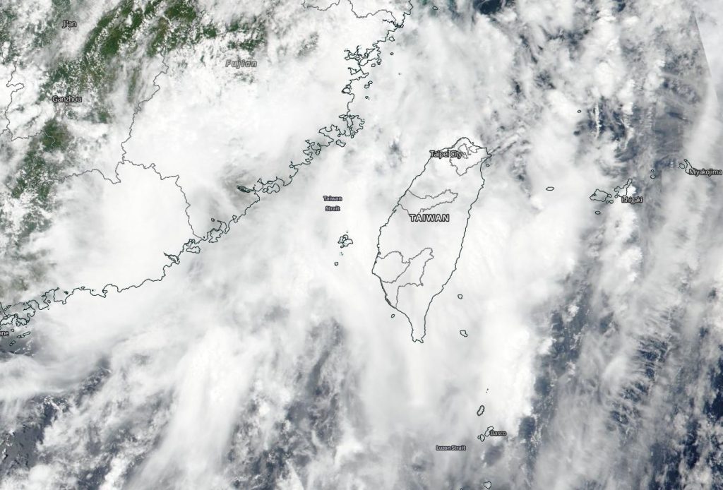
Suomi NPP’s Satellite View
On Aug. 11, the Visible Infrared Imaging Radiometer Suite (VIIRS) instrument aboard NASA-NOAA’s Suomi NPP satellite showed a somewhat shapeless storm. Satellite imagery showed that Typhoon Mekkhala was quickly becoming sheared, with the outer low-level bands of thunderstorms on the north side of the system exposed, but with deep convection and strong thunderstorms remaining in place over and south of the center.
The JTWC expects Mekkhala to dissipate within the next day or two.
NASA Researches Tropical Cyclones
Hurricanes/tropical cyclones are the most powerful weather events on Earth. NASA’s expertise in space and scientific exploration contributes to essential services provided to the American people by other federal agencies, such as hurricane weather forecasting.
For more than five decades, NASA has used the vantage point of space to understand and explore our home planet, improve lives and safeguard our future. NASA brings together technology, science, and unique global Earth observations to provide societal benefits and strengthen our nation. Advancing knowledge of our home planet contributes directly to America’s leadership in space and scientific exploration.