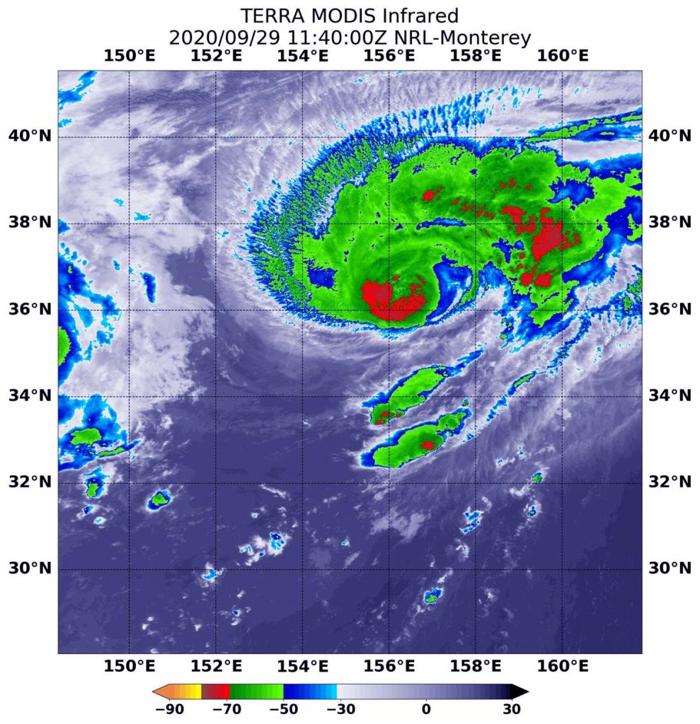
Sep. 29, 2020 – NASA’s Infrared View of Typhoon Kujira
NASA’s Terra satellite used infrared light to identify strongest storms and coldest cloud top temperatures in Typhoon Kujira as it tracked through the northwestern Pacific Ocean.

Infrared Data Reveals Most Powerful Storms
Infrared data provides temperature information about the cloud tops of the many thunderstorms that make up a tropical cyclone. The strongest thunderstorms reach high into the atmosphere and have the coldest cloud top temperatures. Tropical cyclones do not always have uniform strength, so infrared data helps forecasters know the location of the strongest side of a storm.
On Sept. 29 at 7:40 a.m. EDT (1140 UTC), the Moderate Resolution Imaging Spectroradiometer or MODIS instrument aboard NASA’s Terra satellite gathered temperature information about Typhoon Kujira’s cloud tops. MODIS found the most powerful thunderstorms had temperatures that were as cold as or colder than minus 70 degrees Fahrenheit (minus 56.6 Celsius). Those strongest storms were found wrapping around the eye. In addition, a large band of fragmented thunderstorms east of the center contained storms with those temperatures.
Cloud top temperatures that cold indicate strong storms with the potential to generate heavy rainfall.
Typhoon Kujira’s Status on Sept. 29
At 11 a.m. EDT (1500 UTC) on Sept. 29, Typhoon Kujira’s maximum sustained winds were near 65 knots (75 mph/120 kph), making it a Category One hurricane on the Saffir-Simpson Hurricane Wind Scale. Kujira was far from land areas, centered near latitude 36.5 degrees north and longitude 156.4 degrees east, about 814 nautical miles east of Yokosuka, Japan. Kujira was moving to the north-northeast. It is no threat to land areas.
Forecasters at the Joint Typhoon Warning Center in Honolulu, Hawaii noted that Kujira is forecast to become extra-tropical later in the day on Sept. 29. It is then expected to begin a weakening trend.
NASA Researches Tropical Cyclones
Tropical cyclones/hurricanes are the most powerful weather events on Earth. NASA’s expertise in space and scientific exploration contributes to essential services provided to the American people by other federal agencies, such as hurricane weather forecasting.
NASA’s Terra satellite is one in a fleet of NASA satellites that provide data for hurricane research.
