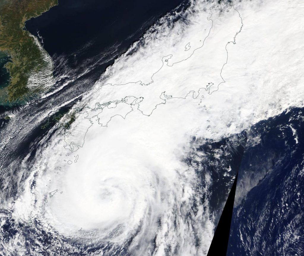
Oct. 08, 2020 – NASA Sees Typhoon Chan-hom Blanket Japan
Typhoon Chan-hom’s clouds blanketed much of the big islands of Japan in a visible image from NASA’s Terra satellite. Chan-hom’s center was located southeast of Kyushu, Japan’s southernmost big island, but the western quadrant of the storm had a large reach.

The Moderate Resolution Imaging Spectroradiometer or MODIS instrument that flies aboard NASA’s Terra satellite captured a visible image of Chan-hom on Oct. 8. Chan-hom’s eye appeared to be obscured by high clouds, but a hint of it could be seen in the imagery. Powerful thunderstorms circled the 30 nautical-mile wide eye.
The satellite imagery was created using NASA’s Worldview product at NASA’s Goddard Space Flight Center in Greenbelt, Md.
Chan-hom’s Status on Oct. 8
At 11 a.m. EDT (1500 UTC) on Oct. 8, the center of Typhoon Chan-hom was located near latitude 29.8 degrees north and longitude 133.4 degrees east. Chan-hom was about 475 nautical miles southwest of Yokosuka, Japan. The storm is moving toward the north-northeast. Maximum sustained winds have increased to near 80 knots (92 mph/148 kph) with higher gusts.
Chan-hom is forecast to continue weakening and track parallel to the eastern coast of Japan while remaining offshore. Its center is forecast to pass just offshore from Tokyo on Oct. 12 as it moves in a northeasterly direction. The storm is forecast to undergo transition into an extra-tropical storm over the next several days.
About NASA’s Worldview and Terra Satellite
NASA’s Earth Observing System Data and Information System (EOSDIS) Worldview application provides the capability to interactively browse over 700 global, full-resolution satellite imagery layers and then download the underlying data. Many of the available imagery layers are updated within three hours of observation, essentially showing the entire Earth as it looks “right now.”
NASA’s Terra satellite is one in a fleet of NASA satellites that provide data for hurricane research.
Tropical cyclones/hurricanes are the most powerful weather events on Earth. NASA’s expertise in space and scientific exploration contributes to essential services provided to the American people by other federal agencies, such as hurricane weather forecasting.
