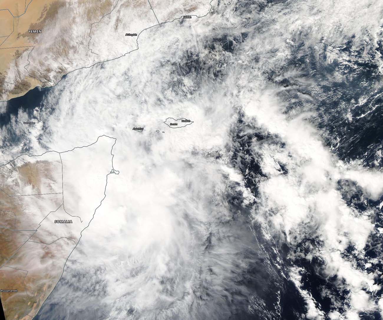
Dec. 06, 2019 – NASA Finds Tropical Cyclone Pawan at the Horn of Africa
NASA’s Aqua satellite captured an image of Tropical Cyclone 06A, known as Pawan near the Horn of Africa. Pawan is forecast to make landfall in Somalia in the next day.

The Horn of Africa is located in eastern Africa and resembles a horn that extends into the western Arabian Sea, Northern Indian Ocean. The region includes the countries of Djibouti, Eritrea, Ethiopia, and Somalia.
On Dec. 6, 2019, the Moderate Imaging Spectroradiometer or MODIS instrument that flies aboard NASA’s Aqua satellite provided a visible image of Pawan that showed the western quadrant of the storm over northern Somalia at the tip of the Horn of Africa. Pawan no longer appears circular in nature, and that is an indication that the storm has weakened. A rounded shape of a tropical cyclone indicates a more organized storm.
At 4 a.m. EST (0900 UTC) on Dec. 6, the Joint Typhoon Warning Center noted that Tropical Cyclone Pawan was located near 7.9 degrees north latitude and 53.0 degrees east longitude. That is about 550 nautical miles south of Salalah, Oman. Maximum sustained winds 35 knots (40 mph/65 kph) and weakening. Pawan is moving to the west-southwest and expected to make landfall into Somalia within 24 hours.
NASA’s Aqua satellite is one in a fleet of NASA satellites that provide data for hurricane research.
Tropical cyclones are the most powerful weather event on Earth. NASA’s expertise in space and scientific exploration contributes to essential services provided to the American people by other federal agencies, such as hurricane weather forecasting.
