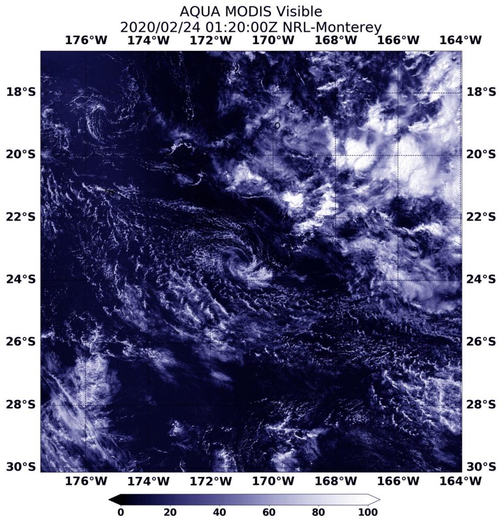
Feb. 24, 2020 – NASA’s Aqua Satellite Sees Tropical Cyclone Vicky Dissipating
Three days after American Samoa had tropical storm warnings from Tropical Cyclone Vicky, the storm had moved far to the south and was dissipating in the Southern Pacific Ocean. NASA’s Aqua satellite provided forecasters with a visible image of the fading former tropical cyclone on Feb. 24.

On Feb 21, the Joint typhoon warning center issued the final warning on Vicky. At 2100 GMT or 4 p.m. EST Vicky had maximum sustained winds near 35 knots (40 mph). At that time, it was located near 17.3 degrees south latitude and 169.7 degrees west longitude about 109 nautical miles north of Niue.
On Feb. 24, 2020 at 0120 UTC (Feb. 23 at 8:20 p.m. EST), the Moderate Imaging Spectroradiometer or MODIS instrument that flies aboard NASA’s Aqua satellite provided a visible image of the dissipating Tropical Cyclone Vicky in the Southern Pacific Ocean. The Aqua image showed wispy clouds devoid of rainfall, circling a weak center. Vicky’s remnants are expected to dissipate later in the day.
NASA’s Aqua satellite is one in a fleet of NASA satellites that provide data for hurricane research.
Tropical cyclones are the most powerful weather event on Earth. NASA’s expertise in space and scientific exploration contributes to essential services provided to the American people by other federal agencies, such as hurricane weather forecasting.
Rob Gutro
NASA’s Goddard Space Flight Center, Greenbelt, Md.
