Jan. 23, 2020 – NASA Finds Wind Shear Affected New Tropical Cyclone 09S
Tropical Cyclone 09S formed on Jan. 22 in the Southern Indian Ocean despite being affected by vertical wind shear, and one day later wind shear caused its demise. The end of 09S was caught by NASA’s Aqua satellite.
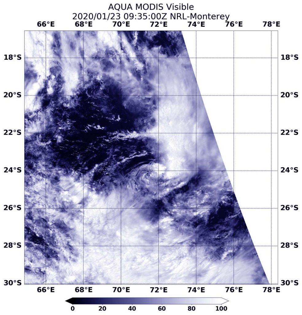
On Jan. 23 at 4:35 a.m. EST (0935 UTC), the Moderate Imaging Spectroradiometer or MODIS instrument that flies aboard NASA’s Aqua satellite provided a visible image of 09S. Forecasters at the Joint Typhoon Warning Center (JTWC) noted that satellite imagery shows “The system has severely degraded as the central convection collapsed and sheared eastward, exposing a ragged and weak low level circulation.”
In general, wind shear is a measure of how the speed and direction of winds change with altitude. Tropical cyclones are like rotating cylinders of winds. Each level needs to be stacked on top each other vertically in order for the storm to maintain strength or intensify. Wind shear occurs when winds at different levels of the atmosphere push against the rotating cylinder of winds, weakening the rotation by pushing it apart at different levels. Wind shear pushing from the west against Tropical Cyclone 09S is moving the bulk of clouds and showers east of the center.
On Jan. 23 at 0300 UTC (Jan. 22 at 10 p.m. EST) JTWC noted that Tropical Cyclone 09S was located near latitude 22.3 degrees south and longitude 71.0 degrees east, about 449 nautical miles south-southeast of Mauritius. Maximum sustained winds 35 knots (40 mph).
The final warning on 09S came at 10 a.m. EST (1500 UTC), when maximum sustained winds had dropped to 25 knots making it a depression. At that time, 09S was located near 25.5 degrees south latitude and 71.9 degrees east longitude. That is about 845 nautical miles south-southeast of Mauritius.
Forecasters at the JTWC said the storm had rapidly deteriorated because of the increasing wind shear and movement into cooler waters.
NASA’s Aqua satellite is one in a fleet of NASA satellites that provide data for hurricane research.
Tropical cyclones/hurricanes are the most powerful weather events on Earth. NASA’s expertise in space and scientific exploration contributes to essential services provided to the American people by other federal agencies, such as hurricane weather forecasting.