Bouchra (Southern Indian Ocean)

November 20, 2018 – NASA Sees Tropical Cyclone Bouchra Being Blown Apart

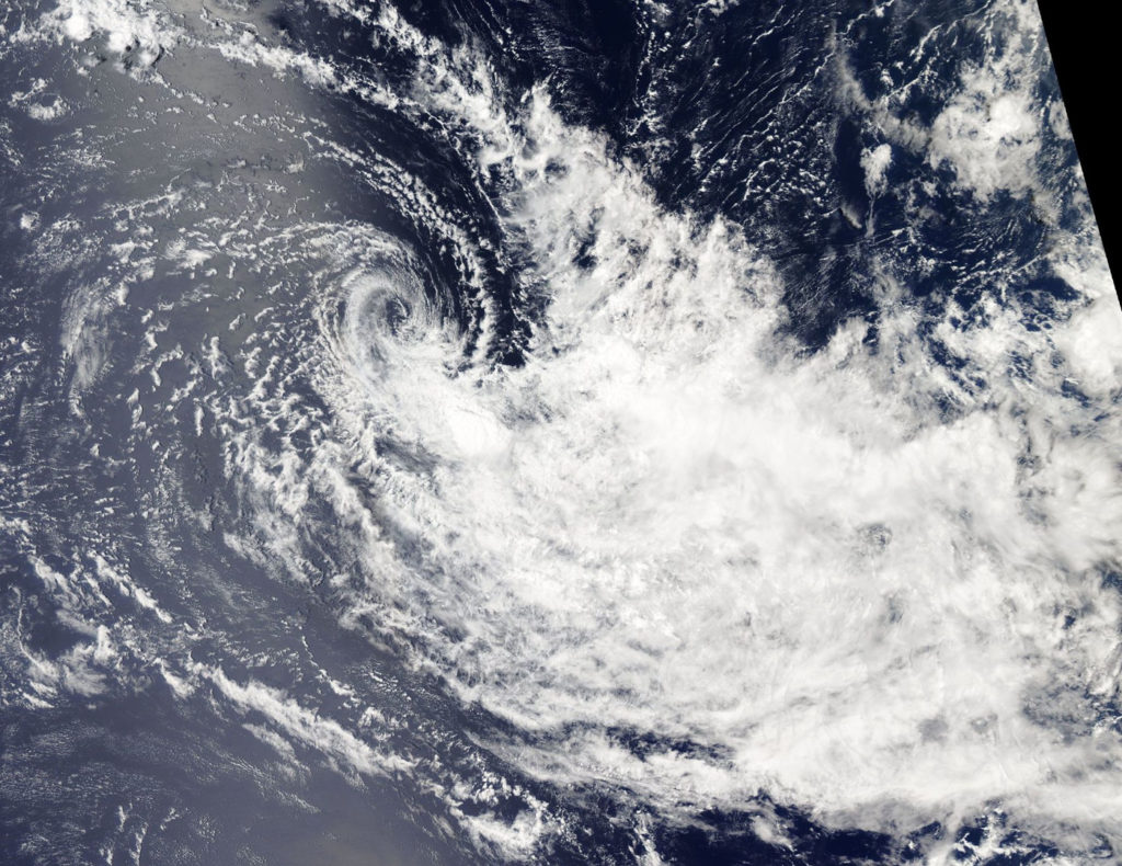
Tropical Cyclone Bouchra may have been re-born over the weekend of Nov. 17 and 18 but by Nov. 20 it was blown apart by wind shear and NASA’s Aqua satellite confirmed that.
Aqua image of Bouchra
On Nov. 20 the MODIS instrument aboard NASA’s Aqua satellite saw Tropical Storm Bouchra being torn apart by winds. The center appeared almost cloud free while the bulk of clouds were pushed to the southeast. Credit: NASA Worldview, Earth Observing System Data and Information System (EOSDIS)

In general, wind shear is a measure of how the speed and direction of winds change with altitude. Wind shear can tear a tropical cyclone apart or weaken it.

On Nov. 20 the MODIS or Moderate Resolution Imaging Spectroradiometer instrument aboard NASA’s Aqua satellite saw Tropical Storm Bouchra being torn apart by winds. The center appeared almost cloud free while the bulk of clouds were pushed to the southeast. That’s an indication that winds or wind shear was affecting the storm and elongating its circulation center, weakening the storm again.

By 4 a.m. EST (0900 UTC) on Nov. 20, Bouchra was already weakening and the Joint Typhoon Warning Center issued their final bulletin on the system. At that time, maximum sustained winds were near 35 knots (40 mph/62 kph). It was located near 5.4 degrees south latitude and 78.0 degrees east longitude, about 604 nautical miles southeast of Diego Garcia. Wind shear had increased since Nov. 19 and was pushing the bulk of clouds to the southeast and about 150 nautical miles away from the center.

Bouchra is expected to make its final dissipation by the end of the day on Nov. 20.

By Rob Gutro
NASA’s Goddard Space Flight Center

Bouchra (Southern Indian Ocean)

November 19, 2018 – Satellite Finds Tropical Cyclone Bouchra Reborn in Southern Indian Ocean

Tropical Cyclone 04S, known as Bouchra formed in the Southern Indian Ocean during the week of Nov. 12 and by the end of the week it had become a remnant low pressure area. Over the weekend of Nov. 17 and 18 it regenerated into a tropical cyclone and the NOAA-20 satellite passed overhead and captured a visible image of the storm.

NOAA-20 image of Bouchra
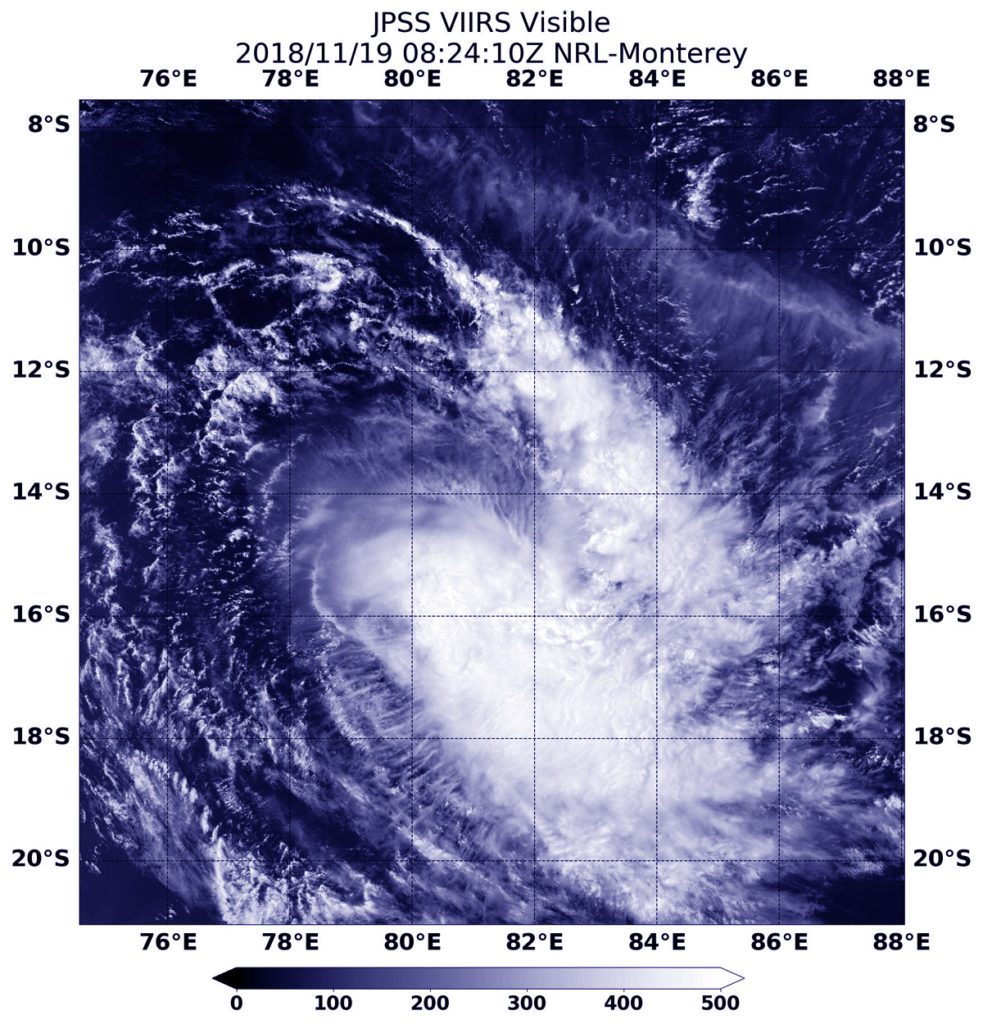
At 3:24 a.m. EDT (0824 UTC) on Nov. 19, the VIIRS instrument aboard NOAA’s NOAA-20 satellite captured a visible image of Tropical Cyclone Bouchra in the Southern Indian Ocean. Credit: NASA/NRL

At 3:24 a.m. EDT (0824 UTC) on Nov. 19the Visible Infrared Imaging Radiometer Suite (VIIRS) instrument aboard the NOAA-20 polar orbiting satellite saw the elongated storm. The VIIRS image revealed that the storm appeared to stretch from northwest to southeast. That’s an indication that winds or wind shear was affecting the storm and elongating its circulation center, weakening the storm (again).

In general, wind shear is a measure of how the speed and direction of winds change with altitude. Wind shear can tear a tropical cyclone apart or weaken it.

On Nov. 19 at 10 a.m. EST (1500 UTC) Bouchra’s maximum sustained winds were near 50 knots (57 mph/92 mph) making it a tropical storm. It was located approximately 672 nautical miles southeast of Diego Garcia near 15.2 south latitude and 80.4 east longitude. Bouchra was moving southwestward and is expected to maintain intensity over the next several days before weakening.

Bouchra is expected to dissipate by Nov. 22.

NOAA-20 is the first in the JPSS series of satellites. JPSS is a collaborative program between the National Oceanic and Atmospheric Administration (NOAA) and its acquisition agent, the National Aeronautics and Space Administration (NASA). NOAA is responsible for managing and operating the JPSS program, and developing portions of the ground segment, while NASA is responsible for developing and building the JPSS instruments, spacecraft, and portions of the ground segment and providing launch services.

For more information about the JPSS series of satellites, visit: https://www.jpss.noaa.gov/ 

By Rob Gutro
NASA’s Goddard Space Flight Center
Bouchra (Southern Indian Ocean)

Nov. 13, 2018 – NASA-NOAA Satellite Catches Short-Lived Tropical Cyclone Bouchra

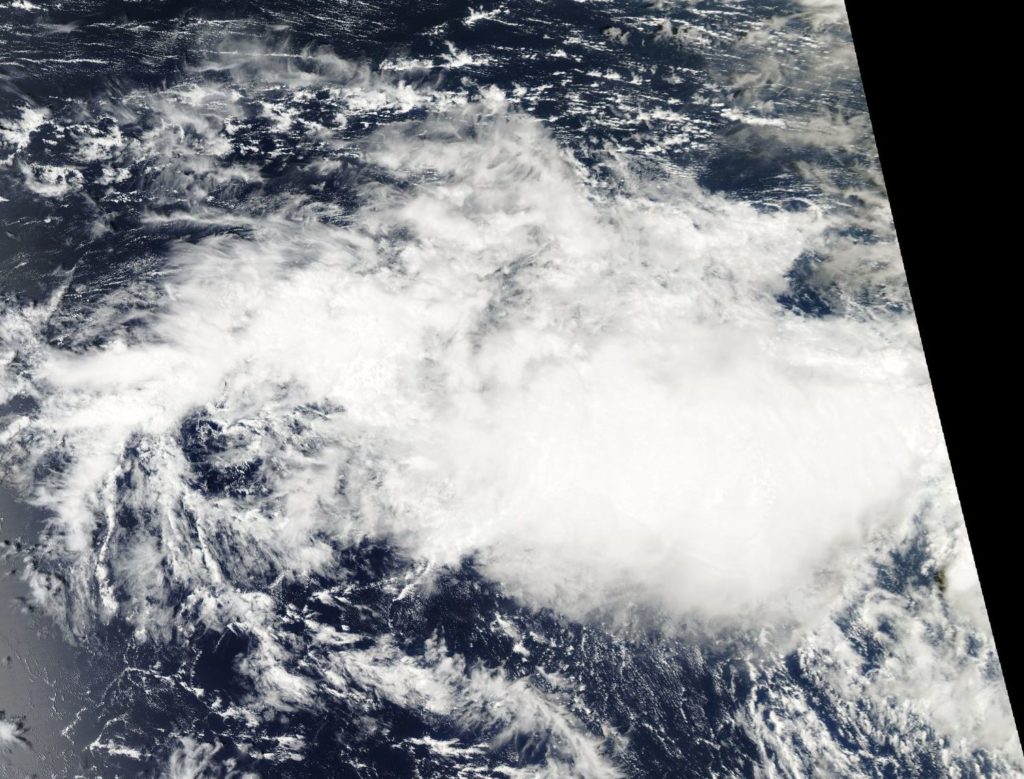
Tropical Cyclone Bouchra formed on Nov. 10 in the Southern Indian Ocean and was already on its way to dissipation when NASA-NOAA’s Suomi NPP satellite passed overhead on Nov. 13.

Suomi NPP Image of Bouchra
On Nov.13, the VIIRS instrument aboard NASA-NOAA’s Suomi NPP satellite captured a visible image of Tropical Cyclone Bouchra in the Southern Indian Ocean. Credit: NASA Worldview, Earth Observing System Data and Information System (EOSDIS)

Bouchra formed on Nov. 10 around 4 a.m. EDT (0900 UTC) about 220 miles northwest of Cocos Island, near 5.5 degrees south latitude and 90.7 east longitude. It was the fourth tropical cyclone of the Southern Indian Ocean cyclone season.

On Nov. 13, the Visible Infrared Imaging Radiometer Suite (VIIRS) instrument aboard NASA-NOAA’s Suomi NPP satellite analyzed Tropical Depression Bouchra showed a disorganized storm. The Joint Typhoon Warning Center noted the storm appeared to have “shallow disorganized central convection sheared eastward, partly exposing a weak and ragged low level circulation.”

Wind shear was stretching the storm out from west to east. In general, wind shear is a measure of how the speed and direction of winds change with altitude. Winds at different levels of the atmosphere pushed against the cylindrical circulation center and skewed it, weakening the rotation.

On Nov., 13 at 4 a.m. EDT (0900 UTC) Bouchra’s maximum sustained winds had dropped to 34.5 mph (30 knots/55.5 kph). It was located approximately 495 nautical miles northwest of Cocos Island near 7.2 degrees south latitude and 90.3 degrees east longitude. Bouchra was moving southeastward, and will dissipate later in the day.

By Rob Gutro
NASA’s Goddard Space Flight Center