Jan. 03 – 07, 2019 – NASA Caught Tropical Cyclone Mona Near Fiji
Tropical Cyclone Mona formed north of Fiji and triggered warnings. NASA’s Aqua satellite captured an infrared image of the storm providing cloud top temperatures.
On Jan. 3, 2019, Regional warnings went into effect. A tropical cyclone alert was in force for Vanua Levu, Taveuni, Lau and Lomaiviti group of islands.
On Jan. 3 at 4 a.m. EST (0900 UTC), Tropical cyclone Mona was located near 12.6 degrees south latitude and 178.2 degrees east longitude, about 330 miles north of Suva, Fiji. Mona was moving to the south and had maximum sustained winds near 35 knots (40 mph/65 kph). Mona is threatening Fiji.
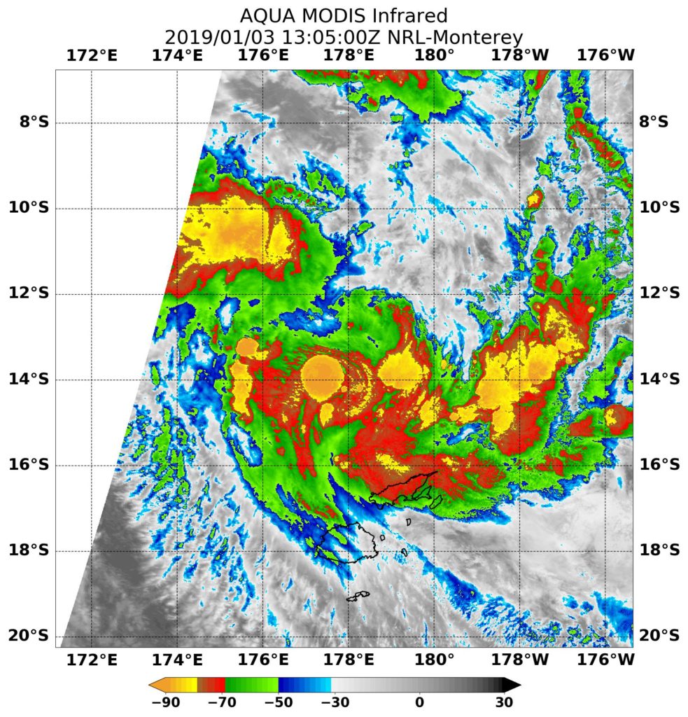
On Jan. 3, 2019 at 12 a.m. EST (0500 UTC) NASA’s Aqua satellite passed over the Southern Pacific Ocean and the MODIS instrument captured an infrared image of Tropical Cyclone Mona. MODIS found some very powerful thunderstorms with cloud tops as cold as minus 90 degrees Fahrenheit.
On Jan. 4, Mona continued tracking toward Fiji and a tropical cyclone alert remained in place for the Yasawa group, Vanua Levu, Taveuni and the rest of Fiji.
On Jan. 7, a tropical cyclone alert was in force for Vatoa and Ono-I-Lau. Mona’s maximum sustained winds were near 40 knots. At that time, the Joint Typhoon Warning Center noted that Mona is veering round to the southwest, through the eastern parts of the Fijian archipelago. The system dissipated later that day.
By Rob Gutro
NASA’s Goddard Space Flight Center