June 15, 2020 – NASA Follows Tropical Storm Nuri’s Path
An animation of four days of imagery from NASA’s Terra satellite showed the progression and landfall of Tropical Storm Nuri.
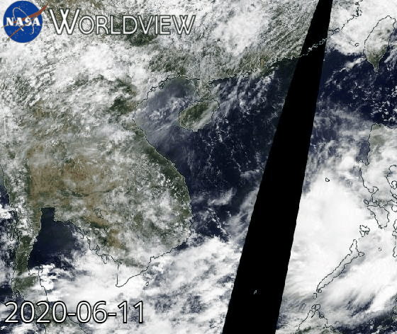
At NASA’s Goddard Space Flight Center in Greenbelt, Md. an animation of Nuri from June 11 to 15 was created using NASA Terra satellite images. It showed Nuri’s path through the South China Sea, its landfall and dissipation over southern China. The Moderate Imaging Spectroradiometer or MODIS instrument that flies aboard NASA’s Terra satellite captured the visible images.
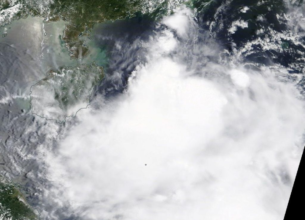
NASA’s Terra satellite provided a visible image to forecasters of Tropical Storm Nuri as it approached the southeastern coast of China during the day on Saturday, June 13. At that time, Strong wind signal #3 was in force for Hong Kong. At 5 a.m. EDT (0900 UTC), Tropical storm Nuri was located near latitude 18.7 north and longitude 115.2 east, 166 miles south-southeast of Hong Kong. Nuri was moving to the west-northwest and had maximum sustained winds of 35 knots (40 mph/65 kph). Nuri was moving northwest and did not strengthen further before making landfall.
On June 13 at 11 p.m. EDT (June 14 at 0300 UTC), the Joint Typhoon Warning Center issued their final warning on Nuri. Nuri had made landfall in China’s Guangdong Province and was located near latitude 21.8 degrees north and longitude 112.0 degrees east, about 126 nautical miles west-southwest of Hong Kong. Nuri had weakened to a depression and had maximum sustained winds near 25 knots (29 mph/46 kph). It was moving to the northwest and dissipating.
NASA’s Terra satellite is one in a fleet of NASA satellites that provide data for hurricane research.
Tropical cyclones/hurricanes are the most powerful weather events on Earth. NASA’s expertise in space and scientific exploration contributes to essential services provided to the American people by other federal agencies, such as hurricane weather forecasting.
For updated forecasts, visit: www.nhc.noaa.gov
