Oct. 30, 2018 – Hurricane Oscar on Satellite Imagery: A One-Eyed Little Monster with a Tail
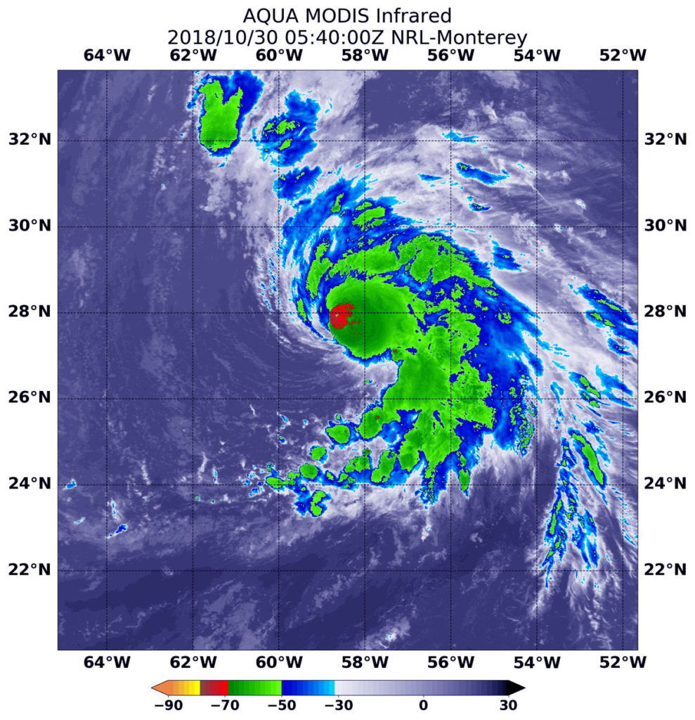
Of course, tropical cyclones have one eye and with Halloween on the horizon, false-colored infrared imagery from NASA’s Aqua satellite brought out that eye in this small tropical monster with a tail of thunderstorms.

When NASA’s Aqua satellite passed over the Central Atlantic Ocean, it took Hurricane Oscar’s cloud top temperatures that helped forecasters key into where the strongest side of the storm was located.
Cloud top temperatures determine strength of the thunderstorms that make up a tropical cyclone. The colder the cloud top, the stronger the uplift in the storm that helps thunderstorm development. Basically, infrared data helps determine where the most powerful storms are within a tropical cyclone.
The Moderate Resolution Imaging Spectroradiometer or MODIS instrument aboard Aqua provided that infrared data on Oct. 30 at 1:40 a.m. EDT (0540 UTC) MODIS data showed cloud top temperatures in strongest storms around Oscar’s eye were as cold as or colder than minus 70 degrees Fahrenheit (minus 56.6 degrees Celsius). NASA research indicates very cold cloud tops with the potential to generate very heavy rainfall.
The National Hurricane Center or NHC said ” Cloud-top temperatures have warmed a bit overall, and the convective pattern is becoming more asymmetric as dry air is infiltrating the southern and eastern part of Oscar’s circulation. However, the hurricane is still producing plenty of inner-core convection and some lightning strikes.”
A fragmented band of thunderstorms wrapping into the center of circulation from the southeast gave the storm an appearance of having a tail.
MODIS imagery also showed that Oscar is a small storm. Hurricane-force winds extend outward up to 25 miles (35 km) from the center, and tropical-storm-force winds extend outward up to 90 miles (150 km).
At 11 a.m. EDT (1500 UTC) on Oct. 30 the center of Hurricane Oscar was located near latitude 29.7 North, longitude 57.7 West. Oscar is moving toward the north-northeast near 14 mph (22 kph). A north-northeastward or northeastward motion with an increase in forward speed is expected through Friday. Maximum sustained winds are near 100 mph (155 kph) with higher gusts. The estimated minimum central pressure is 972 millibars.
Gradual weakening is forecast during the next several days, but Oscar is expected to become a powerful extratropical low over the north-central Atlantic Ocean by late Wednesday, Oct. 31.
For updated forecasts, visit: www.nhc.noaa.gov
