Aug. 12, 2019 – NASA Measures Rain Rate in Tiny Tropical Storm Henriette
Tiny Tropical Storm Henriette is the newest addition to the tropical cyclone line-up in the Eastern Pacific Ocean. The storm developed early on Aug. 12 and soon after the GPM satellite passed overhead and found heavy rain happening around its center.
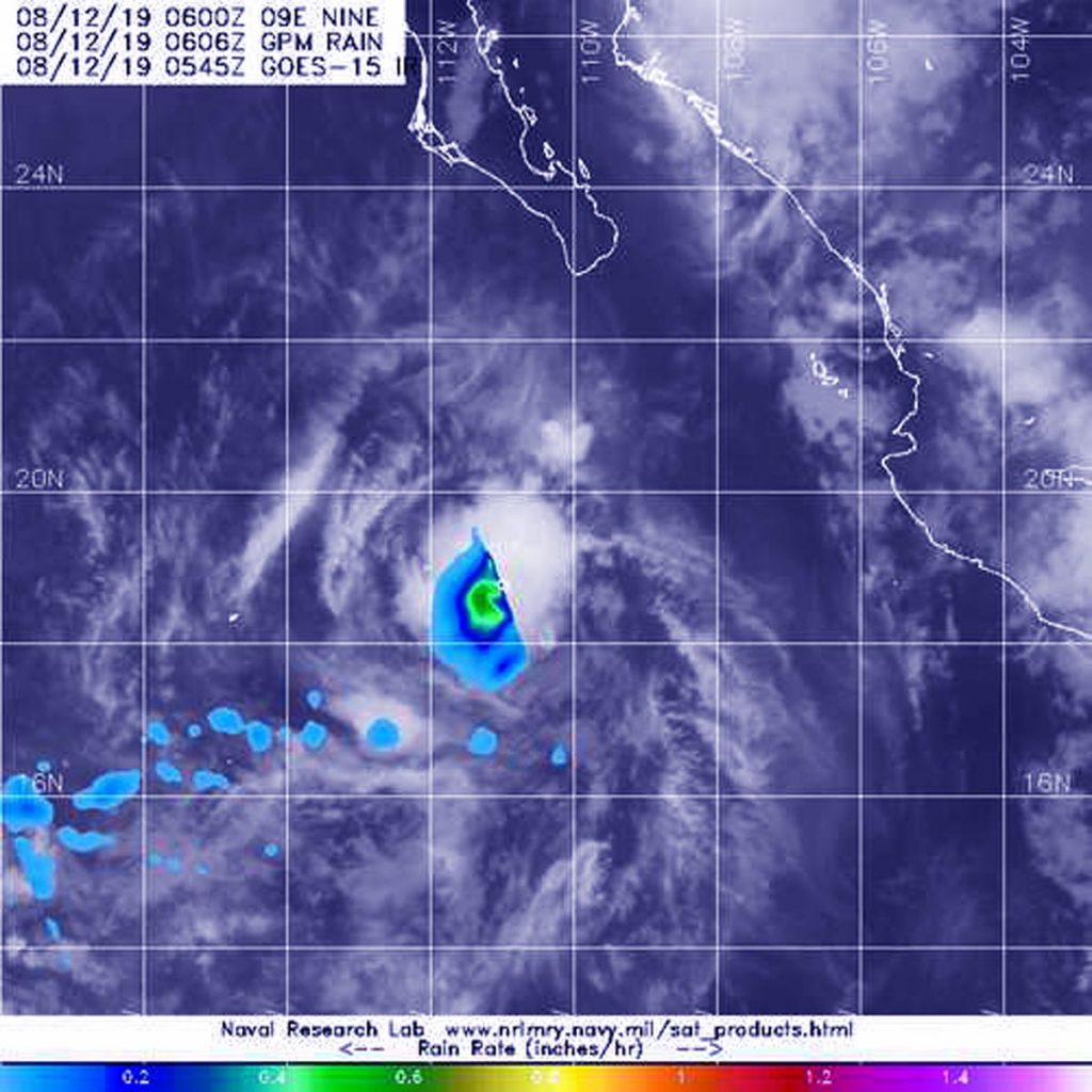
The Global Precipitation Measurement mission or GPM core satellite passed over Tropical Storm Henriette at 2:06 a.m. EDT (0606 UTC) on August 12, 2019. GPM found the heaviest rainfall was around the center of circulation falling at a rate of 25 mm (about 1 inch) per hour, over open waters of the Eastern Pacific. GPM is a joint mission between NASA and the Japan Aerospace Exploration Agency, JAXA.
NOAA’s National Hurricane Center (NHC) said, at 11 a.m. EDT (1500 UTC), the center of Tropical Storm Henriette was located near latitude 19.7 degrees north and longitude 112.2 degrees west. The storm is far enough away from land that there are no coastal warnings in effect. It is about 265 miles (430 km) southwest of the southern tip of Baja California, Mexico.
Henriette is moving toward the west-northwest near 12 mph (19 kph) and this general motion is expected to continue for the next couple of days. Maximum sustained winds are near 40 mph (65 kph) with higher gusts. Tropical-storm-force winds extend outward up to 35 miles (55 km) from the center. The estimated minimum central pressure is 1005 millibars.
Henriette is expected to begin weakening by Tuesday, Aug. 13 and degenerate into a remnant low pressure area by Tuesday night.
For updated forecasts, visit: www.nhc.noaa.gov.