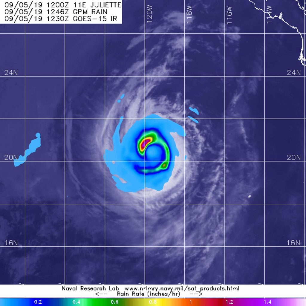
Sep. 05, 2019 – Satellite Finds a “Hook” of Heavy Rainfall in Hurricane Juliette
From its vantage point in orbit around the Earth, when the Global Precipitation Measurement mission or GPM core satellite passed over the Eastern Pacific Ocean, it gathered data on rainfall rates occurring in Hurricane Juliette. The areas of strongest rainfall resembled a hook.

The GPM satellite passed over Juliette on Sept. 5 at 8:46 a.m. EDT (1246 UTC). GPM found the heaviest rainfall in the northwest of thunderstorms circling the center where it was falling at a rate of over 36 mm (about 1.4 inch) per hour. Heavy rainfall of about 25 mm (1 inch per hour) stretched east and south in that same thunderstorm band circling the eye of the storm, giving the appearance of a hook around the storm’s eye. GPM is a joint mission between NASA and the Japan Aerospace Exploration Agency, JAXA.
At 5 a.m. EDT (2 a.m. PDT) on Sept. 5, the National Hurricane Center (NHC) noted, “Juliette’s cloud pattern has changed little during the past several hours. If anything, the spiral bands appear to have improved a bit in the western portion of the cyclone.” At that time, the center of Hurricane Juliette was located near latitude 20.2 degrees north and longitude 119.1 degrees west. That’s about 620 miles (995 km) west-southwest of the southern tip of Baja California, Mexico.
Juliette is moving toward the northwest near 9 mph (15 kph). The hurricane is expected to move to the west-northwest at a slightly faster forward speed on Friday and should continue this motion through Saturday. Maximum sustained winds remain near 90 mph (150 kph) with higher gusts. The estimated minimum central pressure is 976 millibars.
Gradual weakening is forecast to resume today [Sept. 5] as the storm is expected to move over cooler sea surface temperature and encounter dry air and outside winds (vertical wind shear). Further weakening is expected during the next several days. Juliette should weaken to a tropical storm on Friday.
For updated forecasts, visit: www.nhc.noaa.gov
