Sep. 25, 2019 – NASA Finds Light Rain in Former Hurricane Kiko’s Remnants
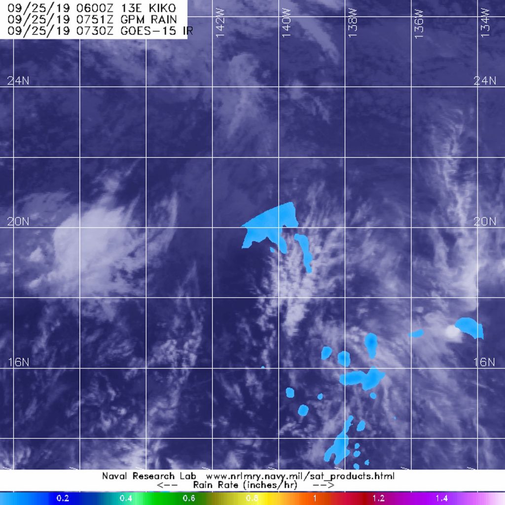
Former Hurricane Kiko is now just a remnant low pressure area that has slid into the Central Pacific Ocean. The Global Precipitation Measurement mission or GPM satellite provided a look at the rainfall occurring within the low.

Kiko weakened to a remnant low pressure area by 11 p.m. EDT on Sept. 24. At the time, it was about 950 miles (1.530 km) east of Hilo, Hawaii, near 19.2 degrees north latitude and 140.5 degrees west longitude. Maximum sustained winds at the time were near 35 mph (55 kph) and weakening. That also marked the last advisory from NOAA’s National Hurricane Center.
The GPM’s core satellite passed over Kiko’s remnants on Sept. 25 at 3:51 a.m. EDT (0751 UTC). GPM found scattered light rain from the remnant clouds falling at less than 0.2 inches (less than 5 millimeters) per hour. Forecasters at NOAA’s National Hurricane Center or NHC incorporate the rainfall data into their forecasts.
On Sept. 25, 2019, the Tropical Weather Discussion from NHC at 6:05 a.m. EDT (10:05 UTC) noted that Post-Tropical Cyclone Kiko is west of 140 degrees west longitude and in the Central Pacific Ocean. Kiko continues to move west.
The air-pressure gradient created between Kiko (a low pressure area) and high pressure north of the area is supporting moderate to fresh trade winds. Kiko’s remnants are producing a large area of ocean swells to 8 feet. Those ocean swells are expected to lessen as Kiko’s remnants dissipate.
Hurricanes are the most powerful weather event on Earth. NASA’s expertise in space and scientific exploration contributes to essential services provided to the American people by other federal agencies, such as hurricane weather forecasting.
GPM is a joint mission between NASA and the Japan Aerospace Exploration Agency, JAXA.
