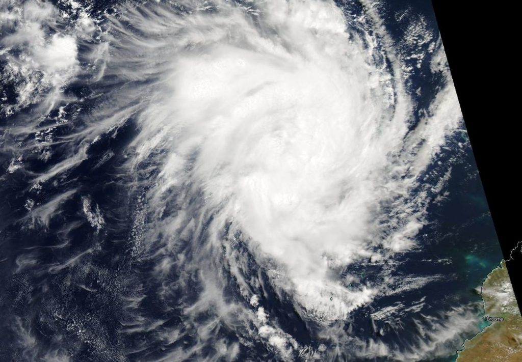
Feb. 24, 2020 – NASA Aqua Satellite Sees Tropical Storm Ferdinand Strengthening
Tropical Storm Ferdinand formed in the Southern Indian Ocean and NASA’s Aqua satellite provided forecasters with a visible image of the strengthening storm.
Ferdinand formed on Feb. 23 by 4 p.m. EST (2100 UTC) as Tropical Cyclone 20S. By Feb. 24, it had been renamed Ferdinand.

On Feb. 24 at 4 a.m. EST (0900 UTC), the Joint Typhoon Warning Center (JTWC) noted Ferdinand had maximum sustained winds near 55 knots (63 mph/102 kph). At that time, it was located near 14.9 degrees south latitude and 117.5 degrees east longitude about 484 nautical miles north-northeast of Learmonth, Australia.
On Feb. 24 at 4 a.m., EST (0900 UTC), the Moderate Imaging Spectroradiometer or MODIS instrument that flies aboard NASA’s Aqua satellite provided a visible image of Ferdinand that showed strong bands of thunderstorms wrapping into the low-level center. In addition to the visible image, animated enhanced infrared satellite imagery revealed a rapidly consolidating system with a developing central dense overcast feature. A microwave image also revealed an eye feature.
The JTWC forecast calls for Ferdinand to move southwest and peak at 90 knots (104 mph/167 kph) on Feb. 26 before weakening. Ferdinand is not expected to affect mainland Australia as it if forecast to turn west and away from Western Australia.
NASA’s Aqua satellite is one in a fleet of NASA satellites that provide data for hurricane research.
Tropical cyclones are the most powerful weather event on Earth. NASA’s expertise in space and scientific exploration contributes to essential services provided to the American people by other federal agencies, such as hurricane weather forecasting.
Rob Gutro
NASA’s Goddard Space Flight Center, Greenbelt, Md.
