Aug. 01, 2020 – NASA Sees New Tropical Storm Sinlaku Form Before a Quick Landfall
NASA’s Aqua satellite obtained visible imagery of a newly developed tropical storm in the South China Sea, the same day it was forecast to make landfall.
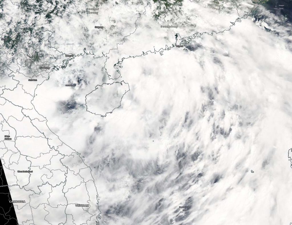
Tropical Storm Sinlaku formed in the South China Sea, within the Northwestern Pacific Ocean basin on Saturday, August 1 at 5 a.m. EDT (0900 UTC). At that time, the storm was centered near 18.9 degrees north latitude and 108.4 degrees east longitude, about 174 nautical miles north of Da Nang, Vietnam. Sinlaku was moving to the west-northwest at 15 knots (17 mph/28 kph) and had maximum sustained winds 35 knots (40 mph/~65 kph).
The Moderate Imaging Spectroradiometer or MODIS instrument that flies aboard NASA’s Aqua satellite captured a visible image of Tropical Storm Sinlaku Aug. 1. The Aqua image showed Sinlaku formed near Hainan Island and appears to have a large circulation. Satellite imagery was generated using NASA’s Worldview product at NASA’s Goddard Space Flight Center in Greenbelt, Md.
In addition to the visible imagery, forecasters used animated enhanced infrared satellite imagery that showed fragmented deep convective banding over the western semicircle with a large low-level circulation center.
The Joint Typhoon Warning Center said that the storm will make landfall in northern Vietnam later today.
About NASA’s Worldview and Aqua Satellite
NASA’s Earth Observing System Data and Information System (EOSDIS) Worldview application provides the capability to interactively browse over 700 global, full-resolution satellite imagery layers and then download the underlying data. Many of the available imagery layers are updated within three hours of observation, essentially showing the entire Earth as it looks “right now.”
NASA’s Aqua satellite is one in a fleet of NASA satellites that provide data for hurricane research.
Tropical cyclones are the most powerful weather event on Earth. NASA’s expertise in space and scientific exploration contributes to essential services provided to the American people by other federal agencies, such as hurricane weather forecasting.
For updated forecasts, visit: www.nhc.noaa.gov