LCROSS Hits Its Mark!


Onlookers participate in LCROSS pre-impact activities at NASA’s Ames
Research Center. Credit: NASA

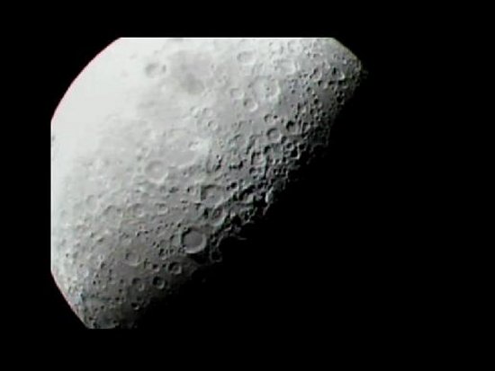
The crowd at NASA Ames was poised and ready for impact as the LCROSS camera started sending back stunning images of the moon’s south pole. At impact, a flash or large plume wasn’t visible with the LCROSS camera, but even though we didn’t see it doesn’t mean it wasn’t there.


The LCROSS mission operations team initiated power-up of the LCROSS science
payload and captured this image of the moon. Credit: NASA

Mission scientists confirmed the LCROSS spacecraft monitored whatever the Centaur rocket lifted from the crater floor. At this time, it isn’t yet clear how much dust was raised but LCROSS Principal Investigator Tony Colaprete did confirm that the instruments onboard the sheparding spacecraft captured the Centaur impact crater.

Now mission scientists need more time to study the data. In the next few weeks, scientists will pore over the information to determine if water ice does exist in the Cabeus crater.

To stay up to date, be sure to follow the LCROSS website, the LCROSS twitter feed, and its Facebook page.

https://www.nasa.gov/mission_pages/LCROSS/main/index.html

Impact from the Lunar Reconnaissance Orbiter's Line of Sight


Scientist and engineers are adjusting LRO’s orbit to have it fly its closest approach to the Cabeus target site just 90 seconds after the Centaur impacts the lunar surface. 


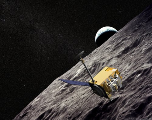
Artist Concept of the Lunar Reconnaissance Orbiter with Apollo mission
imagery in the background. Credit: NASA

The Lunar Reconnaissance Orbiter, better known as LRO, was a sister payload to LCROSS during launch and now the orbiter will pass over the moon at just the right time to capture the Centaur impact to collect key data about the physics of the impact and how volatile materials may have been mobilized.


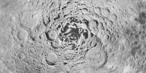
This image shows the moon’s south pole, as seen by the 1994 Clementine
mission. The possibility of frozen water is one of many reasons NASA is
interested in thisspot as a potential future landing site. However, many of the
craters in this area where frozen water sources are most likely to be found are
in constant shadow, which inhibited Clementine’s ability to see into these craters.
These shadows are the very dark areas at the pole’s center. The upcoming
Lunar Reconnaissance Orbiter mission will study this area and search for
evidence of frozen water sources. Credit: NASA

During and after impact LRO’s LAMP far UV spectrometer will search for evidence of significant water ice or water signatures and how they evolve in the moon’s atmosphere.  LRO’s Diviner radiometer will peer into the impact site to measure the heating effects caused by impact and how the temperature changes over time. LRO will continue to study the impact site using its suite of instruments long after the dust settles.

A Personal Perspective
David A. Paige, principal investigator Diviner
Diviner is one of the seven instruments aboard LRO

We on the LRO Diviner team are looking forward to the LCROSS impact with great anticipation. It’s not every day that we will have an opportunity to excavate a significant volume of material from one of the moon’s permanently shadowed polar cold traps.  We expect that a new lunar impact crater will form, and that dust, rock, and possibly cold-trapped volatile materials such as water ice will be thrown into space.

Everything we learn about the LCROSS impact will come from Earth observations and from observations from nearby spacecraft. Diviner will get excellent views of the impact site as LRO flies by. We intend to make maps of the radiometric temperature of the impact site before and after the impact, as well as observations of the dust plume that will be lofted during the impact event. Diviner’s observations may help confirm the location of the LCROSS impact, and its effects on the impact on the surrounding terrain. Diviner has already mapped the impact site on previous orbits and so any changes that are detected will be of great interest. We have no idea what LCROSS will uncover, but we’re anxious to know the results.


Diviner has acquired the first global daytime and nighttime thermal
maps of the moon. These maps were assembled using Diviner data obtained during
August and the first half of September, 2009. Credit: NASA/GSFC/UCLA

Hopefully, everything will go well for LCROSS and LRO on Friday morning and we’ll learn something new and exciting about the moon!

A New Look at an Old Neighbor


We have yet to uncover the full wealth of scientific information the moon holds. It at the cornerstone of understanding the birth and evolution of Earth and other planets, therefore we need to explore it.

The moon looks very unchanging and calm in the night sky and is rarely thought of as an active planetary body. What most people don’t know, is the moon receives LCROSS-sized impacts about once a week — that’s more than 50 impacts a year! It also is interesting to note that it experiences thousands of  “moonquakes” each year and releases energy by heat flow, electromagnetic conduction and tides from Earth and the Sun.


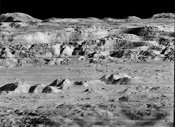
Moon’s Copernicus Crater — Lunar Orbiter Photo 1966 (Credit: NASA)

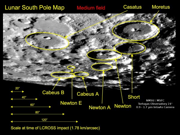
LCROSS is unique compared to the natural barrage of material impacting the moon because it’s designed to know exactly where and when it will impact — the Cabeus crater near the moon’s south pole.


 Craters of interest around the lunar south pole. LCROSS is targeting Cabeus A.
(Credit: NMSU/MSFC Tortugas Observatory)

Little is known about the moon’s permanently shadowed regions and we may find some unexpected results from this unique mission. The crater is more than two miles deep and may be one of the coldest places in the solar system. Scientists believe it has been void of sunlight for billions of years and represents an optimal location for determining if water ice exists on the moon.

Teams of scientists, engineers and astronomers across NASA, industry and academia are working tirelessly to advance space exploration and knowledge of our solar system with this mission. Now that LCROSS is two days away from impact, they still have a lot of work ahead of them. For example, they will observe the impacts, gather images of them, measure the quantity of water and identify its form and study the lunar soil.

This exciting mission promotes participatory exploration from the professional and amateur astronomy community, students and the general public.

During impact, at least twenty-five Earth-based observatories will be aimed at the Cabeus crater to witness the moment the lunar dust rises and is suspended in the sunlight to determine if it contains water vapor.

It's Almost Time!


It’s almost time!

It’s been over three months since the Atlas V soared from Cape Canaveral, Fla. into space carrying the Lunar Reconnaissance Orbiter (LRO) and the Lunar Crater Observation and Sensing Satellite (“LCROSS” for short). Now it’s finally time for LCROSS to do its things and get up close and personal with the moon.
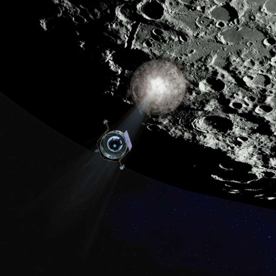

 An artist’s interpretation of NASA’s LCROSS spacecraft observing the first
impact of its rocket booster’s Centaur upper stage before heading in for its
own crash into the moon’s south pole. Credit: NASA

On Oct. 9 beginning at 6:30 a.m. CDT, the LCROSS spacecraft and heavier Centaur upper stage rocket will execute a series of procedures to separately hurl themselves toward the lunar surface to create a pair of debris plumes that will be analyzed for the presence of water ice. The Centaur is aiming for the Cabeus crater near the moon’s south pole and scientist expect it to kick up approximately ten kilometers (6.2 miles) of lunar dirt from the crater’s floor. 
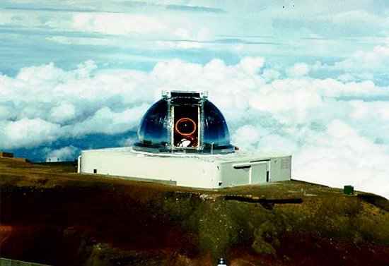

Image of NASA’s Infrared Telescope Facility. Credit: NASA

The sun never rises above certain crater rims at the lunar pole and some crater floors may not have seen sunlight for billions of years. With temperature estimated to be near minus 328 degrees Fahrenheit, these craters can ‘cold trap’ or capture most volatiles or water ice.
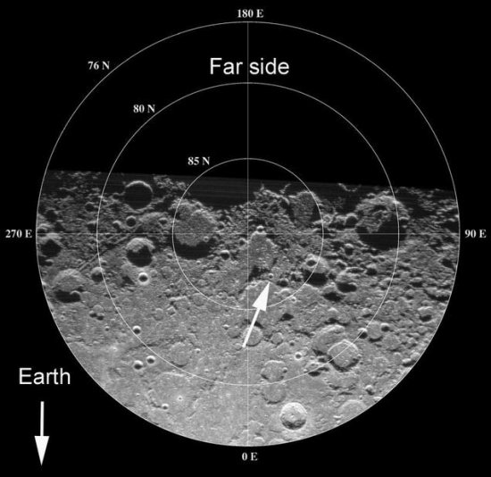

Earth-based radar image of the North Pole of the Moon, showing the position of the crater
Erlanger (arrow). Photo: Arecibo Observatory and NASA

On the day of impact, LCROSS at approximately 40,000 kilometers (25,000 miles) above the lunar surface will spin 180 degrees to turn its science payload toward the moon and fire thrusters to slow down. The spacecraft will observe the flash from the Centaur’s impact and fly through the debris plume. Data will be collected and streamed to LCROSS mission operations for analysis. Four minutes later, LCROSS also will impact, creating a second debris plume.

The LCROSS science team will lead a coordinated observation campaign that includes LRO, the Hubble Space Telescope, observatories on Hawaii’s Mauna Kea and amateur astronomers around the world.

It’s an exciting time for the most prominent object in our night sky with water being found on the surface last week by NASA’s Moon Mineralogy Mapper — one of eleven scientific devices carried by the Chandrayaan-One spacecraft of the Indian Space Research Organization.
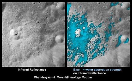

These images show a very young lunar crater on the side of the moon that faces away
from Earth, as viewed by NASA’s Moon Mineralogy Mapper on the Indian Space
Research Organization’s Chandrayaan-1 spacecraft. Image credit: NASA

However, the Moon Mineralogy Mapper can only observe lunar soil to a depth of a few millimeters and the amount of water present in that layer is very small. It’s been said the driest deserts on Earth have more water than the surface of the moon near its poles. LCROSS could prove that water does exist deeper beneath the moon’s surface and present a valuable resource in the human quest to explore the solar system.


Astronaut James Irwin, lunar module pilot, gives a military salute while standing
beside the deployed U.S. flag during the Apollo 15 lunar surface extravehicular
activity (EVA) at the Hadley-Apennine landing site. Credit: NASA

Two ways to watch the impact:

Tune into NASA TV. The Agency will broadcast impact live from the moon, with coverage beginning Friday morning at 5:15 a.m. CDT. The first hour, pre-impact, will offer expert commentary, spacecraft status reports, and a computer-generated preview of the impacts.

Or you can watch in your backyard using your telescope. Viewing opportunities are best for the Pacific Ocean and western parts of North America due to absence of light and a good view of the Moon at the time of impact. Hawaii is the best place to be, with Pacific coast states of the USA a close second. Any place west of the Mississippi River, however, is a potential observing site.
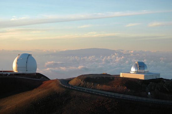

W.M. Keck Observatory and the NASA Infrared Telescope Facility with Haleakala on
Maui in the distance as seen at sunset from Mauna Kea. Credit: John Fischer