Picturing Sea Ice with ARISE’s Digital Camera Instrument

By George Hale, IceBridge Science Outreach Coordinator, NASA Goddard Space Flight Center

Digital camera shot of large sea ice lead
The dark blue in this image is a lead, or opening in sea ice. If you look closely you can see where the lead is starting to refreeze at the edges. Credit: NASA

Flying above, below and through clouds in the Arctic gives the ARISE C-130 a different perspective on the world below. Nowhere is this more apparent than through the lenses of ARISE’s digital camera instrument. This instrument – one of many   ARISE uses – captures views of clouds, ocean and ice that are both scenic and scientifically important.

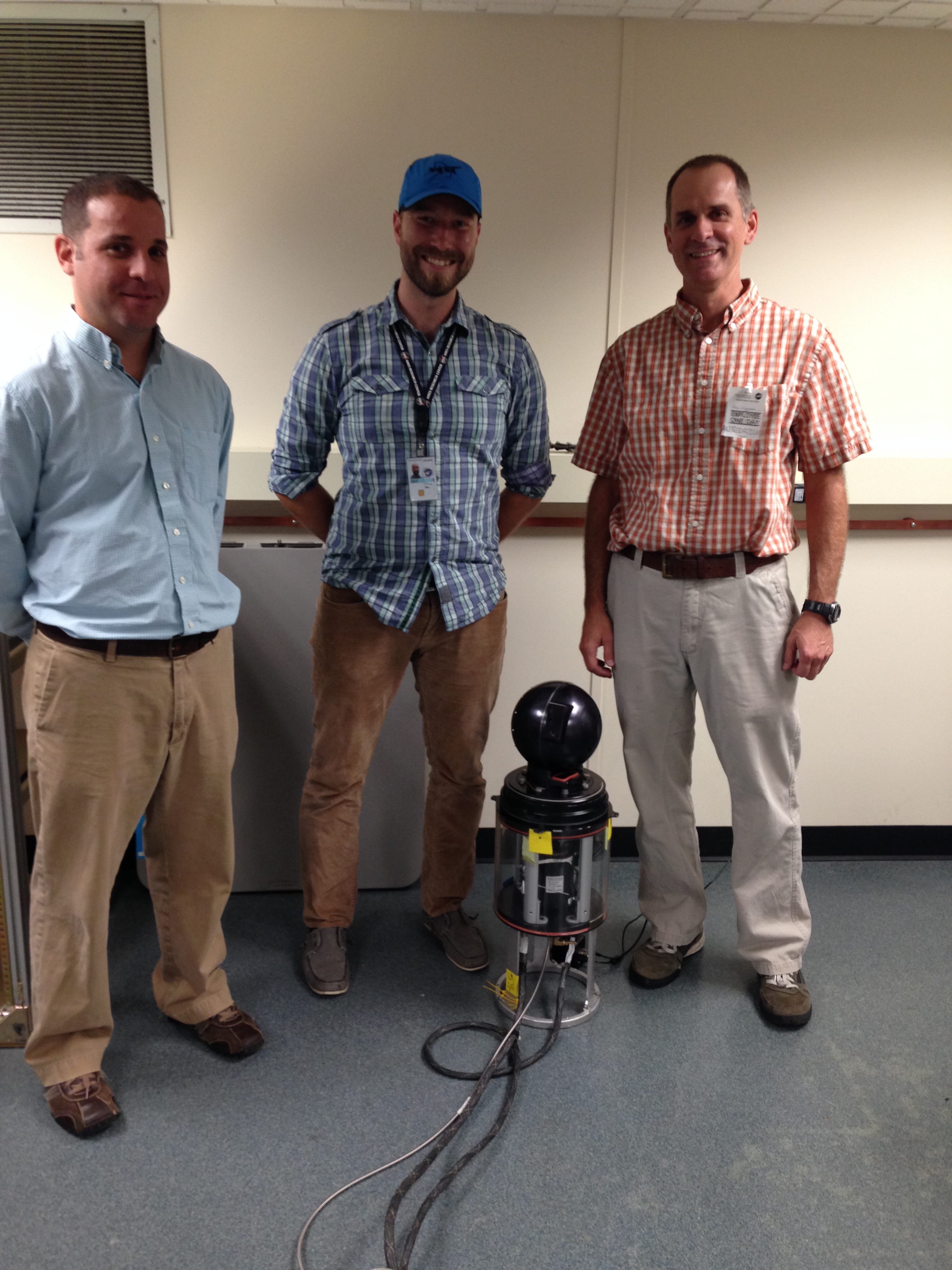
The heart of the digital camera instrument would look familiar to a casual observer. It is made up of two off-the-shelf digital cameras that point down through a clear window in the underside of the aircraft. These cameras are connected to a computer with software that allows the operator to preview images and change camera settings and to a hard drive for storing photographs. An average ARISE flight yields roughly 100 gigabytes of images.

Although the cameras are the same make and model, their lenses are different. Group photos and distant landscape shots call for different size lenses, and low-altitude and high-altitude flights do the same. One camera has a 14 millimeter, wide-angle lens to capture views of the surface during low-level flights. The other camera’s lens has a 50 millimeter focal length, making it useful higher up.

Broken sea ice
A collection of broken sea ice pieces floating together. Far from static, sea ice moves, flexes and breaks under the strain of winds and ocean currents. Credit: NASA

Similarly, the rate at which the shutters snap ranges between one per second to roughly one every three seconds. From high up the surface seems to pass slower than at low altitude, much like the way telephone poles beside the highway are a blur while far away mountains barely seem to move. Instrument operators can fine-tune this rate to best match the situation and can be managed in flight.

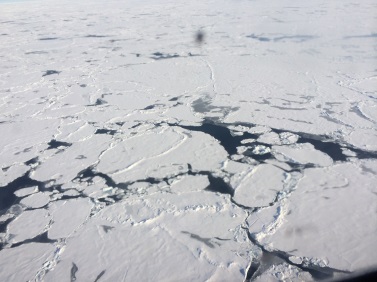
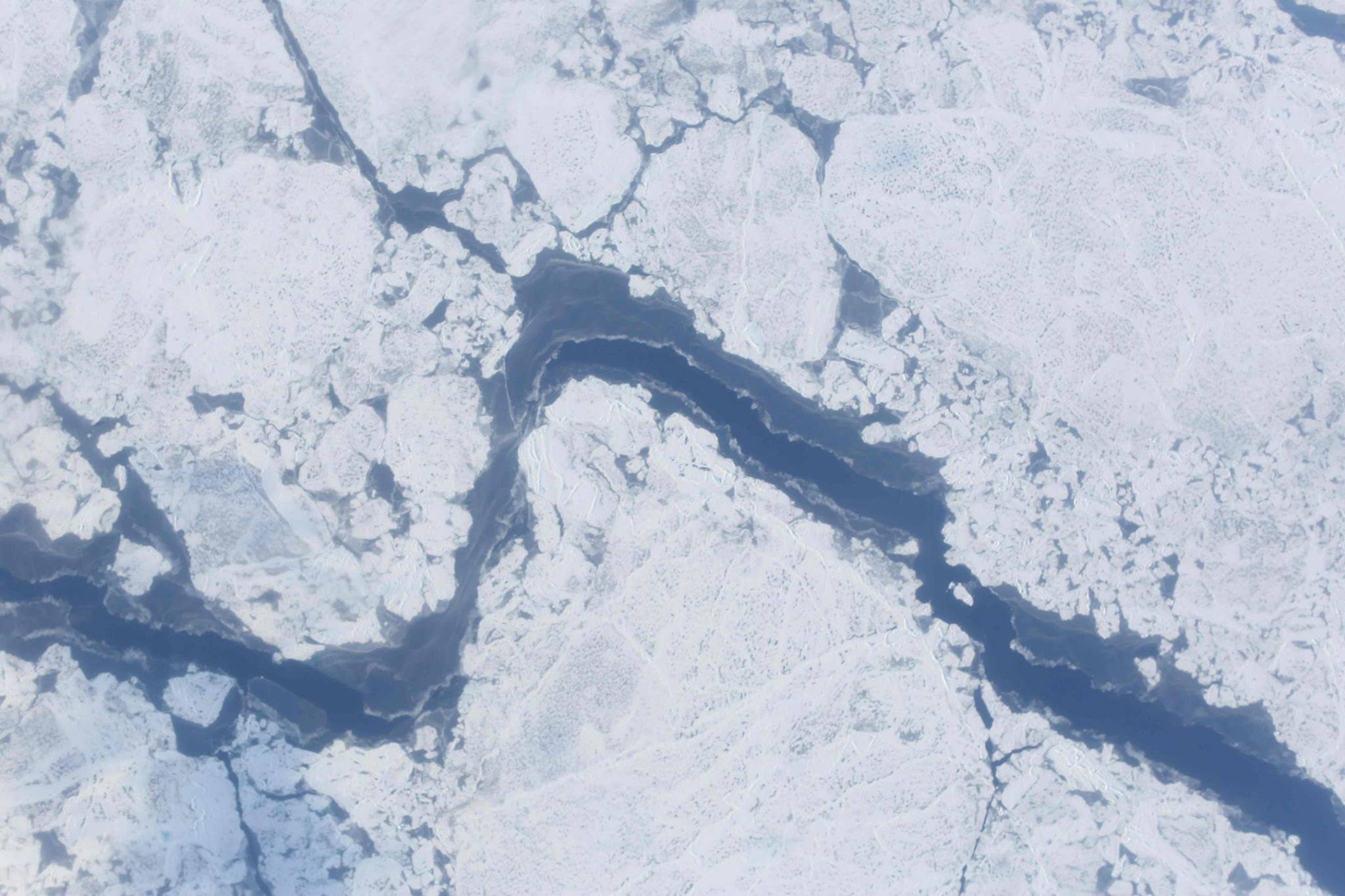
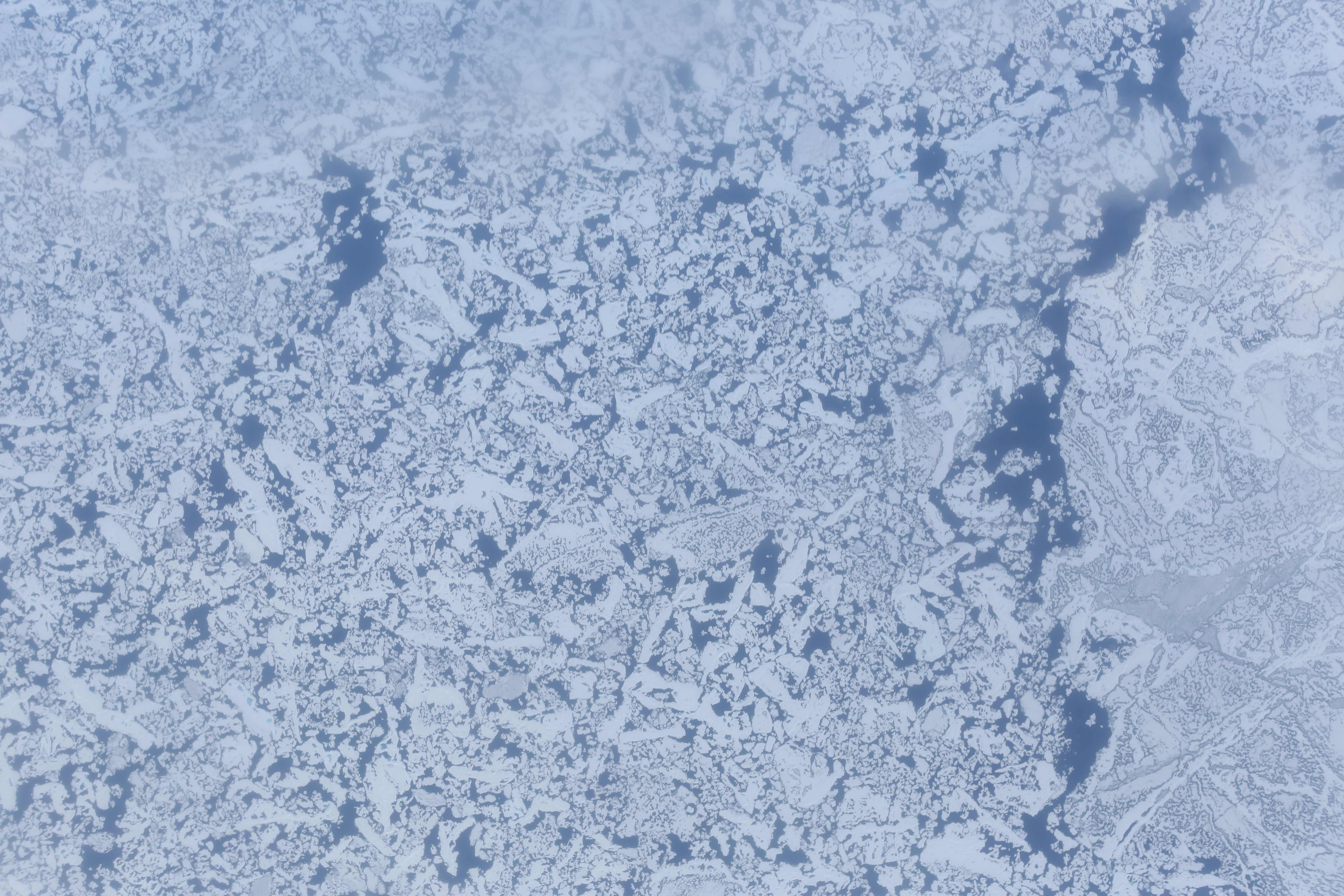
While many of the images these cameras capture are breathtaking, they are also useful in several ways. Researchers can use them to measure how much light is reflected from clouds and ice, also known as albedo. The images also show where there are leads, or openings, in sea ice. ARISE measures ice surface height using the Land, Vegetation and Ice Sensor, which bounces a laser off of the surface and times how long it takes to return to the plane. Locating leads gives scientists a reference for local sea level, helping ensure that measurements are accurate.

Larger broken ice
Larger chunks of sea ice, some with melt ponds on the surface. Credit: NASA

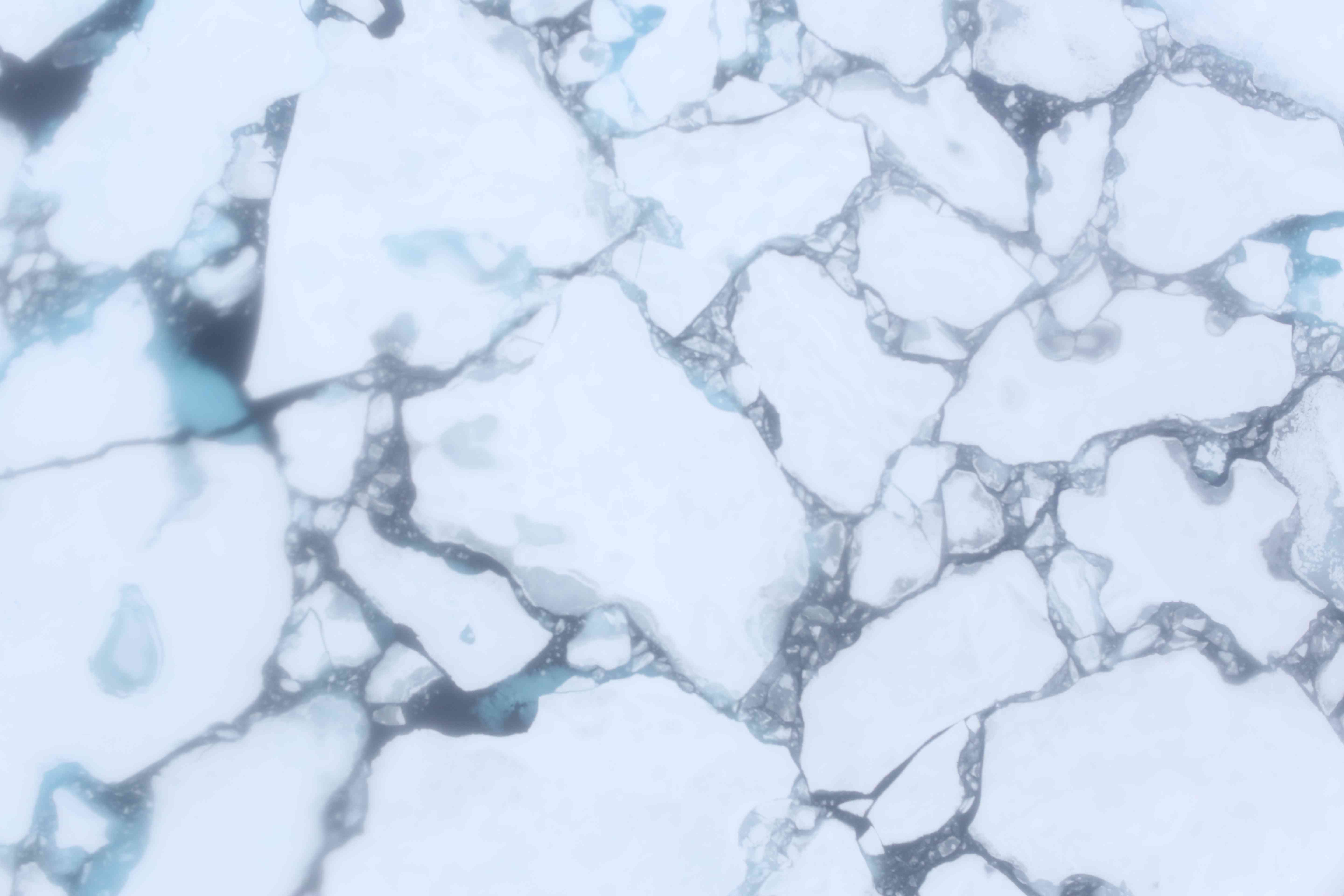
Laser altimeters and other instruments can reveal a great deal about the surface, but through photographs the variety of conditions ranging from open stretches of water to broken bits of floating ice to solid white expanses. The images captured by these cameras benefit researchers studying sea ice, but the views can also be breathtaking.

This entry originally appeared on the NASA Earth Observatory blog Notes from the Field.
http://earthobservatory.nasa.gov/blogs/fromthefield/2014/09/24/picturing-sea-ice-with-arises-digital-camera-instrument/

Bringing It All Together: Planning ARISE

By Christy Hansen, ARISE Project Manager, NASA Goddard Space Flight Center

Christy Hansen in front of NASA C-130
ARISE project manager Christy Hansen stands in front of the NASA C-130. Credit: NASA

By Christy Hansen, ARISE Project Manager, NASA Goddard Space Flight Center

Eielson Air Force Base, Fairbanks, Alaska, day 9 of our deployment: We are currently sitting together in our mission support and flight planning room, next to the Thunderdome Hangar on base. We have appropriately named this room, where we dedicate up to 10 hours each day, our WAR room – where we passionately discuss which ARISE science objectives we’ll fly each day.  Our broad instrument suite provides us with a great number of options for interesting science flights, yet ironically poses additional challenges, as each instrument requires meteorological conditions that often conflict with one another. It is here where we follow the C-130 as it flies our science trajectories, a combination of radiation cloud studies and cryospheric sciences. We can communicate with the science team on board via a basic chat system, send them occasional updated satellite imagery, track their flight, and talk on a satellite-based phone system.

ARISE team at work
Members of the ARISE team operating scientific gear aboard the C-130 during a survey flight. Credit: NASA / Richard Moore

It is the first NASA airborne science mission of its kind, combining a unique instrument suite that would have been unlikely to fly together on the same airborne platform in missions past. And this is what makes ARISE a very exciting mission from a scientific standpoint. New data sets will be combined and studied at the conclusion of this mission.  Our general science goal is to develop an understanding of the Arctic regional energy budget. The amount of sea-ice contributes to how much sunlight is reflected back to space, and thus is an important factor in the radiation balance of the Earth. In additional, we are hoping to learn more about how clouds might interact with sea ice to build a more comprehensive understanding of the Arctic energy budget as a whole. Why is this important?  Because it will help us better understand our Earth system; changes to atmospheric and ocean circulations, precipitation and temperature patterns, and potential sea level rise.

Sea ice through clouds
A view of broken sea ice through low clouds. Credit: NASA / Richard Moore

We are surrounded by  F-16 and F-18 jets taking off and landing all day, against a radiant and beautiful sky. We see an occasional moose on base and along the interstate during our drives in and out, all the while reminding us we are far away from home. We greet the plane as it lands each day – with a swarm of gnats in our face.

I love it when a plan comes together.

As the Project Manager for ARISE, I am reflecting on how far this team has come is such short time. In less than seven months, ARISE has evolved from the initial concept phase, to a fully operational airborne science mission – collecting unique data sets in the Arctic.  This includes identifying science objectives, identifying team members, identifying instruments to meet the mission goals, defining data products, selecting an aircraft, performing research to establish a base of operations that could meet our C-130 aircraft and science team requirements, obtaining country diplomatic clearances, flight planning,  performing C-130 aircraft engineering modifications, completing field logistics, testing and re-testing, and all associated approvals. Bringing a large unique team together, to meet a new set of NASA science goals and requirements, in a challenging environment, within regulations and expected timelines – from start to finish, is what my job is all about.

Weather briefing
ARISE mission planners and a member of the Eielson Air Force Base weather office review forecasts before a survey flight. Credit: NASA / Christy Hansen

The team of professionals and experts I work with each day, from scientists, to flight crew and aircraft maintainers, to logistics teams, and engineers to managers – have each contributed a unique puzzle piece to the overall mission picture. In just one week, we have completed six new science missions together. And “together” means that greater than 30 people have to work together, on time, in a changing and challenging environment with tight deadlines, every single day. Without all pieces of the puzzle working together well, the mission would not be complete.

This first week has proven that we can do it – we have met all initial obstacles and challenges as a team together. We have been moved from our location on base twice, scraped frost from our windows using credit cards, over-heated and froze all in the same day, laughed and politely argued together, heated up ramen noodles and pizza to get us through — all while remembering that we are here together to do GREAT science.

This entry originally appeared on the NASA Earth Observatory blog Notes from the Field.
http://earthobservatory.nasa.gov/blogs/fromthefield/2014/09/18/bringing-it-all-together-planning-arise/

Flying With ARISE

By Michal Segal Rosenheimer, Research Scientist, NASA Ames Research Center

Above the clouds
Above the clouds on NASA’s C-130 during an ARISE survey flight. Credit: NASA / Michal Segal Rozenhaimer

Day 1 (Sep-11-2014)

My first ARISE day started early in the morning after a late arrival into Fairbanks on the night before. This important mission’s goal is to map the sea ice and understand the relation between the complex cloud scene over the Arctic, the sea ice and Earth’s radiation budget,the balance between incoming and outgoing sunlight and infrared.

After arriving on base and seeing our instrument (4STAR) on the plane, I am ready to go out there, realizing again that since I am with NASA I get this great opportunity not only to analyze data as many scientists do, but to actually take part in generating this important dataset.

A view of the ground through clouds
Peering down through a thin cloud layer. Credit: NASA / Michal Segal Rozenhaimer

After initial preparations like getting used to the noise on the planeand figuring out how to buckle myself in (none of my degrees were proven useful in this case) we took off to the northern parts of our planet. From this big bird’s view, cutting through various cloud deck formations, seeing land cover, ocean and ice I suddenly grasp the immense variability of this region and how we, as a mobile platform, can bridge satellites and ground measurements by going above, in and below clouds. Yes, as is probably obvious from my text and images, I am interested in clouds!

More clouds
Another view of clouds. Credit: NASA / Michal Segal Rozenhaimer

The 4STAR instrument can measure clouds from below, and can also look at the sun and characterize the thin cloud wisps surrounding the sun in this third image. Harmless as they seem, these cirrus (which means a curling lock of hair in Latin) clouds are hard to detect from space and have a large effect on warming/cooling of our planet.

After a seven hour flight it is time to land and think about the next flight.

Day 2 (Sep-13-2014)

solid sea ice
Solid sea ice seen during an ARISE survey flight. Credit: NASA / Michal Segal Rozenhaimer

My second ARISE flight day started with lots of adrenaline and excitement. We would fly low over the sea-ice sheets!
Some regions are broken, with small water lakes in between and some are rock-solid.

Flying so low over the sea-ice makes me wonder whether I’ll be able to detect a polar bear out there.

The views are so awe-inspiring that I am practically out of words or breathe. After eight hours above these amazing surfaces, with some roller-coaster ups and downs, we are back on the ground, and I am with a big smile that will last for many more hours after that.

broken sea ice
Broken sea ice seen during an ARISE survey flight. Credit: NASA / Michal Segal Rozenhaimer

This entry originally appeared on the NASA Earth Observatory blog Notes from the Field.
http://earthobservatory.nasa.gov/blogs/fromthefield/2014/09/17/flying-with-arise/

May the 4STAR Be With You

By Michal Segal Rosenheimer, Research Scientist, NASA Ames Research Center

4STAR on top of C-130
The Spectrometer for Sky-Scanning, Sun-Tracking Atmospheric Research (4STAR) mounted on top of NASA’s C-130 research aircraft.
Credit: NASA

The Spectrometer for Sky-Scanning, Sun-Tracking Atmospheric Research, or 4STAR, is an airborne instrument that measures aerosols (small particles suspended in the atmosphere), gases (ozone for example), and a variety of cloud properties. Currently it is being deployed on the NASA C-130 aircraft on its quest to measure aerosol and cloud properties in the Arctic, helping to answer some of the most difficult questions of climate change: what is the link between sea ice changes, clouds and global warming?

How does it work?

The 4STAR instrument has three different modes. The first of these, and the instrument’s main mode, is Sun-Tracking. This is where the instrument tracks the sun’s location in the sky, staring at it to measure the light transmitted from the sun to the instrument as it travels through the atmosphere. If the atmosphere is clean, we would measure the sun’s intensity. But because the atmosphere contains aerosols, gases and cirrus clouds, which are high, thin clouds made of ice crystals, we measure the amount of light that makes it through instead of being scattered and absorbed by these components of the atmosphere. By comparing measured light through the atmosphere to what we would have seen with no atmosphere we can deduce the amount of aerosol and gases in the air.

4STAR sun tracking diagram
A diagram showing 4STAR’s sun-tracking mode. The instrument locks on to the sun and measures the amount of light that makes it through clouds, gases and aerosols. Comparing this with what would be seen in clear air lets researchers calculate the amount of aerosols and gases in the atmosphere. 
Credit: NASA

Another operating mode, which will be used heavily during ARISE, would be the zenith (or upward) viewing mode. Here, we look upward to the sky and measure the diffused radiation that originated from the sun, but now is scattered due to aerosols and clouds. We use this measurement, along with assumptions on ground surface properties, cloud height, and the surrounding atmospheric composition to derive cloud properties such as optical depth (how much light gets through the cloud) and the size of water droplets in the cloud.

4STAR zenith mode diagram
Diagram of how 4STAR measures cloud properties above the aircraft in zenith mode. In this mode, researchers can derive cloud water droplet size and how much light is transmitted through the cloud, or its optical depth.
Credit: NASA

The last and most involved measurement mode we have is the Sky-Scanning mode. Here we measure the diffused sun radiation, that is light not coming directly from the sun, at different distinct angles from the sun (remember that we know where the sun is because we are tracking its location). This radiation is the result of scattered light from aerosols in the atmosphere. The amount of light at the different angles can tell us something about these aerosol particles, such as how well they absorb sunlight (and heat the earth), their shape (sphere or irregular), and their size.

4STAR sky scanning diagram
Diagram showing 4STAR’s sky-scanning mode. The instrument scans the sky above the aircraft to measure how light is scattered by aerosol particles in the air.
Credit: NASA

This entry originally appeared on the NASA Earth Observatory blog Notes from the Field.
http://earthobservatory.nasa.gov/blogs/fromthefield/2014/09/08/may-the-4star-be-with-you/

Preparing for the Trip North

By George Hale, IceBridge Science Outreach Coordinator, NASA Goddard Space Flight Center

A new NASA airborne campaign known as ARISE, or the Arctic Radiation – IceBridge Sea and Ice Experiment, will take measurements intended to help researchers better understand the role that clouds play in Arctic warming as sea ice conditions change. From Sep. 3 to Oct. 3, researchers flying aboard NASA’s C-130 research aircraft will measure incoming and reflected sunlight, thermal infrared radiation, ice surface elevation and various cloud properties to gain a better understanding of changes to the Arctic climate.

C-130 in hangar
NASA’s C-130 research aircraft sitting in the hangar at Wallops Flight Facility as it is being prepared for the ARISE field campaign. Credit: NASA / Christy Hansen

For the past few weeks, aircraft technicians and instrument experts have been preparing the C-130 for its upcoming trip to the Arctic. A large part of this process was installing and testing the scientific gear that the ARISE team will use to collect data on clouds and ice.

  • Ice Land, Vegetation and Ice Sensor (LVIS) – LVIS is a laser altimeter used to measure ice surface elevation. Data from this instrument can tell researchers about surface conditions below the plane.
  • Broadband Radiometer (BBR) and Solar Spectral Flux Radiometer (SSFR) – These instruments measure the strength of incoming and outgoing sunlight and thermal radiation.
  • Spectrometer for Sky-Scanning, Sun Tracking Atmospheric Research (4STAR) – 4STAR studies aerosol and cloud properties by measuring sunlight as it passes through the atmosphere.
  • Probes – The C-130 is also equipped with probes to measure properties like cloud water content and droplet size to better understand Arctic clouds.
Instrument equipment inside C-130
Land, Vegetation and Ice Sensor (LVIS) instrument and control racks aboard the NASA C-130 research aircraft seen during instrument integration at Wallops Flight Facility in Virginia. LVIS is a laser altimeter that will be used to measure land and sea ice elevation during NASA’s ARISE campaign.
Credit: NASA / David Rabine

Once the instruments are installed and tested on the ground, the ARISE team carried out a pair of check flights – one to make sure the C-130 is flying in peak condition and one to verify that the mission’s various instruments are working properly.

C-130 flying a check flight
A view of NASA’s C-130 research aircraft seen from the T-34 chase plane during the ARISE engineering check flight on August 24, 2014.
Credit: NASA / Dennis Rieke and Mark Russell

For the next few weeks, the ARISE team will fly out of Eielson Air Force Base, Alaska, to collect data on Arctic ice and clouds.

This entry originally appeared on the NASA Earth Observatory blog Notes from the Field.
http://earthobservatory.nasa.gov/blogs/fromthefield/2014/09/02/preparing-for-the-trip-north