IceBridge Science Team Meets at UC Irvine

By George Hale, IceBridge Science Outreach Coordinator, NASA Goddard Space Flight Center
Twice a year the IceBridge science team meets to present their latest research, discuss the mission’s scientific aims and plan for the next campaign. On June 17 and 18 the science team met on the campus of the University of California Irvine, where researchers talked about IceBridge’s accomplishments and cooperative work with various agencies, discussed future directions for the mission and looked over proposed flight lines for the Antarctic campaign coming up this fall.

1038207

Participants of the IceBridge Science Team Meeting pose for a group photo on the campus of UC Irvine. Credit: UC Irvine / Bernd Scheuchl

1038208
Scientists in one of the sessions held during the IceBridge Science Team Meeting. Credit: UC Irvine / Bernd Scheuchl
1038209
Researchers look over proposed flight lines for the upcoming Antarctic campaign. Credit: UC Irvine / Bernd Scheuchl

IceBridge Visits McMurdo Station

By George Hale, IceBridge Science Outreach Coordinator, NASA Goddard Space Flight Center

A team from NASA’s Operation IceBridge recently traveled to Antarctica to conduct a site survey of U.S. Antarctic Program facilities at McMurdo Station in Antarctica. From Dec. 6 to Dec. 13, IceBridge project manager Christy Hansen, NASA P-3B pilot Matt Elder and NASA flight engineer Brian Yates met with people from the U.S. National Science Foundation (NSF), the U.S. Antarctic Program’s Antarctic Support Contract (ASC) team and 109th Airlift Wing of the New York Air National Guard to study the feasibility of operating NASA’s P-3B research aircraft out of Antarctica. Large airborne science missions like IceBridge are a significant logistical undertaking, requiring runways, aircraft maintenance facilities, fuel, electrical power and facilities to house mission personnel.

109th AW LC-130 at Christchurch, New Zealand
One of the 109th AW LC-130s at Christchurch, New Zealand. Credit: NASA / Christy Hansen

This site survey is in preparation for an upcoming meeting with NSF to discuss possible future options for expanding IceBridge’s mission into previously unsurveyed parts of Antarctica. All U.S.-based science operations in Antarctica are required to go through NSF’s Office of Polar Programs (OPP) to receive official approval and support. Because OPP and the 109th AW handle logistic and airlift operations for McMurdo and other U.S. scientific stations in Antarctica, IceBridge has to coordinate operations with them. IceBridge has a history of working with the 109th AW during previous Arctic campaigns in Greenland.

First, the team traveled to Christchurch, New Zealand, a jumping off point for travel to Antarctica. There they met with USAP ASC and 109th AW personnel to determine the logistics needed to support NASA’s P-3B, checked out cold weather gear needed for Antarctica and prepared for the transit flight from Christchurch to McMurdo. “The [U.S. Antarctic Program] and 109th guys welcomed our attendance, questions and shared some of their general flight experiences with us,” said Hansen.

IceBridge project manager Christy Hansen wearing NSF-issued cold weather gear
IceBridge project manager Christy Hansen wearing NSF-issued cold weather gear. Credit: NASA / Christy Hansen

After arriving at McMurdo, the survey team got to work meeting with various people to discuss IceBridge’s needs and how the mission would fit into overall operations there. With many airborne operations going on at McMurdo, flights will need to be carefully scheduled and coordinated. This is to avoid interfering with existing takeoff, landing and fueling operations. In addition, some of IceBridge’s scientific instruments require power at all times. This would mean finding a way to route power to the P-3 or run a generator near the aircraft when it is parked.

View of McMurdo Station from Hut Point
View of McMurdo Station from Hut Point. Credit: NASA / Christy Hansen

The cold, unpredictable and rapidly-changing weather in Antarctica adds an extra layer of difficulty to flying and maintaining aircraft there. Elder and Yates met with 109th AW personnel to discuss the finer points of operating and maintaining aircraft in Antarctica’s challenging conditions. For instance, operating in Antarctica means that the P-3B may need a few modifications to make it compliant with existing airfield capabilities at McMurdo and meet the unique challenges of flying in the Antarctic. For example, lines of longitude converge at the pole, meaning the P-3B needs additional navigational systems.

The P-3B is only part of the overall picture though. With flight crew, scientists and instrument operators, IceBridge has a fairly large personnel footprint. This means arranging lodging for people and providing space and power for instrument teams to set up their equipment, including GPS ground stations, gravimeter and magnetometer instruments and various computers.

Building that could serve as a location for gravimeter and ATM GPS equipment.
Building that could serve as a location for gravimeter and ATM GPS equipment. Credit: NASA / Christy Hansen

Another objective of the visit was to observe 109th flight crew operations first hand. The IceBridge team achieved this by riding along on a flight to the Amundsen-Scott South Pole Station. There, the team observed the condition of the South Pole ski way, in the unlikely event the P-3B had to land there. “The 109th and Antarctic Support Contract reps have been treating us well,” said Hansen. “We did not expect the South Pole opportunity.”

The IceBridge team and members of the 109th AW strike a pose at the South Pole
The IceBridge team and members of the 109th AW strike a pose at the South Pole. Credit: NASA / Christy Hansen

With the site survey completed, IceBridge mission planners will prepare for a Jan. 3 face-to-face meeting with NSF to discuss future plans. IceBridge is looking forward to continued work with the USAP teams to break new ground on operating NASA aircraft out of Antarctica. “NSF, ASC and the 109th provided the IceBridge survey team with excellent support and feedback during their visit,” Hansen said. “This could not be achieved without the team work and support of the National Science Foundation.”

IceBridge Preparations Continue

By George Hale, IceBridge Science Outreach Coordinator, NASA Goddard Space Flight Center

The work of installing IceBridge’s science instruments on the NASA DC-8 airborne laboratory continued this week. People from the Center for the Remote Sensing of Ice Sheets at the University of Kansas (CReSIS) and from Sander Geophysics Limited (SGL) spent the week installing the aircraft’s various radar instruments and the AirGrav gravimeter

With the last of the instruments installed and operational, IceBridge is now ready to start test flights next week. Monday afternoon’s schedule includes pilot proficiency flights and on Tuesday and Wednesday IceBridge will carry out instrument check flights.
University of Kansas Fernando Rodriguez-Morales & Bryan Townley work the MCoRDS Radar instrument installation
University of Kansas FernandoRodriguez-Morales and Bryan Townley install the MCoRDS Radar instrument 


SGL's Stefan Elieff and Sean O’Rourke complete the Gravimeter instrument installation


SGL’s Stefan Elieff and Sean O’Rourke finish installing the gravimeter instrument 


University of Kansas Ben Panzer and NASA Tech Donny Bailes work the KU and Snow Radar instruments antennas installation in the DC-8 wing root area


University of Kansas’ Ben Panzer and NASA Tech Donny Bailes work on the KU and Snow Radar instruments antennas in the DC-8 wing root area 


NASA Techs Kevin Mount and Terrance Dilworth accomplish instrument rack inspections on the DC-8


NASA Techs Kevin Mount and TerranceDilworth inspect instrument racks on the DC-8


NASA DC-8 Techs weigh the aircraft with the OIB instrument installation on board


NASA DC-8 Techs weigh the aircraft withthe OIB instruments on board 


Q&A: Michael Studinger

By Maria-Jose Viñas, Cryospheric Sciences Laboratory Outreach Coordinator, NASA Goddard Space Flight Center 

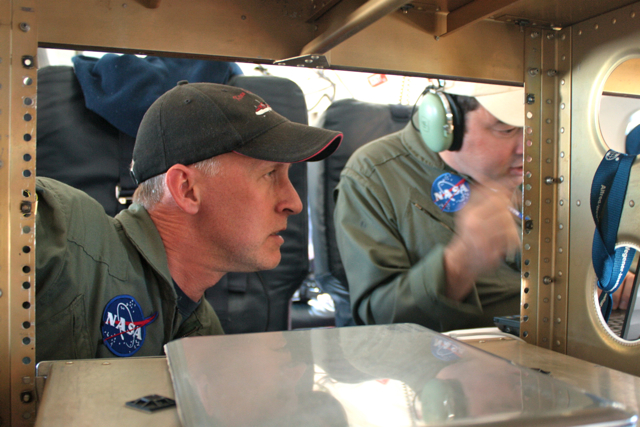
Michael Studinger is Operation IceBridge’s project scientist. He trained as a geophysicist in Germany, his home country, before moving to the U.S. to take a position at the Lamont-Doherty Earth Observatory and then transferring to NASA Goddard Space Flight Center in 2010. Studinger has been studying polar regions for 18 years, expanding his initial focus on the geology and tectonics of the Antarctic continent to the overall dynamic of polar ice sheets.

IceBridge project scientist Michael Studinger

Operation IceBridge Project Scientist Michael Studinger. Credit: Jefferson Beck / NASA

Studinger recently returned from Greenland, where he was leading Operation IceBridge’s 2012 Arctic campaign.

This was IceBridge’s fourth Arctic campaign. How different was it from previous years?

We flew more than last year: During the 75 days we were there, we only had to cancel a single flight because of weather, something I’ve never seen before. Regarding sea ice, we have expanded coverage in terms of area. For the first time we went to the Chukchi and Beaufort Seas to collect data there. But the biggest change this year is that we published a new data product that we had to deliver to the National Snow and Ice Data Center before we even returned from the field. This product is being used by modelers and other scientists to make a better prediction of the annual sea ice minimum in the summer. We can now feed ice thickness measurements from March and early April into these predictions and see how they improve them.

What are the benefits of improving Arctic sea ice minimum predictions?

There seems to be enough people who have an interest in finding out how thick or thin the sea ice will be. People who live in the Arctic and shipping companies…they want to know, they want to prepare. It’s like long-range weather forecast: People who grow crops would like to know if they’re going to get a wet season or a dry season.

Also, it’s a relatively short-term prediction, so we’ll soon find out if the models are working or not. It helps building better models because you can compare the results to the reality in a few months.

This Arctic campaign, you teamed up with CryoVEx, ESA’s calibration and validation campaign for the CryoSat-2 satellite. How did it go?

We did two coordinated flights with them. We were in Thule, Greenland, and they were in Alert, Canada. We both took off at the same time and made sure we were over the same point in the Arctic Ocean with CryoSat-2 flying overhead. It was quite a bit of a coordination effort. We measured the same spot along the satellite track within a few hours. The CryoVEx team has instruments similar to ours, but also some that we don’t have. IceBridge has unique instrument suite for sea ice that includes the world’s only airborne snow radar. By combining all the data from all the instruments, we can learn a lot about what each instrument is seeing and what CryoSat-2 is actually measuring over sea ice.

How’s your average Arctic campaign?

We start in Thule because we want to get the sea ice flights out of the way early on, as long as it’s cold over the Arctic Ocean. It’s still fairly dark there, that far north [Thule is 750 miles north of the Arctic Circle]. We have just enough light in the second half of March to fly the sea ice missions, during the first three weeks of the campaign. Then we go down to central Greenland while it’s still cold there and start doing ice sheet flights, for three or four weeks. Then we go back to Thule because it’s getting too warm in southern Greenland, and we finish the ice sheet flights in the northern half.

Can you describe your daily routine while in Greenland?

We get up at 5 a.m. In Kangerlussuaq, we try to be in the air at 8:30, and in Thule we try to be flying at 8, when the airport opens. Eight hours later, we land. After that, we have a science meeting where we talk about how the flight went and the plan for the following day. Then we eat dinner, check email, look at data… all that before we go to bed and do it all over again the next day.

How do Arctic and Antarctic campaigns differ?

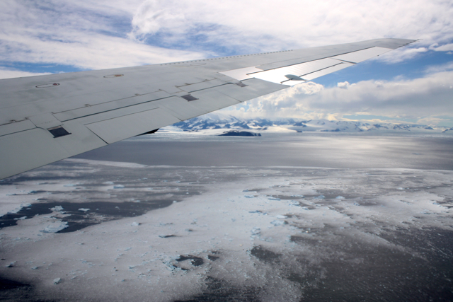
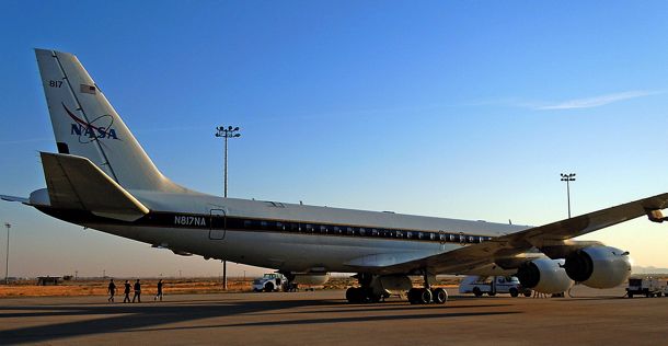
We use different aircraft: a P-3B for the Arctic and a DC-8 for Antarctica. In Greenland, when we fly out of Kangerlussuaq or Thule, we start collecting data pretty much right away, except for the sea ice missions. In Antarctica, we “commute” from Punta Arenas in southern Chile, which takes a few hours. Then we can only collect data for a few hours before we go back home to Punta Arenas. Typically, in the DC-8 we fly for 11 to 11.5 hours, much longer than the about 8 hours of flight with the P-3.

We actually fly more instruments on the P-3: the accumulation radar and the magnetometer (which is much easier to install on the P-3 than on the DC-8). We don’t really have the room in the fuselage to mount the accumulation radar antennas and there’s not really much of a need to use it in Antarctica. The snow accumulation in Greenland is higher. We can actually see annual layers with the accumulation radar but it’d be far more difficult in Antarctica because less snow falls there.

Personally, do you prefer one campaign to the other?

No, they’re just different. It’s a different airplane: the DC-8 is much more comfortable, less noisy. You don’t have the vibration of the P-3, so you can actually get a lot of work done on the transit flights. But the flights are very long.

And scientifically, is one campaign more interesting than the other?

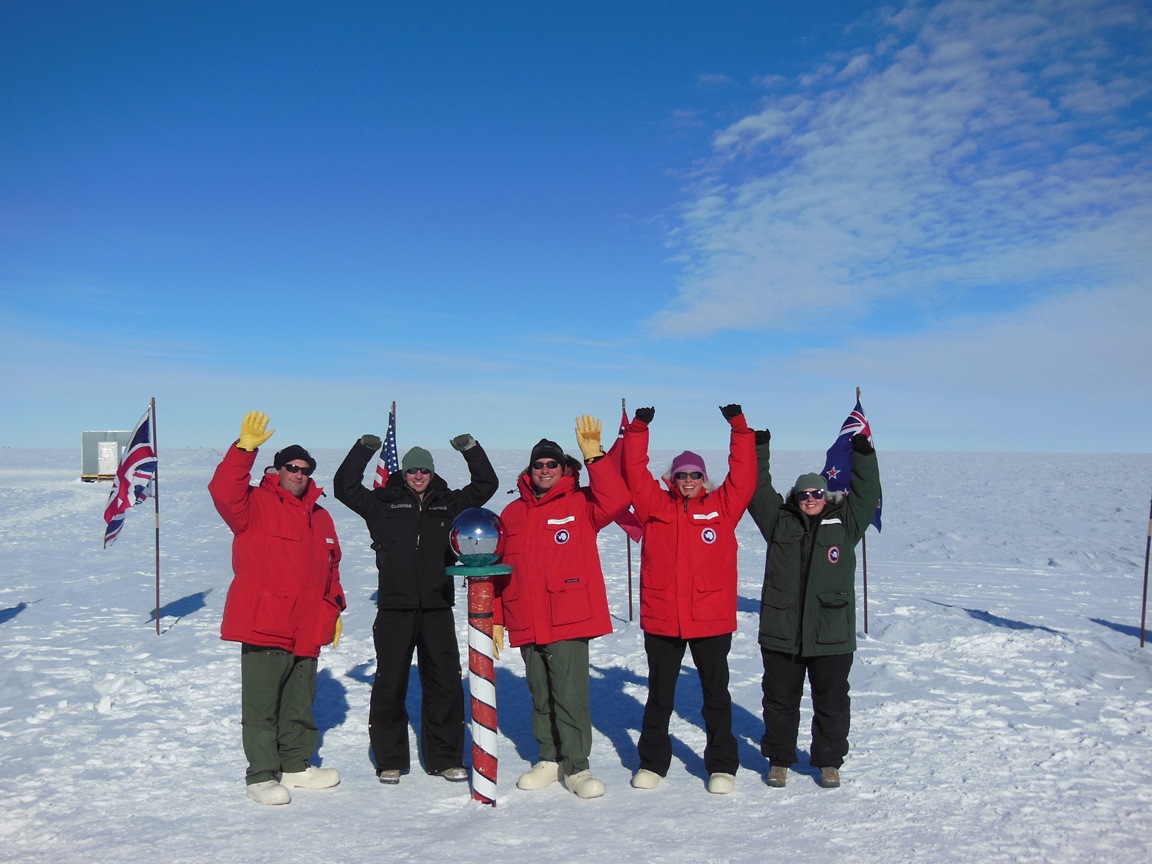
Not for me. Most of my work I’ve done in Antarctica, but I’m getting more and more interested in what Greenland has to tell us. If you look at the two biggest glaciers we study, Jakobshavn Isbrae in Greenland and Pine Island Glacier in Antarctica, the kind of mechanism through which both glaciers are losing ice is similar — warm ocean water is melting the ice from underneath. So we’re studying similar processes. Antarctica is far more challenging to get there and collect data, but from a scientific point we need to do both, otherwise we’re missing part of the picture.

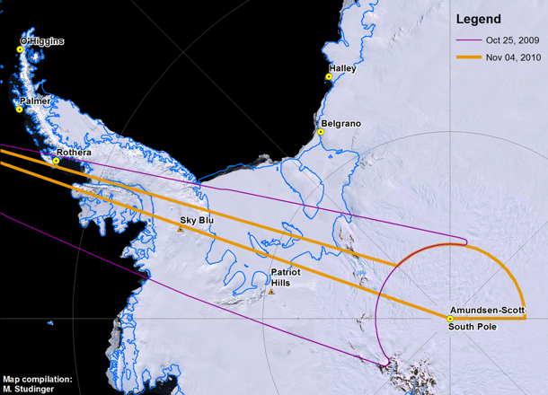
What’s the 2012 Antarctic campaign going to look like?

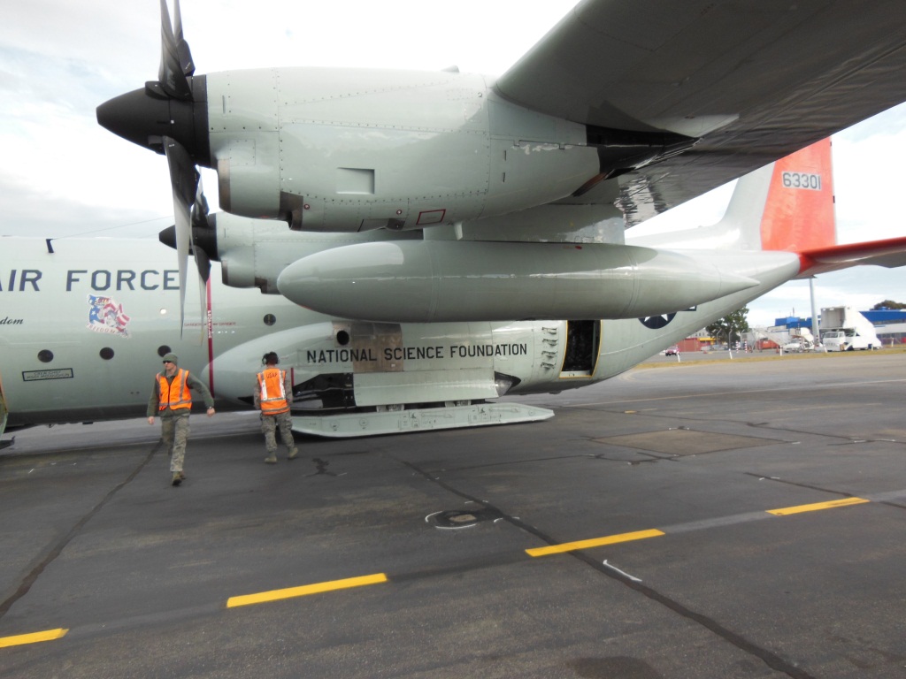
It’s going to be shorter for a number of reasons, mostly because the aircraft has already been committed for an international multi-aircraft experiment in Thailand, and it’s also committed afterward. We’ll try to fly as much as we can, we’ll be using two aircraft: a G-V from the National Science Foundation, flying at high altitude, and NASA’s DC-8 flying low.

What will the future bring for IceBridge?

The plan is we will start using unmanned aerial vehicles and we’ll probably be doing it mostly over sea ice in the Arctic Ocean, but we don’t know the details yet. We will be doing some test flights over the Arctic Ocean later this year with the Global Hawk, either with the radar or laser altimeter onboard. I don’t think we can replace manned aircraft completely over the course of IceBridge.

After ICESat-2 launches, will IceBridge continue to some extent?

There will always be airborne campaigns to some degree, because there are some datasets that we can only collect from planes, and we will also need to calibrate and validate the satellite data. We need a variety of different scales, wavelengths, different types of measurements in order to really answer the science questions that we have, such as what is the contribution of Greenland to sea level rise in the next 20 or 30 years. For example, if we only have ICESat-2 collecting measurements of how the surface elevation is changing, we’ll know a lot, but we’ll never be able to answer with certainty what is causing these changes. It’s almost like you’re taking the pulse of a patient; you’re only looking at the symptoms of the illness without understanding what’s causing it. In order to find out why the ice sheet is changing its surface, we need to understand what’s beneath the ice sheet because that’s what’s driving a lot of the dynamic changes. And those are datasets that you can’t collect from space, you need an airplane to go in there and get the greater picture of what’s below there and other things, like snow accumulation, which can be done much better from airplane. It’s not a single satellite that will provide us the answer, not a single airborne measurement – it all has to come together.

A Spanish version of this post is available on National Public Radio’s Science Friday blog.

IceBridge the subject of interest at two meetings

By George Hale, Science Outreach Coordinator, NASA Goddard Space Flight Center

Operation IceBridge has been a subject of interest over the past two weeks in different parts of the world, with a presentation in Copenhagen on the mission’s recent work and the Antarctic campaign science operations meeting in Seattle.

At a meeting of the U.S.-Denmark-Greenland Joint Committee in Copenhagen on June 13, U.S. Embassy public affairs officer Robert Kerr delivered a presentation on the cooperative education and outreach efforts that took place during the 2012 Arctic campaign. During his presentation, Kerr talked about the joint effort between NASA, embassy personnel, and people from the Danish and Greenlandic education ministries to provide a research experience for Danish and Greenlandic teachers. He also spoke on their work getting journalists on board the NASA P-3B and showed examples of upcoming articles by a Danish reporter.

The IceBridge science and instrument teams held their 2012 Antarctic campaign planning meeting in Seattle from June 20-22. The meeting featured speakers from the IceBridge science and instrument teams, the Cryospheric Sciences Laboratory at the NASA Goddard Space Flight Center and from NASA headquarters. There were also planning sessions for the upcoming Antarctic campaign. Speakers talked about the various IceBridge instruments, the 2012 Arctic campaign, NASA’s overall vision for IceBridge, the future of the mission and the status of ICESat-2, scheduled for launch in early 2016.

Science and instrument team members at the Antarctic campaign planning meeting at the University of Washington in Seattle.

IceBridge science and instrument team members at the Antarctic campaign planning meeting at the University of Washington in Seattle. Credit: Hajo Eiken/ University of Alaska – Fairbanks.

During the breakout planning sessions, team members summarized the collected mission plans for Antarctica, identified the need for additional missions and discussed future directions and potential new measurement requirements. The IceBridge science meeting is one of many steps on the way to the Antarctic campaign scheduled to start later this year.

Media Day in Chile

From: Kathryn Hansen, NASA’s Earth Science News Team, NASA’s Goddard Space Flight Center

Video conference between IceBridge scientists in Punta Arenas, Chile, and reporters in Santiago. Credit: NASA/Sarah DeWitt

PUNTA ARENAS, Chile — In a perfect world, IceBridge researchers would make science flights over Antarctica almost every day and return home with a check next to every high-priority science flight. The 2009 campaign — the first year IceBridge made flights over Antarctica — was just about perfect. But that’s a rarity in Antarctic research where whether and unanticipated aircraft maintenance can ground flights.

During days on the ground, however, researchers keep busy. On Monday, Nov. 15, IceBridge scientists gathered at Universidad de Magallanes in Punta Arenas, Chile, to answer questions from local reporters and from reporters in Santiago via live video feed (video below).


Video credit: NASA/Michelle Williams

Missed it? Get a replay of the teleconference until Nov. 29 by calling:

Phone: Tfree:800-469-6597

Toll:203-369-3288

Rollercoaster of Opportunity

From Kathryn Hansen, NASA’s Earth Science News Team, Goddard Space Flight Center

Nov. 13, 2010

John Sonntag (left), of NASA’s Wallops Flight Facility/URS, and Michael Studinger (right), of NASA’s Goddard Space Flight Center/UMBC, evaluate the Peninsula mission on the fly. Credit: NASA/Kathryn Hansen

PUNTA ARENAS, Chile — Friday evening, IceBridge teams gathered in the hotel conference room to discuss logistics for upcoming flights. First up: weather. The audience watched the animated WRF model, a tool used for flight planning because it tells you what the weather will be like in the next 6-12 hours. On this particular morning, the model showed system after system lined up to pummel Antarctica. “Are we sure this isn’t the WTF model?” a scientists inquired.

Saturday morning, scientist and flight planner John Sonntag arrived at the airport offices with the flight decision. Weather conditions weren’t perfect, but were the best the Antarctic Peninsula had seen in a month. Given that it had been a few days since the last flight and the forecast looked to only worsen in the days ahead, mission planners decided to take the opportunity to fly under the cloud ceiling. The model predicted clear skies below 10,000 feet. “I hope they’re right,” Sonntag said.

The flight planners quickly worked up a modified version of the “Pen 23” flight plan and at 9:23 we took off for the Peninsula.

The DC-8 approaches the Antarctic Peninsula. Credit: NASA/Kathryn Hansen

We flew the planned route backward, hitting northern cloud-free regions first. Heading south, we followed the eastern side the “spine” — the crest of a mountain range that extends down the middle of the Peninsula. Unfortunately for stomachs, the spine influences weather patterns and the east side also happened to be the windy, turbulent side. The DC-8 may need to restock the little white bags!

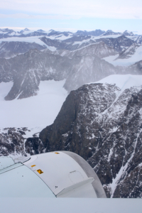
Stomachs also suffered from the dramatic changes in altitude necessary to collect data. The measurements require a relatively consistent altitude, which can be tricky when accessing a glacier behind a rock cliff. But the pilots deftly handled the 7,000-foot-roller coaster flight line to collect data over targets also surveyed during the 2009 campaign.

Glaciers meander through the rocky terrain of the Antarctic Peninsula (right). Credit: NASA/Kathryn Hansen

Targets flown: Hektoria, Drygalski, Crane, Flask and Leppard. Each of these glaciers drain into the Larsen A and B ice shelves which broke apart in 1995 and 2002, respectively. Attlee, Hermes, Lurabee and Clifford. Each of these glaciers drains into Larsen C, which is still intact.

So what? Like a cork in a bottle, ice sheets can plug the neck of a glacier. Remove that ice shelf and the glacier more freely dumps ice into the ocean. Scientists want to keep an eye on how these glaciers continue to respond years and decades after the loss of the shelves. Crane, for example, which feeds into the remnant of Larsen B, shows little sign of slowing down.

Cruising further south, however, we encountered too many clouds so we cut across to the west side of the spine to check out the Fleming Ice Shelf. Clouds there also proved too dense, however, so we turned north back to Punta Arenas. At 8.4 hours, the modified Pen 23 became the shortest flight of the campaign — to the relief of many yellow-faced passengers.

A Three-Hour Car Survey

From Sarah DeWitt, NASA’s Goddard Space Flight Center

November 7, 2010

Dave Jordan (NASA ARC), Kyle Krabill (NASA WFF) and Matt Beckley (NASA GSFC) affix a GPS antenna to a pick-up truck for the three-hour Operation IceBridge car survey. Credit: Sarah DeWitt, NASA GSFC.

PUNTA ARENAS, Chile — Today marks the end of Daylight Savings Time in the United States, but the clocks remain unchanged in Punta Arenas. Just 18 hours after setting foot on Chilean soil, I was packing my bag at 5:30 this morning for a DC-8 flight over Pine Island Glacier. I thought that was an exceptionally appropriate first foray into the IceBridge mission, considering that Pine Island is one of the few Antarctic features I know quite well.

Alas, the IceBridge team and I will keep our feet on the ground for at least a few more days while we wait for a replacement airplane part to be delivered from California. The news came over breakfast as the team prepared to fly for a fourth day in a row – a welcome stroke of good luck now put on temporary hold. While the DC-8 team hustled to get the part shipped on the next available plane from L.A., others shifted their focus from the air to the ground.

The ground calibration team is really just one person – Kyle Krabill, engineer at NASA’s Wallops Flight Facility. This morning Kyle took advantage of the DC-8 downtime and set out to create a topographic map of the airport ramp. This type of map is called a “car survey” because it involves a three-hour journey criss-crossing the rectangular speck of pavement at a maximum speed of 5 miles per hour. The entire area is only about 200,000 square meters, but it varies in elevation by a factor of about one meter. An accurate elevation map of the ramp is critical for calibrating IceBridge’s airborne instruments. Kyle’s goal is an elevation map with centimeter precision.

He starts his car survey by attaching a GPS antenna to the top of a car. He carefully arranges all of the equipment and passengers before the survey begins, because even a slight difference in weight can affect the measurement. Would-be passengers must commit to the three-hour road trip or be relegated to watch from the sidelines.

Image is courtesy of Kyle Krabill/ATM team

The LVIS 86 Pole Flight

From: Scott B. Luthcke, Geophysicist, NASA’s Goddard Space Flight Center

November 4, 2010, 8:05 p.m. EDT

After several days without flights due to unfavorable weather over Antarctica, the Operation Ice Bridge DC-8 is in flight supporting its latest mission. The mission today is the LVIS 86 pole flight. It’s a long 12-hour mission during which the DC-8 will navigate around the South Pole following an arc of -86 deg. latitude at an altitude of 35,000 feet. The South Pole arc will enable NASA’s Land, Vegetation and Ice Sensor (LVIS) to map the surface of the interior of the ice sheet with a 2-kilometer-wide swath, and 25-meter spatial resolution within the swath. This mission will extend the coverage around the pole first collected by LVIS during a 2009 mission. In addition to LVIS, NASA’s Digital Mapping System (DMS) will also be collecting data during this flight. Two other instruments, NASA’s Airborne Topographic Mapper and Kansas University’s MCoRDS radar, typically operate only at lower altitudes, but today both are experimenting with new operational modes and equipment that may allow them to collect data from higher altitudes with LVIS.

The LVIS surface height mapping data provide an important datum to calibrate measurements of ice sheet surface elevation obtained from the Ice Cloud and land Elevation Satellite (ICESat) laser altimeter. ICESat was in a near-polar orbit with the laser altimeter surface profiles densely converging in an arc around the south pole at -86 deg. Therefore, the swath of data LVIS is collecting today, along with that collected in the 2009 pole arc flight, intersects nearly 70 percent of ICESat orbits and provides over a million LVIS and ICESat difference observations for comparison. It’s a unique set of data leveraging the converging satellite tracks around the pole. In addition, the LVIS observations will provide an important datum to monitor long-term interior ice sheet change with respect to current and future near-polar satellite mission data. The DMS and MCoRDS systems complement and enhance the LVIS data by providing high-resolution surface imagery and bedrock topography respectively.

Principal investigator Bryan Blair and scientist Michelle Hofton are running LVIS for today’s mission. Through the magic of technology, lead instrument engineer David Rabine is supporting the mission via xchat while he is on an airplane flying back to the United States after spending the previous three weeks in the field with the instrument. LVIS obtains measurements of surface height using a laser altimeter approach. A laser pulse is transmitted from the instrument, and is reflected back from the surface where the return pulse is recorded. The distance, or range from the instrument to the reflecting surface, is computed as the round trip time of flight of the pulse divided by two (to get the one-way travel time) and then divided by the speed of light. GPS receivers are used to compute the position of the instrument, while the pointing or direction of flight of the laser pulse is determined using instrument orientation data provided by a gyro attitude sensor. The surface elevation for each laser shot can then be computed from these data using the position of the instrument, the direction of the laser pulse travel and the distance or range of the laser pulse travel to the surface.

Credit: NASA/Michael Studinger

Nearly 30 minutes into the flight the excitement ramped up as the pilots prepared to perform the LVIS instrument calibration maneuver. Everyone took their seats and strapped in. A few minutes later the go was given to perform the maneuver and the airplane pitched up and down several times followed by several rolls left and right, giving us all a roller coaster ride. After a few minutes all was clear and we were back to business.

Now, over six hours into the mission we have completed the data collection for the pole arc and are heading back to Punta Arenas, Chile. On the transit back we flew directly over the South Pole! The mission was clearly a success with mostly clear skies and a full data collection from the instruments. Everyone is looking forward to getting on the ground, having a good dinner, and getting rested up for, potentially, another flight tomorrow.

The South Pole Station was easily visible during a flight there on Nov. 4. Credit: Digital Mapping System (DMS) group

Welcome to the Operation IceBridge 2010 Antarctic Campaign

From: Michael Studinger, IceBridge project scientist, Goddard Earth Science and Technology Center at the University of Maryland


The DC-8, parked outside the hanger at NASA’s Dryden Flight Research Center, is prepared for a instrument test flight. Credit: NASA/Michael Studinger

Oct. 17, 2010

Dryden Flight Research Center, CA — Welcome to our 2010 Antarctic campaign with NASA’s DC-8 Flying Laboratory. For the past two weeks Operation IceBridge teams have been busy installing instruments and sensors onto the DC-8 aircraft here in Palmdale, Calif., at NASA’s Dryden Flight Research Center. Over the next couple of weeks we will fly with the DC-8 over Antarctica to measure changes in thickness of the sea ice surrounding Antarctica and to monitor changes in the thickness of ice sheets and glaciers that cover 98% of the Antarctic continent. 

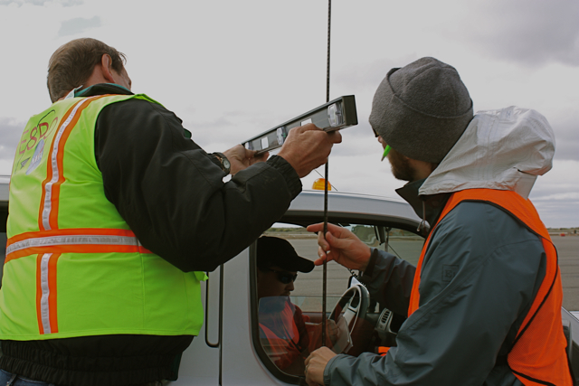
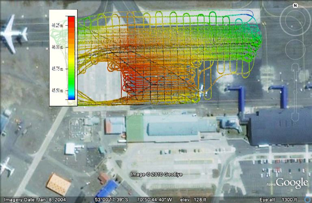
But before we can go south we have to go through a series of test flights here in California to make sure that all the installed sensors work and to calibrate our science instruments. In order to do this we fly over target sites in the Mojave Desert that we have surveyed on the ground a few days before the test flights. The desert environment that we have selected for our test flights here is very different from the barren land of snow and ice that we will be flying over the next couple of weeks and we all enjoy the low altitude flights over the Mojave Desert, the San Gabriel Mountains and the San Andreas Fault. When the pilots ask you if it would be a problem if the belly of the aircraft is facing the sun you know that you are in the world of research flying. We did a couple of 90 roll maneuvers at high altitude over the Pacific Ocean to calibrate the antennas of the ice-penetrating radar systems that we will use to survey sea ice, glaciers, and ice sheets.

Instrument test flight over the San Gabriel Mountains in California. Credit: NASA/Michael Studinger

The IceBridge teams have enjoyed a few days of work here in warm and sunny California and we are now ready to fly to Punta Arenas in southern Chile, which will be the base of operation for our Antarctic flights. We are looking forward to another successful campaign with exciting new data and spectacular Antarctic scenery.